


10099 Résultats
Classification:
livres
livres
Actions:
Prix:
$34.95
(disponible sur commande)
Résumé:
For decades, Philip Ashforth Coppola has meticulously documented the New York City subway in a series of extraordinary drawings, detailing the terracotta mosaics, faience, and tile patterns that millions of riders pass by every day. Coppola's drawings are what "Hyperallergic" calls "the most encyclopedic history of the art and architecture of the New York City subway(...)
$34.95
(disponible sur commande)
Résumé:
For decades, Philip Ashforth Coppola has meticulously documented the New York City subway in a series of extraordinary drawings, detailing the terracotta mosaics, faience, and tile patterns that millions of riders pass by every day. Coppola's drawings are what "Hyperallergic" calls "the most encyclopedic history of the art and architecture of the New York City subway(...)
Titre:
One-track mind: drawing the New York subway
Actions:
Prix:
$34.95
(disponible sur commande)
Résumé:
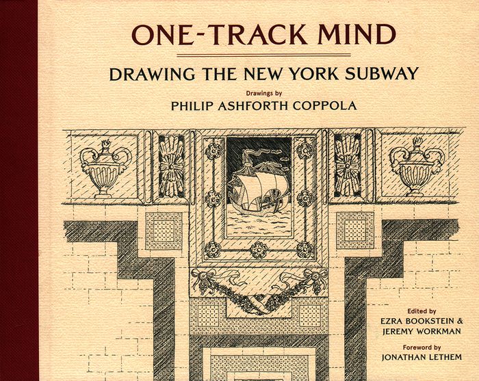
For decades, Philip Ashforth Coppola has meticulously documented the New York City subway in a series of extraordinary drawings, detailing the terracotta mosaics, faience, and tile patterns that millions of riders pass by every day. Coppola's drawings are what "Hyperallergic" calls "the most encyclopedic history of the art and architecture of the New York City subway system." Along with Coppola's intricate ink drawings are anecdotes he assembled through painstaking research involving hundreds of hours poring through microfilms to discover the names behind the artisanship of what is rightly called New York's largest public art work---its legendary subway system. Philip Ashforth Coppola's drawings have been featured in the New York Times, "Hyperallergic", and on the BBC and are included in the New York Transit Museum's permanent collection. Foreword by Jonathan Lethem.
One-track mind: drawing the New York subway
Actions:
Prix:
$34.95
(disponible sur commande)
Résumé:
For decades, Philip Ashforth Coppola has meticulously documented the New York City subway in a series of extraordinary drawings, detailing the terracotta mosaics, faience, and tile patterns that millions of riders pass by every day. Coppola's drawings are what "Hyperallergic" calls "the most encyclopedic history of the art and architecture of the New York City subway system." Along with Coppola's intricate ink drawings are anecdotes he assembled through painstaking research involving hundreds of hours poring through microfilms to discover the names behind the artisanship of what is rightly called New York's largest public art work---its legendary subway system. Philip Ashforth Coppola's drawings have been featured in the New York Times, "Hyperallergic", and on the BBC and are included in the New York Transit Museum's permanent collection. Foreword by Jonathan Lethem.
Classification:
livres
livres
Publication:
janvier 2018
janvier 2018
Sujet:
Dessin d’architecture
Dessin d’architecture
Classification:
livres
livres
Titre:
Drawing architecture
Drawing architecture
Actions:
Prix:
$105.00
(disponible sur commande)
Résumé:
Throughout history, architects have relied on drawings both to develop their ideas and communicate their vision to the world. This collection brings together more than 250 of the finest architectural drawings of all time, revealing each architect's process and personality as never before. Creatively paired to stimulate the imagination, the illustrations span the centuries(...)
$105.00
(disponible sur commande)
Résumé:
Throughout history, architects have relied on drawings both to develop their ideas and communicate their vision to the world. This collection brings together more than 250 of the finest architectural drawings of all time, revealing each architect's process and personality as never before. Creatively paired to stimulate the imagination, the illustrations span the centuries(...)
Titre:
Drawing architecture
Actions:
Prix:
$105.00
(disponible sur commande)
Résumé:
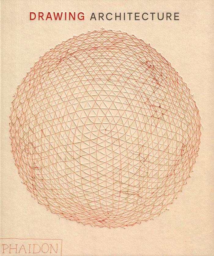
Throughout history, architects have relied on drawings both to develop their ideas and communicate their vision to the world. This collection brings together more than 250 of the finest architectural drawings of all time, revealing each architect's process and personality as never before. Creatively paired to stimulate the imagination, the illustrations span the centuries and range from sketches to renderings, simple to intricate, built projects to a utopian ideal, famous to rarely seen - a true celebration of the art of architecture. Visually paired images draw connections and contrasts between architecture from different times, styles, and places. From Michelangelo to Frank Gehry, Louise Bourgeois to Tadao Ando, B.V. Doshi to Zaha Hadid, and Grafton to Luis Barragán, the book shows the incredible variety and beauty of architectural drawings.
Drawing architecture
Actions:
Prix:
$105.00
(disponible sur commande)
Résumé:
Throughout history, architects have relied on drawings both to develop their ideas and communicate their vision to the world. This collection brings together more than 250 of the finest architectural drawings of all time, revealing each architect's process and personality as never before. Creatively paired to stimulate the imagination, the illustrations span the centuries and range from sketches to renderings, simple to intricate, built projects to a utopian ideal, famous to rarely seen - a true celebration of the art of architecture. Visually paired images draw connections and contrasts between architecture from different times, styles, and places. From Michelangelo to Frank Gehry, Louise Bourgeois to Tadao Ando, B.V. Doshi to Zaha Hadid, and Grafton to Luis Barragán, the book shows the incredible variety and beauty of architectural drawings.
Classification:
livres
livres
Publication:
octobre 2018
octobre 2018
Sujet:
Dessin d’architecture
Dessin d’architecture
Classification:
livres
livres
Prix:
$70.00
(disponible sur commande)
Résumé:
Part of the generation of architects who were trained to draw both by hand and with digital tools, Nalina Moses recently returned to hand drawing. Finding it to be direct, pleasurable, and intuitive, she wondered whether other architects felt the same way. "Single-Handedly" is the result of this inquiry. A collection of 220 hand drawings by more than forty emerging(...)
$70.00
(disponible sur commande)
Résumé:
Part of the generation of architects who were trained to draw both by hand and with digital tools, Nalina Moses recently returned to hand drawing. Finding it to be direct, pleasurable, and intuitive, she wondered whether other architects felt the same way. "Single-Handedly" is the result of this inquiry. A collection of 220 hand drawings by more than forty emerging(...)
Titre:
Single-handedly: contemporary architects draw by hand
Actions:
Prix:
$70.00
(disponible sur commande)
Résumé:
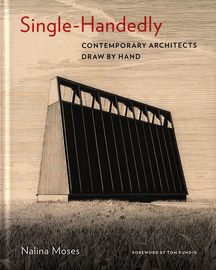
Part of the generation of architects who were trained to draw both by hand and with digital tools, Nalina Moses recently returned to hand drawing. Finding it to be direct, pleasurable, and intuitive, she wondered whether other architects felt the same way. "Single-Handedly" is the result of this inquiry. A collection of 220 hand drawings by more than forty emerging architects and well-known practitioners from around the world, this book explores the reasons they draw by hand and gives testimony to the continued vitality of hand drawing in architecture. The powerful yet intimate drawings carry larger propositions about materials, space, and construction, and each one stands on its own as a work of art.
Single-handedly: contemporary architects draw by hand
Actions:
Prix:
$70.00
(disponible sur commande)
Résumé:
Part of the generation of architects who were trained to draw both by hand and with digital tools, Nalina Moses recently returned to hand drawing. Finding it to be direct, pleasurable, and intuitive, she wondered whether other architects felt the same way. "Single-Handedly" is the result of this inquiry. A collection of 220 hand drawings by more than forty emerging architects and well-known practitioners from around the world, this book explores the reasons they draw by hand and gives testimony to the continued vitality of hand drawing in architecture. The powerful yet intimate drawings carry larger propositions about materials, space, and construction, and each one stands on its own as a work of art.
Classification:
livres
livres
Publication:
mai 2019
mai 2019
Sujet:
Dessin d’architecture
Dessin d’architecture
Classification:
livres
livres
Prix:
$72.00
(disponible sur commande)
Résumé:
The spread of Renaissance culture in England coincided with the birth of the profession of architecture, whose practitioners soon became superior to simple builders in social standing and perceived intellectual prowess. This book, which focuses in particular on the scientist, mathematician, and architect Sir Christopher Wren, explores the extent to which this new(...)
$72.00
(disponible sur commande)
Résumé:
The spread of Renaissance culture in England coincided with the birth of the profession of architecture, whose practitioners soon became superior to simple builders in social standing and perceived intellectual prowess. This book, which focuses in particular on the scientist, mathematician, and architect Sir Christopher Wren, explores the extent to which this new(...)
Titre:
Compass & rule : architecture as mathematical practice in England
Actions:
Prix:
$72.00
(disponible sur commande)
Résumé:
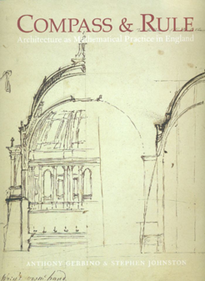
The spread of Renaissance culture in England coincided with the birth of the profession of architecture, whose practitioners soon became superior to simple builders in social standing and perceived intellectual prowess. This book, which focuses in particular on the scientist, mathematician, and architect Sir Christopher Wren, explores the extent to which this new professional identity was based on expertise in the mathematical arts and sciences. Featuring drawings, instruments, paintings, and other examples of the material culture of English architecture, the book discusses the role of mathematics in architectural design and building technology. It begins with architectural drawing in the 16th century, moves to large-scale technical drawing under Henry VIII, considers Inigo Jones and his royal buildings and Christopher Wren and the dome of St. Paul’s, and concludes with the architectural education of George III. Interweaving text and visual image, the book investigates the boundaries between art and science in architecture—the most artistic of the sciences and the most scientific of the arts.
Compass & rule : architecture as mathematical practice in England
Actions:
Prix:
$72.00
(disponible sur commande)
Résumé:
The spread of Renaissance culture in England coincided with the birth of the profession of architecture, whose practitioners soon became superior to simple builders in social standing and perceived intellectual prowess. This book, which focuses in particular on the scientist, mathematician, and architect Sir Christopher Wren, explores the extent to which this new professional identity was based on expertise in the mathematical arts and sciences. Featuring drawings, instruments, paintings, and other examples of the material culture of English architecture, the book discusses the role of mathematics in architectural design and building technology. It begins with architectural drawing in the 16th century, moves to large-scale technical drawing under Henry VIII, considers Inigo Jones and his royal buildings and Christopher Wren and the dome of St. Paul’s, and concludes with the architectural education of George III. Interweaving text and visual image, the book investigates the boundaries between art and science in architecture—the most artistic of the sciences and the most scientific of the arts.
Classification:
livres
livres
Publication:
mai 2009
mai 2009
Sujet:
Dessin d’architecture
Dessin d’architecture
Classification:
livres
livres
Actions:
Prix:
$120.00
(disponible sur commande)
Résumé:
Whether from military necessity or unbridled curiosity, mapmakers since early antiquity have attempted to represent the configuration of the land about them. The Greeks paid homage to the landscape and struck its image on their coins. Medieval scholars viewed the (...)
$120.00
(disponible sur commande)
Résumé:
Whether from military necessity or unbridled curiosity, mapmakers since early antiquity have attempted to represent the configuration of the land about them. The Greeks paid homage to the landscape and struck its image on their coins. Medieval scholars viewed the (...)
Sujet:
Dessin d’architecture
Dessin d’architecture
Publication:
octobre 1999, New York
octobre 1999, New York
Titre:
Infinite perspectives : two thousand years of three-dimensional mapmaking
Actions:
Prix:
$120.00
(disponible sur commande)
Résumé:
Whether from military necessity or unbridled curiosity, mapmakers since early antiquity have attempted to represent the configuration of the land about them. The Greeks paid homage to the landscape and struck its image on their coins. Medieval scholars viewed the highest elevations as a boundary between the physical and the spiritual; the images they created of their sacred shrines and historic sites were drawn atop simple caricatures of mountains. Leonardo da Vinci's maps of Tuscany and other more realistic representations of landforms appeared during the Renaissance, thanks to a wealth of scientific study and new artistic methods. In the modern era, new techniques were invented as attempts to portray the three-dimensional world on a flat surface became more sophisticated. Hachuring, a system that involves shading with fine parallel or crossed lines, was developed with the use of copper plates; contour lines slowly replaced this technique in the nineteenth century. Lithography allowed for the introduction of color to the printing process, and multi-color tints were used to impart a sense of elevation. Aerial and satellite photography and the dawn of the digital era have yielded maps of unprecedented realism; today's computer technology allows planetary surfaces to be portrayed in three dimensions with a precision unimaginable to previous generations of mapmakers. "Infinite Perspectives" traces the artistic and scientific evolution of topographic representation from its origins to the present. Over 80 colour plates of some of the most significant maps ever made detail important advances in the portrayal of three dimensions in map form. The final section of the book contains 20 plates presenting a revolutionary cartographic technique that allows viewers wearing ordinary 3D glasses to view planetary surfaces without distortion. This invention, developed by the authors with Dr. Russell Ambroziak and named Infinite Perspective Projection, is currently in use by NASA and the Department of Defense. Included are maps of Mars, the Grand Canyon, and Mount McKinley, as well as one large fold-out map, suitable for framing; two pairs of the necessary 3D viewing glasses are also provided.
Infinite perspectives : two thousand years of three-dimensional mapmaking
Actions:
Prix:
$120.00
(disponible sur commande)
Résumé:
Whether from military necessity or unbridled curiosity, mapmakers since early antiquity have attempted to represent the configuration of the land about them. The Greeks paid homage to the landscape and struck its image on their coins. Medieval scholars viewed the highest elevations as a boundary between the physical and the spiritual; the images they created of their sacred shrines and historic sites were drawn atop simple caricatures of mountains. Leonardo da Vinci's maps of Tuscany and other more realistic representations of landforms appeared during the Renaissance, thanks to a wealth of scientific study and new artistic methods. In the modern era, new techniques were invented as attempts to portray the three-dimensional world on a flat surface became more sophisticated. Hachuring, a system that involves shading with fine parallel or crossed lines, was developed with the use of copper plates; contour lines slowly replaced this technique in the nineteenth century. Lithography allowed for the introduction of color to the printing process, and multi-color tints were used to impart a sense of elevation. Aerial and satellite photography and the dawn of the digital era have yielded maps of unprecedented realism; today's computer technology allows planetary surfaces to be portrayed in three dimensions with a precision unimaginable to previous generations of mapmakers. "Infinite Perspectives" traces the artistic and scientific evolution of topographic representation from its origins to the present. Over 80 colour plates of some of the most significant maps ever made detail important advances in the portrayal of three dimensions in map form. The final section of the book contains 20 plates presenting a revolutionary cartographic technique that allows viewers wearing ordinary 3D glasses to view planetary surfaces without distortion. This invention, developed by the authors with Dr. Russell Ambroziak and named Infinite Perspective Projection, is currently in use by NASA and the Department of Defense. Included are maps of Mars, the Grand Canyon, and Mount McKinley, as well as one large fold-out map, suitable for framing; two pairs of the necessary 3D viewing glasses are also provided.
Classification:
livres
livres
Publication:
octobre 1999, New York
octobre 1999, New York
Sujet:
Dessin d’architecture
Dessin d’architecture
Classification:
livres
livres
Prix:
$102.00
(disponible sur commande)
Résumé:
This sequel to our highly acclaimed title "An Atlas of Rare City Maps" collects over 100 views dating between 1835 and 1902, showing the streets, buildings, churches, bridges, waterways, and surrounding(...)
$102.00
(disponible sur commande)
Résumé:
This sequel to our highly acclaimed title "An Atlas of Rare City Maps" collects over 100 views dating between 1835 and 1902, showing the streets, buildings, churches, bridges, waterways, and surrounding(...)
Titre:
Bird's eye view : historic lithographs of North American cities
Actions:
Prix:
$102.00
(disponible sur commande)
Résumé:
This sequel to our highly acclaimed title "An Atlas of Rare City Maps" collects over 100 views dating between 1835 and 1902, showing the streets, buildings, churches, bridges, waterways, and surrounding countryside of North American towns, ranging from burgeoning metropolitan centers to small logging towns and mining camps. Baltimore, Brooklyn, Denver, Indianapolis, Memphis, Montreal, New Orleans, Pittsburgh, Seattle, Syracuse, and Washington are just a few of the cities presented in this collection. The exquisite colour and fine detail of these bird's eye views have been reproduced in all their original glory; also included is an introduction by John W. Reps providing a background on the artistic process and on urban development in the nineteenth century.
Bird's eye view : historic lithographs of North American cities
Actions:
Prix:
$102.00
(disponible sur commande)
Résumé:
This sequel to our highly acclaimed title "An Atlas of Rare City Maps" collects over 100 views dating between 1835 and 1902, showing the streets, buildings, churches, bridges, waterways, and surrounding countryside of North American towns, ranging from burgeoning metropolitan centers to small logging towns and mining camps. Baltimore, Brooklyn, Denver, Indianapolis, Memphis, Montreal, New Orleans, Pittsburgh, Seattle, Syracuse, and Washington are just a few of the cities presented in this collection. The exquisite colour and fine detail of these bird's eye views have been reproduced in all their original glory; also included is an introduction by John W. Reps providing a background on the artistic process and on urban development in the nineteenth century.
Classification:
livres
livres
Publication:
octobre 1998, New York
octobre 1998, New York
Sujet:
Dessin d’architecture
Dessin d’architecture
Classification:
livres
livres
Titre:
Maps and politics
Maps and politics
Actions:
Prix:
$49.00
(disponible sur commande)
Résumé:
Do maps accurately and objectively present the information we expect them to portray, or are they instead colored by the political purposes of their makers? In this lively and well-illustrated book, Jeremy Black investigates this dangerous territory, arguing persuasively that the supposed "objectivity" of the map-making and map-using process cannot be divorced from(...)
$49.00
(disponible sur commande)
Résumé:
Do maps accurately and objectively present the information we expect them to portray, or are they instead colored by the political purposes of their makers? In this lively and well-illustrated book, Jeremy Black investigates this dangerous territory, arguing persuasively that the supposed "objectivity" of the map-making and map-using process cannot be divorced from(...)
Titre:
Maps and politics
Actions:
Prix:
$49.00
(disponible sur commande)
Résumé:
Do maps accurately and objectively present the information we expect them to portray, or are they instead colored by the political purposes of their makers? In this lively and well-illustrated book, Jeremy Black investigates this dangerous territory, arguing persuasively that the supposed "objectivity" of the map-making and map-using process cannot be divorced from aspects of the politics of representation.
Maps and politics
Actions:
Prix:
$49.00
(disponible sur commande)
Résumé:
Do maps accurately and objectively present the information we expect them to portray, or are they instead colored by the political purposes of their makers? In this lively and well-illustrated book, Jeremy Black investigates this dangerous territory, arguing persuasively that the supposed "objectivity" of the map-making and map-using process cannot be divorced from aspects of the politics of representation.
Classification:
livres
livres
Publication:
février 1998, Chicago
février 1998, Chicago
Sujet:
Dessin d’architecture
Dessin d’architecture
Classification:
livres
livres
Prix:
$60.00
(disponible sur commande)
Résumé:
This book examines how the structure and content of medieval maps can provide an intriguing insight into how medieval mapmakers and readers saw their world.
$60.00
(disponible sur commande)
Résumé:
This book examines how the structure and content of medieval maps can provide an intriguing insight into how medieval mapmakers and readers saw their world.
Titre:
Mapping Time and Space: How Medieval Mapmakers Viewed Their World
Actions:
Prix:
$60.00
(disponible sur commande)
Résumé:
This book examines how the structure and content of medieval maps can provide an intriguing insight into how medieval mapmakers and readers saw their world.
Mapping Time and Space: How Medieval Mapmakers Viewed Their World
Actions:
Prix:
$60.00
(disponible sur commande)
Résumé:
This book examines how the structure and content of medieval maps can provide an intriguing insight into how medieval mapmakers and readers saw their world.
Classification:
livres
livres
Publication:
janvier 1998, London
janvier 1998, London
Sujet:
Dessin d’architecture
Dessin d’architecture
Classification:
livres
livres
Actions:
Prix:
$69.75
(disponible sur commande)
Résumé:
In "Apollo's Eye", geographer Denis Cosgrove examines the historical implications for the West of conceiving and representing the earth as a globe: a unified, spherical body. Cosgrove traces how ideas of globalism and globalization have shifted historically in relation to changing images of the earth, from antiquity to the Space Age. He connects the evolving image(...)
$69.75
(disponible sur commande)
Résumé:
In "Apollo's Eye", geographer Denis Cosgrove examines the historical implications for the West of conceiving and representing the earth as a globe: a unified, spherical body. Cosgrove traces how ideas of globalism and globalization have shifted historically in relation to changing images of the earth, from antiquity to the Space Age. He connects the evolving image(...)
Titre:
Apollo's eye : a cartographic genealogy of the earth in the Western imagination
Actions:
Prix:
$69.75
(disponible sur commande)
Résumé:
In "Apollo's Eye", geographer Denis Cosgrove examines the historical implications for the West of conceiving and representing the earth as a globe: a unified, spherical body. Cosgrove traces how ideas of globalism and globalization have shifted historically in relation to changing images of the earth, from antiquity to the Space Age. He connects the evolving image of a unified globe to politically powerful conceptions of human unity. Cosgrove constructs a genealogy of global images from classical Greece and Rome to the present, giving special attention to the early sixteenth century, when Europeans circumnavigated the earth, relocated it within their understanding of the cosmos, and revolutionized its representation in models and maps. Each chapter focuses on specific images of the globe or whole earth, reproduced in a wealth of illustrations. Cosgrove's analysis traces a pattern of associations between global images and the formation of Western identities, paying tribute to the complex cosmographic tradition out of which today's geographical imagination has emerged.
Apollo's eye : a cartographic genealogy of the earth in the Western imagination
Actions:
Prix:
$69.75
(disponible sur commande)
Résumé:
In "Apollo's Eye", geographer Denis Cosgrove examines the historical implications for the West of conceiving and representing the earth as a globe: a unified, spherical body. Cosgrove traces how ideas of globalism and globalization have shifted historically in relation to changing images of the earth, from antiquity to the Space Age. He connects the evolving image of a unified globe to politically powerful conceptions of human unity. Cosgrove constructs a genealogy of global images from classical Greece and Rome to the present, giving special attention to the early sixteenth century, when Europeans circumnavigated the earth, relocated it within their understanding of the cosmos, and revolutionized its representation in models and maps. Each chapter focuses on specific images of the globe or whole earth, reproduced in a wealth of illustrations. Cosgrove's analysis traces a pattern of associations between global images and the formation of Western identities, paying tribute to the complex cosmographic tradition out of which today's geographical imagination has emerged.
Classification:
livres
livres
Publication:
mars 2001, Baltimore
mars 2001, Baltimore
Sujet:
Dessin d’architecture
Dessin d’architecture
Classification:
livres
livres
Actions:
Prix:
$42.50
(disponible sur commande)
Résumé:
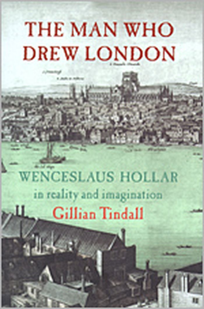
A young engraver making a precarious living wandering around Europe, Hollar was employed by an English lord who took him to London, where he became known for his fashion plates, maps and panoramas. This book traces the story of the artist/engraver who drew London before and after the Great Fire of 1666.
$42.50
(disponible sur commande)
Résumé:
A young engraver making a precarious living wandering around Europe, Hollar was employed by an English lord who took him to London, where he became known for his fashion plates, maps and panoramas. This book traces the story of the artist/engraver who drew London before and after the Great Fire of 1666.
Titre:
The man who drew London : Wenceslaus Hollar in reality and imagination
Actions:
Prix:
$42.50
(disponible sur commande)
Résumé:
A young engraver making a precarious living wandering around Europe, Hollar was employed by an English lord who took him to London, where he became known for his fashion plates, maps and panoramas. This book traces the story of the artist/engraver who drew London before and after the Great Fire of 1666.
The man who drew London : Wenceslaus Hollar in reality and imagination
Actions:
Prix:
$42.50
(disponible sur commande)
Résumé:
A young engraver making a precarious living wandering around Europe, Hollar was employed by an English lord who took him to London, where he became known for his fashion plates, maps and panoramas. This book traces the story of the artist/engraver who drew London before and after the Great Fire of 1666.
Classification:
livres
livres
Publication:
janvier 1900, London
janvier 1900, London
Sujet:
Dessin d’architecture
Dessin d’architecture


