


A City in Process
Álvaro Siza’s first proposal for Porto’s Avenida da Ponte
The following text consists of objects from our Main Galleries exhibition The fortune of the city is that it has never been perfect, running from 21 May 2026 until 6 January 2027, paired with Álvaro Siza’s handwritten notes, which have been transcribed in an ongoing, collaborative project.
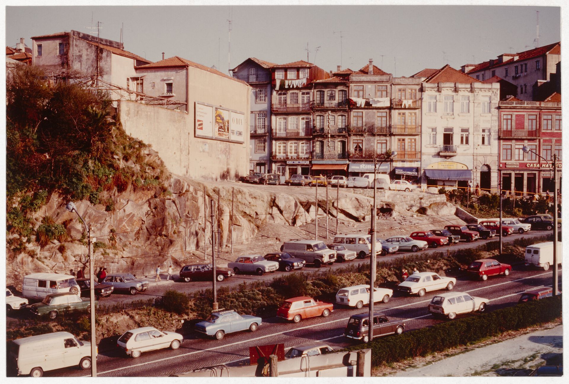
Álvaro Siza, Photograph of quarry on the east side of Avenida da Ponte, visible since the 1940s demolition, Porto, ca. 1968. Chromogenic colour print. ARCH290873, AP178.S1.1968.PR02, Álvaro Siza fonds, CCA. Gift of Álvaro Siza
In the 1940s, an entire neighbourhood in Porto’s historic centre, including the hill where the Porto Cathedral was located, was demolished to make way for the D. Afonso Henriques Avenue, also known as Avenida da Ponte. The new avenue aimed to connect the double-decker Luiz I Bridge to the train station and shift the city’s centre of activity away from the riverfront to Praça Nova, now known as Praça da Liberdade.
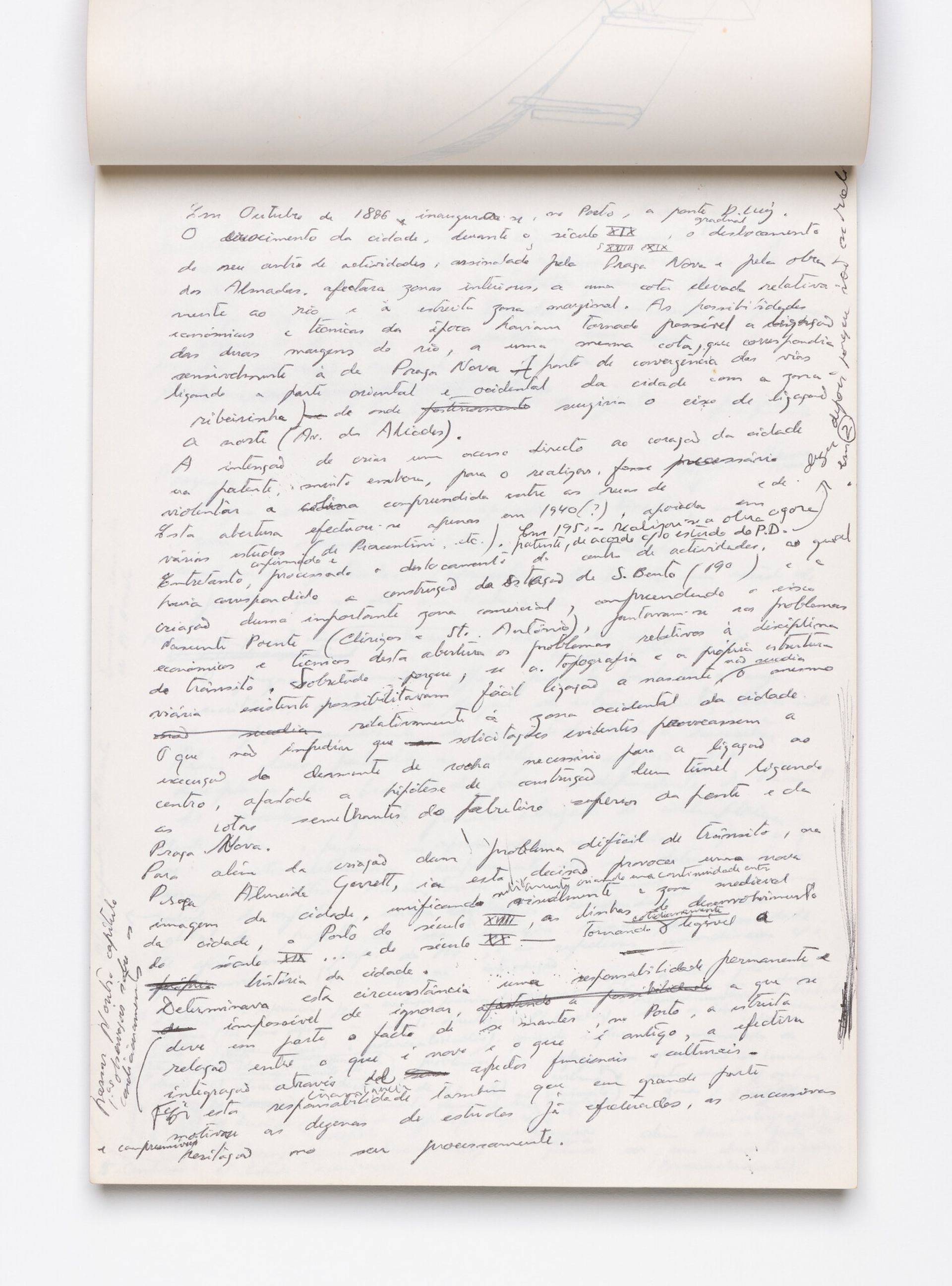
Álvaro Siza, Sketchbook: Av. Da Ponte, 1968. ARCH289935, AP178.S2.1968.002, Álvaro Siza fonds, CCA. Gift of Álvaro Siza © Álvaro Siza


In October 1886, the D. Luiz Bridge was inaugurated in Porto. The city’s growth throughout the 19th century {18th, 19th}, along with the {gradual} shift of its centre of activity—marked by Praça Nova and the work at [Avenida dos Aliados]—had affected [interior] areas, which were at a higher elevation relative to the [river] and the narrow riverside zone. The economic and technical possibilities of the time had made it possible to connect the two banks of the river at the same elevation, which corresponded roughly to that of Praça Nova (the convergence point of the roads linking the eastern and western parts of the city with the riverside area), from which the northern connecting axis ([Avenida dos Aliados]) later emerged.
The intention to create direct access to the heart of the city was evident, even though, to achieve this, it would be necessary to cut through the hill located between [ ] Street and [ ] Street. This opening was not completed until 1940([ ]), based on various studies (by Piacentini, etc.).
{In 1950, the project—now underway, in accordance with the [planning] study}
{ ↑ The following text inserted above} {I’ll explain later why it didn’t happen on page 2}.
Meanwhile, [following] the shift in the centre of activity, which had been marked by the construction of [Estação de São Bento] (190) and the creation of a major commercial district encompassing the East-West axis ([Clérigos and Santo Antonio]), the economic and technical problems associated with this aperture were compounded by issues related to traffic management. This was especially true because, while the topography and the existing road network allowed for easy access to the eastern part of the city, the same was not true for the western part of the city. This did not prevent [obvious] demands from leading to the execution of the rock blasting necessary to establish a connection to the centre, ruling out the possibility of building a tunnel linking the similar routes of [ ], despite the bridge to Praça Nova.
In addition to creating a serious traffic problem at Praça Almeida Garrett, this decision would give rise to a new image of the city, [visually] unifying {[to some extent] creating a continuity between} the medieval part of the city, the 18th-century port, the development patterns of the 19th century… and those of the 20th century—making the city’s own history legible {on a daily basis}. This circumstance imposed a lasting obligation that was impossible to ignore, ruling out the possibility, to which we owe, in part, to the fact that Porto preserves the relationship between the new and the old—of effective integration through functional and cultural aspects. It was this obligation {[ ]} that also largely motivated the dozens of studies already conducted, as well as the successive {and compromised} approaches to their implementation.
{The following text inserted in the margin} {Move the observations on constraints to another chapter}
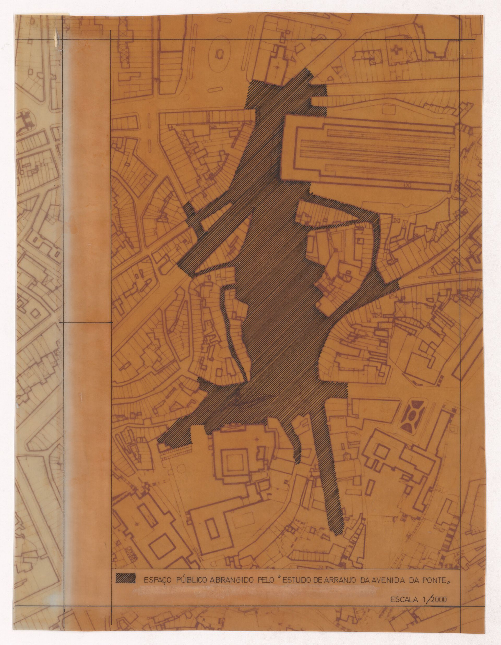
Álvaro Siza, Plan of the area to be included in the urban redevelopment of Avenida da Ponte, Porto, ca. 1968. Sepia diazo print with notes in ink on translucent paper. ARCH289990, AP178.S1.1968.PR03, Álvaro Siza fonds, CCA. Gift of Álvaro Siza © Álvaro Siza
Álvaro Siza presented his first project for Avenida da Ponte in 1968. This marked the beginning of his long-term work with the site, based on an evolving approach to spatial planning and preservation. Instead of following earlier plans for an overpass that would partially cover the cathedral, Siza proposed keeping the avenue at the same level and consolidating the space by mending its edges. On the east side of the avenue, Siza projected a mixed-use ten-story building that would conceal the rocks that had been exposed during construction of the avenue.
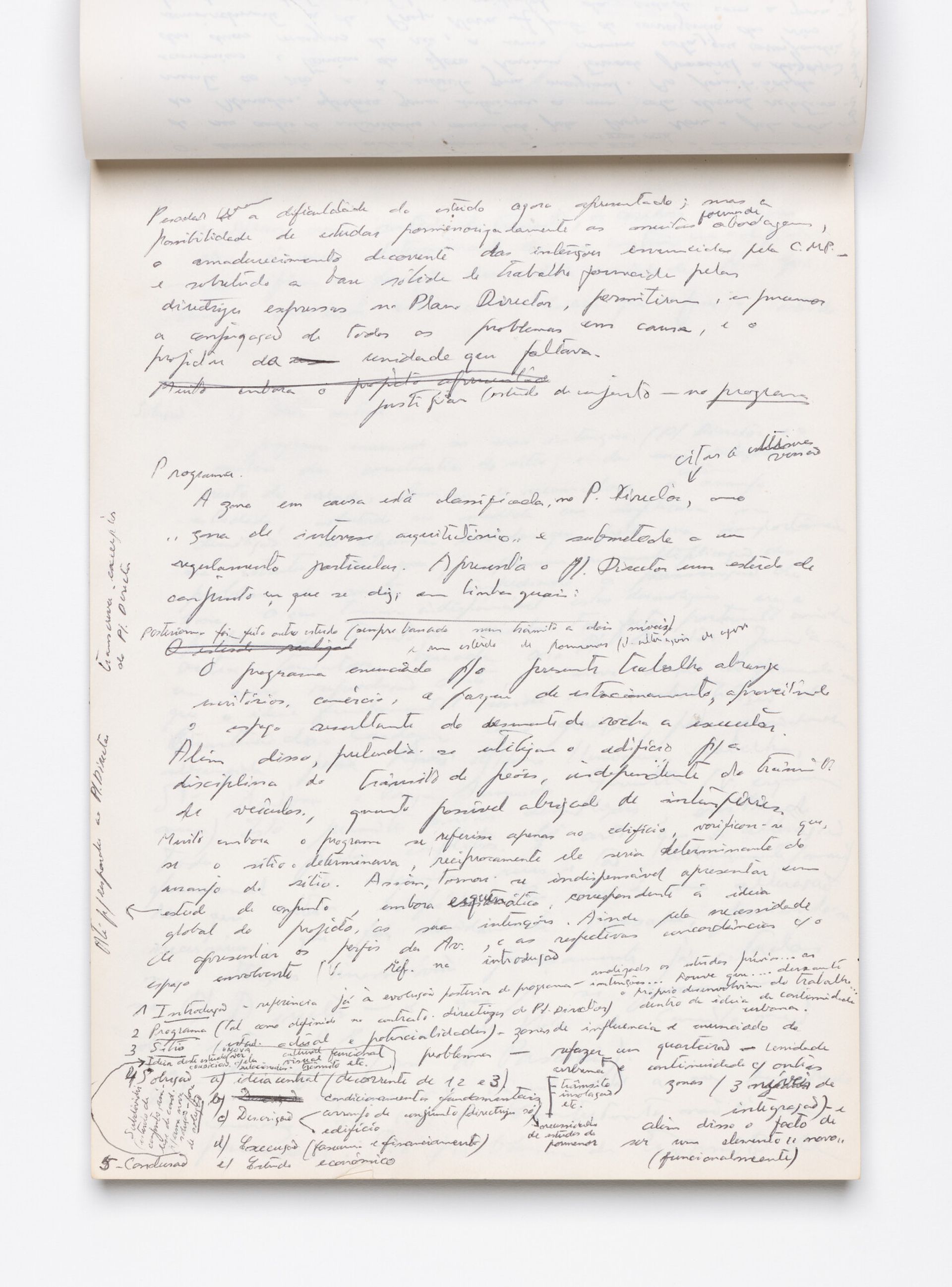
Álvaro Siza, Sketchbook: Av. Da Ponte, 1968. ARCH289935, AP178.S2.1968.002, Álvaro Siza fonds, CCA. Gift of Álvaro Siza © Álvaro Siza
Beyond the difficulty of the study, now presented; but the opportunity to examine [ ] the many {ways of} approaching the issue, the maturation resulting from the intentions endorsed by the [Câmara Municipal do Porto]—and above all, the solid foundation provided by the guidelines set forth in the [Master Plan]—allowed for the compilation of all the issues at hand, and the design of the [ ] unit that was missing.
Although the [ ] project
It was, however, justified by the whole—in the program.
Program
The area in question is designated in the [Master Plan]
{↓ The following text inserted above}{listing the most recent}
as an “area of architectural interest” and, above all, subject to specific regulation. The Master Plan provides an overview that states, in general terms:
The study conducted
Subsequently another study was conducted ([examining] a two-level [traffic flow])
and a detailed study [(See current changes)]
The program outlined in the study encompasses offices, commercial spaces, and parking lots, making use of the space resulting from the excavation.
Although the program referred only to the building, it is evident that, if the site determined it, it would in turn influence the layout of the site. It is essential to present a study of the {even if only to respond to the Master Plan} of the complex, albeit schematic, corresponding to the overall concept of the project and its intentions. Also, due to the need to present the contours of the avenue and the respective alignments with the surrounding space [ ] refer to the introduction.
- 1
- Introduction—already referring to the program’s subsequent evolution— {[cited] previous studies [ ]} … the intentions … it was necessary … during the very development of the project… within the concept of urban continuity.
- 2
- Program (as defined in the contract and the [Master Plan])
- 3
- Site (current conditions and potential). Areas of influence and problem statement—redeveloping a city block—[unit] continuity with other areas (3 levels of integration) and, furthermore, the fact that it is a “new” element (functionally)
- 4
- Solution
- a.
- central idea (derived from 1, 2, and 3)
- b.
- fundamental constraints
- c.
Description—overall layout (guidelines for {the need for studies on [ ]} the building- d.
- Implementation ([ ] and financing)
- e.
- idea Economic study
- 5
- Conclusion {Conclusions of this study (see conditions related to cultural, functional, visual [ ], etc.)}.
{Subdivide (overall study, analysis of conditions for this new solution - alternative solutions)}
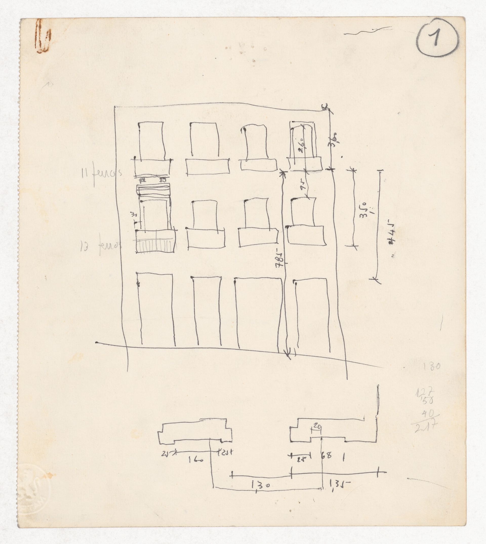
Álvaro Siza, Study of existing historic building on Avenida da Ponte. Ink on paper. ARCH290837, AP178.S1.1968.PR02, Álvaro Siza fonds, CCA. Gift of Álvaro Siza © Álvaro Siza
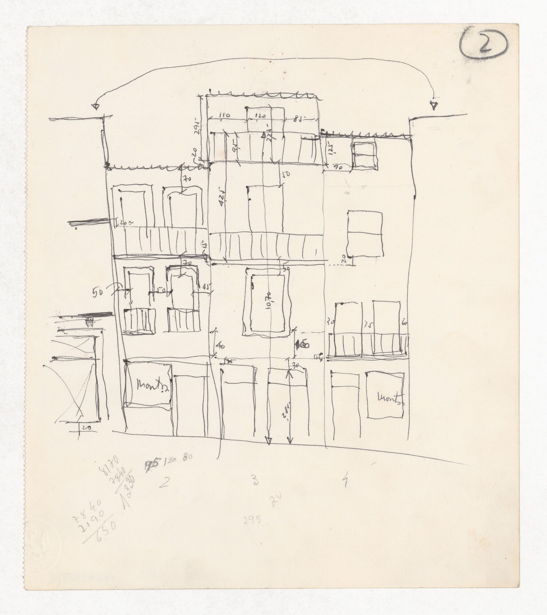
Álvaro Siza, Study of existing historic buildings on Avenida da Ponte. Ink on paper. ARCH290838, AP178.S1.1968.PR02, Álvaro Siza fonds, CCA. Gift of Álvaro Siza © Álvaro Siza
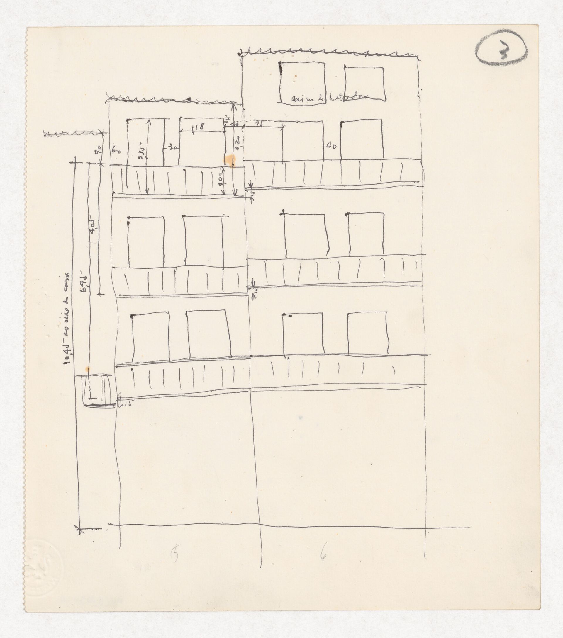
Álvaro Siza, Study of existing historic buildings on Avenida da Ponte. Ink on paper. ARCH290839, AP178.S1.1968.PR02, Álvaro Siza fonds, CCA. Gift of Álvaro Siza © Álvaro Siza
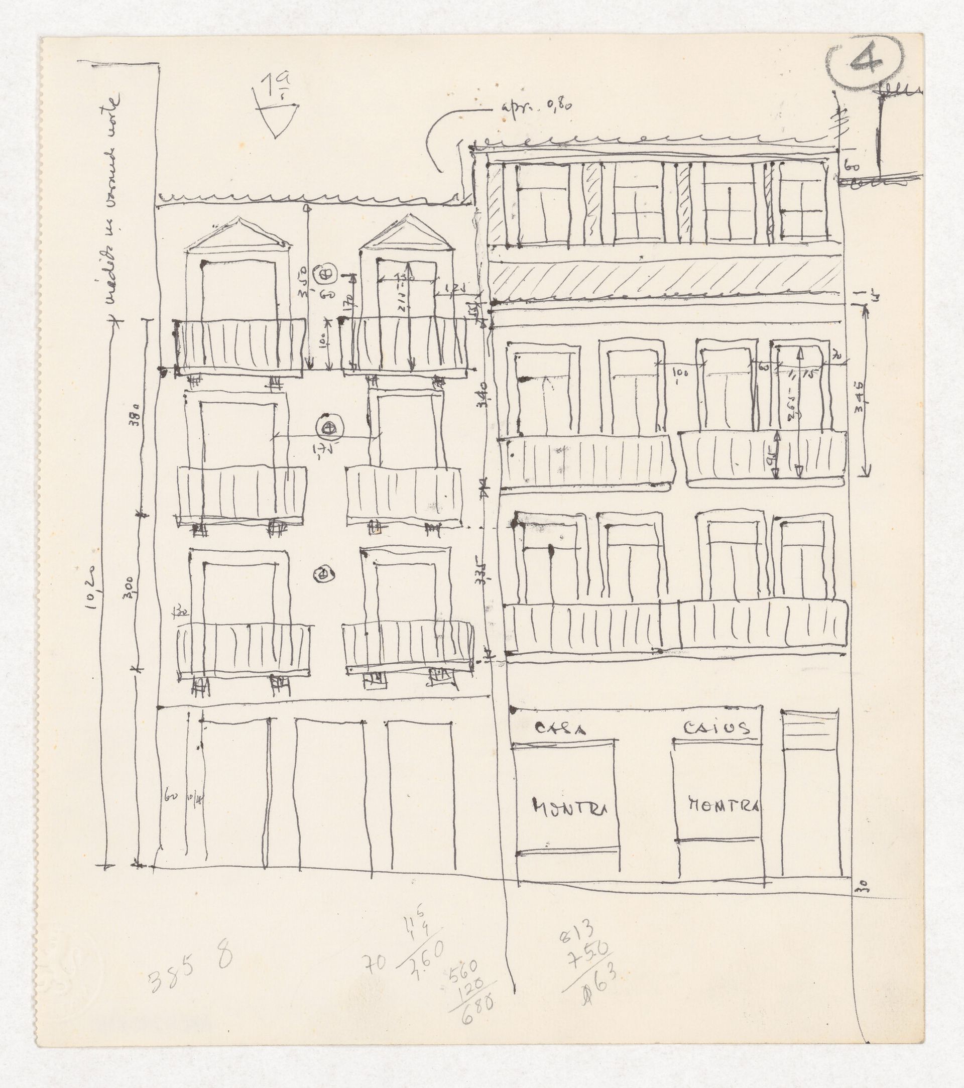
Álvaro Siza, Study of existing historic buildings on Avenida da Ponte. Ink on paper. ARCH290840, AP178.S1.1968.PR02, Álvaro Siza fonds, CCA. Gift of Álvaro Siza © Álvaro Siza
To integrate with its surroundings, the building featured different street-level entrances that accommodated the hill’s slope and incorporated the neighbouring historic structures. Its interior was open to the public, creating a passage that connected the perimeter streets with the lower part of the avenue. The building’s glass facade acted as a mirror reflecting Porto’s layers of historical development. On the other side of the avenue, Siza designed a public space nestled among the exposed rocks, with terraces rising towards the cathedral.
Álvaro Siza, Sketchbook: Av. Da Ponte, 1968. ARCH289935, AP178.S2.1968.002, Álvaro Siza fonds, CCA. Gift of Álvaro Siza © Álvaro Siza
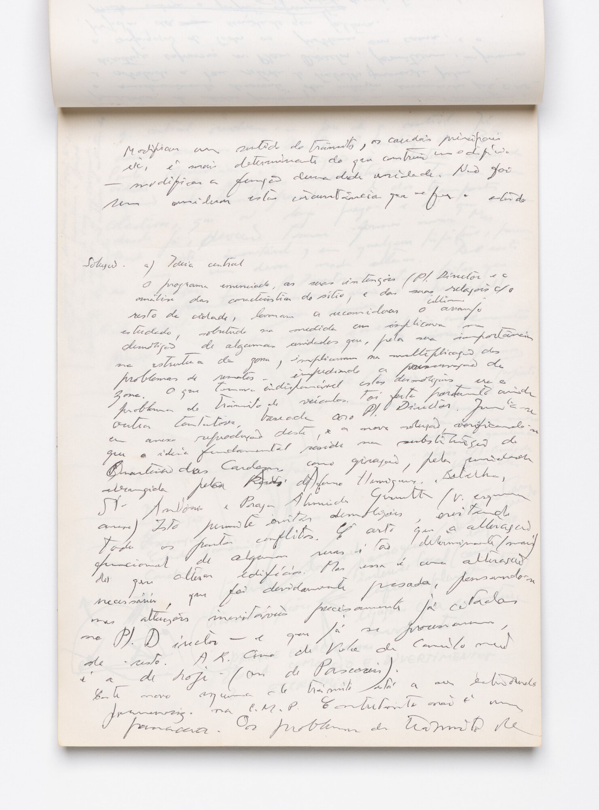
Modifying the flow of traffic, the main arteries, etc., is more decisive than constructing a building—it involves changing the entire function of the system. The study does not refer to these instances.
Solution - a) Central Idea
The program as stated, its intentions (according to the [Master Plan] and the analysis of the site’s characteristics and its relationship with the rest of the city led to a reconsideration of the {[final]} layout being studied, especially since it entailed the demolition of certain buildings which, due to their importance in the area’s structure, would have compounded the problems of [completing the project]—preventing the [preservation] of the area. What made these demolitions indispensable was the vehicle traffic problem.
Yet another attempt was made, based on the [Master Plan]. A copy of this plan is included, and the new solution, show that the fundamental idea lies in replacing the [Quarteirão das Cardosas], as [a development], with the surrounding area covered [by] [Alfermo] Henrique, [ ], [Santo Antonio], and [Praça Almeida Garrett] (See attached diagram). This makes it possible to avoid demolitions, thereby preventing all [ ] conflicts. The [fact] that the functional alteration of some streets is even more decisive than altering buildings. But this is a necessary change, which has been duly considered, taking into account the inevitable changes already mentioned in the [Master Plan]—and which have already taken place.
[…]
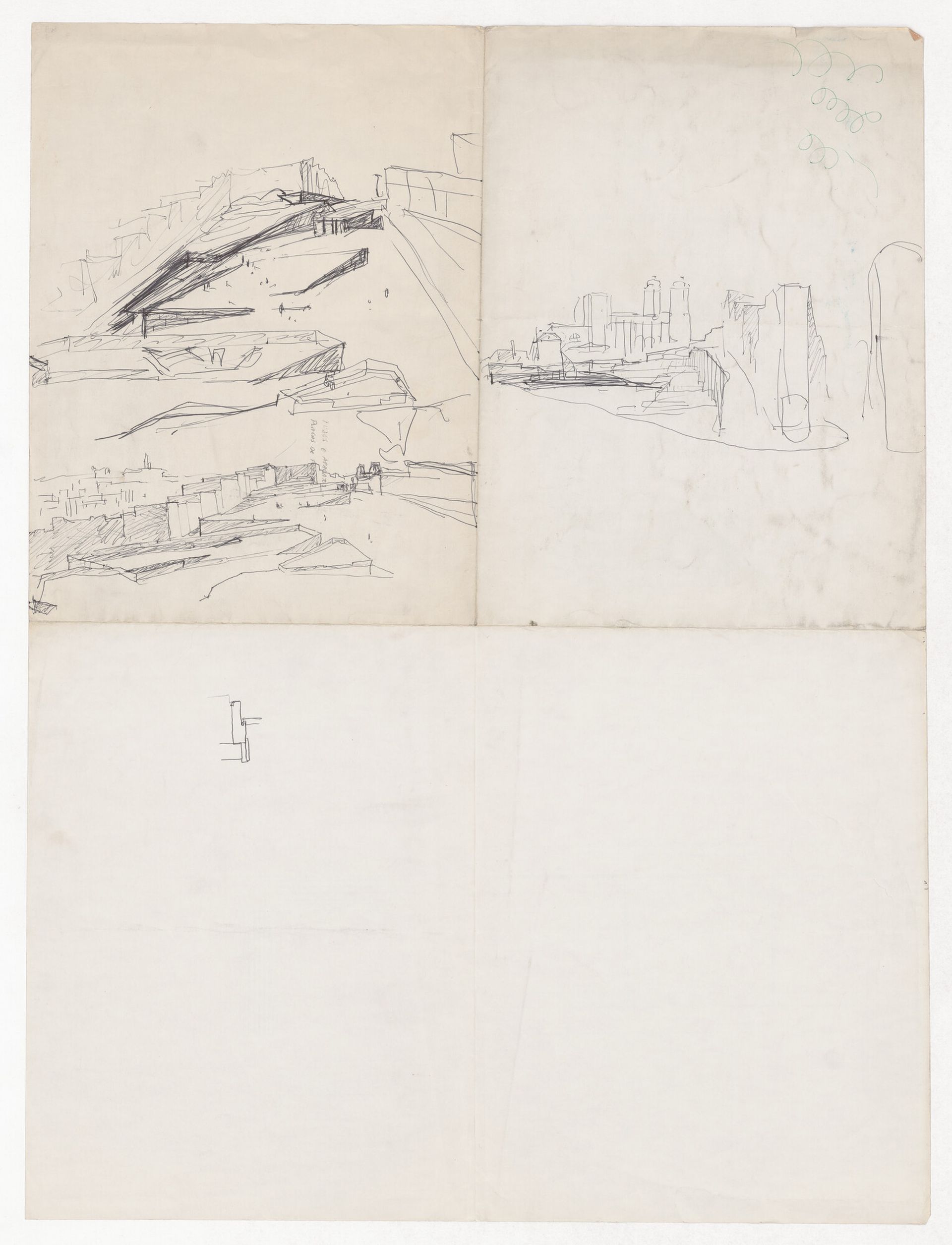
Álvaro Siza, Sketches of the public space on the west side of Avenida da Ponte rising toward the Porto Cathedral, Porto, ca. 1969-1974. Ink on paper. ARCH290791.002, AP178.S1.1968.PR02, Álvaro Siza fonds, CCA. Gift of Álvaro Siza
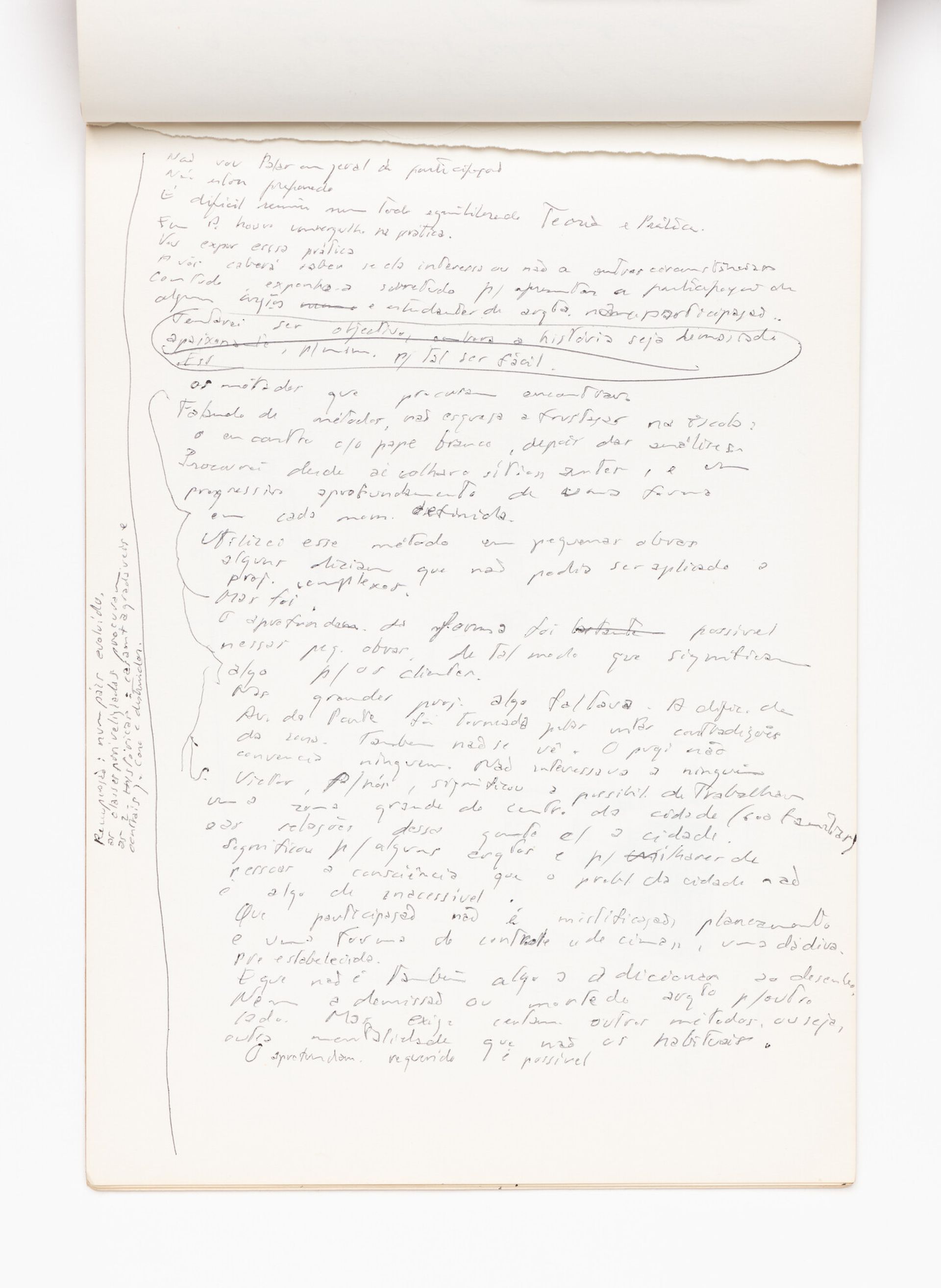
Although Siza’s proposal was never built, his attempt records an understanding of the city and method of working that would resurface in later projects. His words reproduced here echo the lessons learned from a site he would return to repeatedly over his career.
Álvaro Siza, Sketchbook: SAAL, 1974. ARCH292231, AP178.S2.1974.007, Álvaro Siza fonds, CCA. Gift of Álvaro Siza © Álvaro Siza
I won’t speak generally about participation.
I’m not prepared.
It’s difficult to bring theory and practice together into a balanced whole.
In [Planning] there was a deep immersion into practice.
I’ll describe this practice to see if it applies to other circumstances or not; however, I’m describing it primarily to highlight the participation of some architects and architecture students in this project.
I’ll try to be objective, even though the story is far too passionate for me to keep it simple.
[These]
Are the methods they are seeking.
Speaking of methods, I haven’t forgotten the frustration at school: encountering the blank page, after the first analyses. Starting there, I suggest “looking at the site” first and gradually refining a form defined at each moment.
Using this method in small works, some said it couldn’t be applied to more complex projects.
But it was.
It was quite possible to explore the form in greater depth in these small projects, in a way that was meaningful to the clients.
The large projects were missing something. The difference in Avenida da Ponte was created by the many contradictions of the site. You can’t even see it. The reason didn’t convince anyone. No one cared. They came to us, which meant the chance to work on a large project in the city centre (600 families) and these people’s relationship with the city led some architects, and thousands of others, to the realization that the city’s problems are not something inaccessible.
That participation is not a myth, planning, or a form of “top-down control,” nor a pre-established gift.
And neither is it something to be directed toward design. Nor is it the architect’s resignation or the death of another profession. But it requires strategy, other methods, in other words, a different approach than the standard. The required depth is possible.


