


12885 Results
Level of archival description:
Project
Project
Title:
Westpen
Westpen
Reference number:
AP144.S2.D101
Description:
File documents an unexecuted project for Westpen, an animal enclosure for the property at West Green House at Hartley Wintney, in Hampshire, England, and also the location for the project Greenbird (AP144.S2.D96). The pen can be adapted for several uses and its pivoting and sliding gates can be removed when not used for livestock, to be converted into a sculptured landscape for picnicking and leisure activities. Conceptual drawings include diagrammatic sketches which show the movement of animals through the pen for collecting, weighing, cleaning, and shearing. Sketches show pivoting rails, and preliminary plans are annotated with individual gate dimensions. Design development and working drawings illustrate the development of the pen components: 8 ft swing slide and cattle gates; 3 ft sheep gates; a sheep dip and footbath area; a sheep drafting and guillotine gate; and feed bins. Plans and details show the concrete apron and pre-formed gate sockets. Reprographic copies made from a consultant's drawings show the configuration of gates and hurdles. Some material in this file was published in Price-Works II' (London: Architectural Press, 1984), 72, 79. Material in this file was produced between 1977 and 1979. File contains conceptual drawings, design development drawings, model, photographic materials and textual records.
AP144.S2.D101
Description:
File documents an unexecuted project for Westpen, an animal enclosure for the property at West Green House at Hartley Wintney, in Hampshire, England, and also the location for the project Greenbird (AP144.S2.D96). The pen can be adapted for several uses and its pivoting and sliding gates can be removed when not used for livestock, to be converted into a sculptured landscape for picnicking and leisure activities. Conceptual drawings include diagrammatic sketches which show the movement of animals through the pen for collecting, weighing, cleaning, and shearing. Sketches show pivoting rails, and preliminary plans are annotated with individual gate dimensions. Design development and working drawings illustrate the development of the pen components: 8 ft swing slide and cattle gates; 3 ft sheep gates; a sheep dip and footbath area; a sheep drafting and guillotine gate; and feed bins. Plans and details show the concrete apron and pre-formed gate sockets. Reprographic copies made from a consultant's drawings show the configuration of gates and hurdles. Some material in this file was published in Price-Works II' (London: Architectural Press, 1984), 72, 79. Material in this file was produced between 1977 and 1979. File contains conceptual drawings, design development drawings, model, photographic materials and textual records.
People:
Date:
1977-1979
1977-1979
Title:
Westpen
Actions:
AP144.S2.D101
Description:
File documents an unexecuted project for Westpen, an animal enclosure for the property at West Green House at Hartley Wintney, in Hampshire, England, and also the location for the project Greenbird (AP144.S2.D96). The pen can be adapted for several uses and its pivoting and sliding gates can be removed when not used for livestock, to be converted into a sculptured landscape for picnicking and leisure activities. Conceptual drawings include diagrammatic sketches which show the movement of animals through the pen for collecting, weighing, cleaning, and shearing. Sketches show pivoting rails, and preliminary plans are annotated with individual gate dimensions. Design development and working drawings illustrate the development of the pen components: 8 ft swing slide and cattle gates; 3 ft sheep gates; a sheep dip and footbath area; a sheep drafting and guillotine gate; and feed bins. Plans and details show the concrete apron and pre-formed gate sockets. Reprographic copies made from a consultant's drawings show the configuration of gates and hurdles. Some material in this file was published in Price-Works II' (London: Architectural Press, 1984), 72, 79. Material in this file was produced between 1977 and 1979. File contains conceptual drawings, design development drawings, model, photographic materials and textual records.
Westpen
Actions:
AP144.S2.D101
Description:
File documents an unexecuted project for Westpen, an animal enclosure for the property at West Green House at Hartley Wintney, in Hampshire, England, and also the location for the project Greenbird (AP144.S2.D96). The pen can be adapted for several uses and its pivoting and sliding gates can be removed when not used for livestock, to be converted into a sculptured landscape for picnicking and leisure activities. Conceptual drawings include diagrammatic sketches which show the movement of animals through the pen for collecting, weighing, cleaning, and shearing. Sketches show pivoting rails, and preliminary plans are annotated with individual gate dimensions. Design development and working drawings illustrate the development of the pen components: 8 ft swing slide and cattle gates; 3 ft sheep gates; a sheep dip and footbath area; a sheep drafting and guillotine gate; and feed bins. Plans and details show the concrete apron and pre-formed gate sockets. Reprographic copies made from a consultant's drawings show the configuration of gates and hurdles. Some material in this file was published in Price-Works II' (London: Architectural Press, 1984), 72, 79. Material in this file was produced between 1977 and 1979. File contains conceptual drawings, design development drawings, model, photographic materials and textual records.
Level of archival description:
File 101
File 101
Date:
1977-1979
1977-1979
People:
Level of archival description:
Project
Project
Actions:
Reference number:
AP056.S1.1991.PR03
Description:
This project series documents planning for the Westnor Development Project, later called Wittington Place, in North York, Ontario from 1991-1997. The office identified the project number as 9106. This project consisted of a competition entry to develop the area above Highway 401 next to Yonge Street. The large plot of land would be a mix of residential, retail, hotel, office and outdoor spaces. The competition also called for the creation of a sports arena, Canada Coliseum, to be used for professional basketball and hockey. This entry was proposed by New York based firm Ehrenkrantz Eckstut and Whitelaw Architects, working with KPMB, among others.[1] The development was to be carried out in multiple phases, divided by city blocks. The drawings present different schemes for this development, most of which include a large park at its centre. This project was never built. The project is recorded through drawings and a site plan painting dating from 1991-1997. The large part of these drawings are originals and include sketches, model drawings, site plans and surveys, elevations, sections, perspectives and axonometric drawings. These drawings focus primarily on the development of the area as a whole and less on individual buildings. [1] Mark Osbaldeston, Unbuilt Toronto 2: More of the City That Might Have Been (Toronto: Dundurn Press, 2001), 160.
AP056.S1.1991.PR03
Description:
This project series documents planning for the Westnor Development Project, later called Wittington Place, in North York, Ontario from 1991-1997. The office identified the project number as 9106. This project consisted of a competition entry to develop the area above Highway 401 next to Yonge Street. The large plot of land would be a mix of residential, retail, hotel, office and outdoor spaces. The competition also called for the creation of a sports arena, Canada Coliseum, to be used for professional basketball and hockey. This entry was proposed by New York based firm Ehrenkrantz Eckstut and Whitelaw Architects, working with KPMB, among others.[1] The development was to be carried out in multiple phases, divided by city blocks. The drawings present different schemes for this development, most of which include a large park at its centre. This project was never built. The project is recorded through drawings and a site plan painting dating from 1991-1997. The large part of these drawings are originals and include sketches, model drawings, site plans and surveys, elevations, sections, perspectives and axonometric drawings. These drawings focus primarily on the development of the area as a whole and less on individual buildings. [1] Mark Osbaldeston, Unbuilt Toronto 2: More of the City That Might Have Been (Toronto: Dundurn Press, 2001), 160.
People:
Date:
1991-1997
1991-1997
Title:
The Westnor Development Project, North York, Ontario (1991-1997)
Actions:
AP056.S1.1991.PR03
Description:
This project series documents planning for the Westnor Development Project, later called Wittington Place, in North York, Ontario from 1991-1997. The office identified the project number as 9106. This project consisted of a competition entry to develop the area above Highway 401 next to Yonge Street. The large plot of land would be a mix of residential, retail, hotel, office and outdoor spaces. The competition also called for the creation of a sports arena, Canada Coliseum, to be used for professional basketball and hockey. This entry was proposed by New York based firm Ehrenkrantz Eckstut and Whitelaw Architects, working with KPMB, among others.[1] The development was to be carried out in multiple phases, divided by city blocks. The drawings present different schemes for this development, most of which include a large park at its centre. This project was never built. The project is recorded through drawings and a site plan painting dating from 1991-1997. The large part of these drawings are originals and include sketches, model drawings, site plans and surveys, elevations, sections, perspectives and axonometric drawings. These drawings focus primarily on the development of the area as a whole and less on individual buildings. [1] Mark Osbaldeston, Unbuilt Toronto 2: More of the City That Might Have Been (Toronto: Dundurn Press, 2001), 160.
The Westnor Development Project, North York, Ontario (1991-1997)
Actions:
AP056.S1.1991.PR03
Description:
This project series documents planning for the Westnor Development Project, later called Wittington Place, in North York, Ontario from 1991-1997. The office identified the project number as 9106. This project consisted of a competition entry to develop the area above Highway 401 next to Yonge Street. The large plot of land would be a mix of residential, retail, hotel, office and outdoor spaces. The competition also called for the creation of a sports arena, Canada Coliseum, to be used for professional basketball and hockey. This entry was proposed by New York based firm Ehrenkrantz Eckstut and Whitelaw Architects, working with KPMB, among others.[1] The development was to be carried out in multiple phases, divided by city blocks. The drawings present different schemes for this development, most of which include a large park at its centre. This project was never built. The project is recorded through drawings and a site plan painting dating from 1991-1997. The large part of these drawings are originals and include sketches, model drawings, site plans and surveys, elevations, sections, perspectives and axonometric drawings. These drawings focus primarily on the development of the area as a whole and less on individual buildings. [1] Mark Osbaldeston, Unbuilt Toronto 2: More of the City That Might Have Been (Toronto: Dundurn Press, 2001), 160.
Level of archival description:
Project
Project
Date:
1991-1997
1991-1997
People:
Form:
photographs
photographs
Reference number:
AP140.S2.SS1.D19.P4
Description:
views of presentation drawings including site plans, plans, elevations and sectional elevations for the outer wall of students' rooms and residential buildings, and plans for the married fellows maisonettes (row houses), and views of a no longer extant model for the main buildings of the College
AP140.S2.SS1.D19.P4
Description:
views of presentation drawings including site plans, plans, elevations and sectional elevations for the outer wall of students' rooms and residential buildings, and plans for the married fellows maisonettes (row houses), and views of a no longer extant model for the main buildings of the College
People:
Date:
1958 or after
1958 or after
Title:
Views of presentation drawings including site plans
Actions:
AP140.S2.SS1.D19.P4
Description:
views of presentation drawings including site plans, plans, elevations and sectional elevations for the outer wall of students' rooms and residential buildings, and plans for the married fellows maisonettes (row houses), and views of a no longer extant model for the main buildings of the College
Views of presentation drawings including site plans
Actions:
AP140.S2.SS1.D19.P4
Description:
views of presentation drawings including site plans, plans, elevations and sectional elevations for the outer wall of students' rooms and residential buildings, and plans for the married fellows maisonettes (row houses), and views of a no longer extant model for the main buildings of the College
Form:
photographs
photographs
Date:
1958 or after
1958 or after
People:
Level of archival description:
Sub-series
Sub-series
Actions:
Reference number:
AP018.S1.1980.PR09.SS1
Description:
This project series documents the design and construction of an office building for Marathon Realty in Toronto at the corner of York and Front Streets from 1980-1983. The office identified the project number as 8009. The project consisted of two nineteen storey towers with stainless steel and glass exteriors connected by a glass atrium on each floor. Owned and commissioned by Marathon Realty, the majority of the building’s space was designed for rental. Due to this, the design was highly modular with no interior walls on most floors. Each floor was approximately 18,000 square feet. The ground floor consisted of a lobby, a bank and a restaurant. At the beginning of this project, the project was named Marathon Realty Office Building, Front and York Streets. Soon after, the office building became known as University Place, which it is often referred to as in these materials. Eventually, the building would become the headquarters of CitiBank and renamed Citigroup Place. The project is recorded through drawings, photographs, textual records and other materials dating from 1980-1987. The majority of the drawings are located within the textual records and show the design of building details. Other drawings include site surveys, design development drawings, presentation drawings, and construction drawings. The photographs show construction progress, tests, models, and the finished project. The textual records contain the project proposal, contracts, client and contractor correspondence, inter-office memos, meeting minutes, financial records, change orders, supplementary instructions, specifications, detail planning, artist’s portfolios for the building’s art competition, site inspection reports, and schedules. File AP018.S1.1980.PR09.004 contains an index to the textual records, which was created by the office. The CCA also holds materials for a subproject under this project series, which document the installation of signs to the top of the building after the building's construction (AP018.S1.1980.PR09.SS1). Subproject materials are viewed separately from the project due to the different project numbers originally assigned by the office.
AP018.S1.1980.PR09.SS1
Description:
This project series documents the design and construction of an office building for Marathon Realty in Toronto at the corner of York and Front Streets from 1980-1983. The office identified the project number as 8009. The project consisted of two nineteen storey towers with stainless steel and glass exteriors connected by a glass atrium on each floor. Owned and commissioned by Marathon Realty, the majority of the building’s space was designed for rental. Due to this, the design was highly modular with no interior walls on most floors. Each floor was approximately 18,000 square feet. The ground floor consisted of a lobby, a bank and a restaurant. At the beginning of this project, the project was named Marathon Realty Office Building, Front and York Streets. Soon after, the office building became known as University Place, which it is often referred to as in these materials. Eventually, the building would become the headquarters of CitiBank and renamed Citigroup Place. The project is recorded through drawings, photographs, textual records and other materials dating from 1980-1987. The majority of the drawings are located within the textual records and show the design of building details. Other drawings include site surveys, design development drawings, presentation drawings, and construction drawings. The photographs show construction progress, tests, models, and the finished project. The textual records contain the project proposal, contracts, client and contractor correspondence, inter-office memos, meeting minutes, financial records, change orders, supplementary instructions, specifications, detail planning, artist’s portfolios for the building’s art competition, site inspection reports, and schedules. File AP018.S1.1980.PR09.004 contains an index to the textual records, which was created by the office. The CCA also holds materials for a subproject under this project series, which document the installation of signs to the top of the building after the building's construction (AP018.S1.1980.PR09.SS1). Subproject materials are viewed separately from the project due to the different project numbers originally assigned by the office.
People:
Date:
1980-1987
1980-1987
Title:
University Place Building, Front and York Streets, Toronto (1980-1987)
Actions:
AP018.S1.1980.PR09.SS1
Description:
This project series documents the design and construction of an office building for Marathon Realty in Toronto at the corner of York and Front Streets from 1980-1983. The office identified the project number as 8009. The project consisted of two nineteen storey towers with stainless steel and glass exteriors connected by a glass atrium on each floor. Owned and commissioned by Marathon Realty, the majority of the building’s space was designed for rental. Due to this, the design was highly modular with no interior walls on most floors. Each floor was approximately 18,000 square feet. The ground floor consisted of a lobby, a bank and a restaurant. At the beginning of this project, the project was named Marathon Realty Office Building, Front and York Streets. Soon after, the office building became known as University Place, which it is often referred to as in these materials. Eventually, the building would become the headquarters of CitiBank and renamed Citigroup Place. The project is recorded through drawings, photographs, textual records and other materials dating from 1980-1987. The majority of the drawings are located within the textual records and show the design of building details. Other drawings include site surveys, design development drawings, presentation drawings, and construction drawings. The photographs show construction progress, tests, models, and the finished project. The textual records contain the project proposal, contracts, client and contractor correspondence, inter-office memos, meeting minutes, financial records, change orders, supplementary instructions, specifications, detail planning, artist’s portfolios for the building’s art competition, site inspection reports, and schedules. File AP018.S1.1980.PR09.004 contains an index to the textual records, which was created by the office. The CCA also holds materials for a subproject under this project series, which document the installation of signs to the top of the building after the building's construction (AP018.S1.1980.PR09.SS1). Subproject materials are viewed separately from the project due to the different project numbers originally assigned by the office.
University Place Building, Front and York Streets, Toronto (1980-1987)
Actions:
AP018.S1.1980.PR09.SS1
Description:
This project series documents the design and construction of an office building for Marathon Realty in Toronto at the corner of York and Front Streets from 1980-1983. The office identified the project number as 8009. The project consisted of two nineteen storey towers with stainless steel and glass exteriors connected by a glass atrium on each floor. Owned and commissioned by Marathon Realty, the majority of the building’s space was designed for rental. Due to this, the design was highly modular with no interior walls on most floors. Each floor was approximately 18,000 square feet. The ground floor consisted of a lobby, a bank and a restaurant. At the beginning of this project, the project was named Marathon Realty Office Building, Front and York Streets. Soon after, the office building became known as University Place, which it is often referred to as in these materials. Eventually, the building would become the headquarters of CitiBank and renamed Citigroup Place. The project is recorded through drawings, photographs, textual records and other materials dating from 1980-1987. The majority of the drawings are located within the textual records and show the design of building details. Other drawings include site surveys, design development drawings, presentation drawings, and construction drawings. The photographs show construction progress, tests, models, and the finished project. The textual records contain the project proposal, contracts, client and contractor correspondence, inter-office memos, meeting minutes, financial records, change orders, supplementary instructions, specifications, detail planning, artist’s portfolios for the building’s art competition, site inspection reports, and schedules. File AP018.S1.1980.PR09.004 contains an index to the textual records, which was created by the office. The CCA also holds materials for a subproject under this project series, which document the installation of signs to the top of the building after the building's construction (AP018.S1.1980.PR09.SS1). Subproject materials are viewed separately from the project due to the different project numbers originally assigned by the office.
Level of archival description:
Project
Project
Date:
1980-1987
1980-1987
People:
Actions:
Reference number:
PH1986:0900.03
Description:
Album PH1986:0900:03 comprises 42 photographs of the construction of the superstructure of the former Hôtel Roland Bonaparte on avenue d'Iéna, Paris, France, designed by Michel Roux-Spitz. View show the construction sites, a scale model, and exterior and interior views of the building.
PH1986:0900.03
Description:
Album PH1986:0900:03 comprises 42 photographs of the construction of the superstructure of the former Hôtel Roland Bonaparte on avenue d'Iéna, Paris, France, designed by Michel Roux-Spitz. View show the construction sites, a scale model, and exterior and interior views of the building.
People:
Subject:
architecture, engineering
architecture, engineering
Date:
1925-1928
1925-1928
Title:
Surélévation - Iéna - 1925-1928
Actions:
PH1986:0900.03
Description:
Album PH1986:0900:03 comprises 42 photographs of the construction of the superstructure of the former Hôtel Roland Bonaparte on avenue d'Iéna, Paris, France, designed by Michel Roux-Spitz. View show the construction sites, a scale model, and exterior and interior views of the building.
Surélévation - Iéna - 1925-1928
Actions:
PH1986:0900.03
Description:
Album PH1986:0900:03 comprises 42 photographs of the construction of the superstructure of the former Hôtel Roland Bonaparte on avenue d'Iéna, Paris, France, designed by Michel Roux-Spitz. View show the construction sites, a scale model, and exterior and interior views of the building.
Date:
1925-1928
1925-1928
People:
Subject:
architecture, engineering
architecture, engineering
Form:
exhibitions
exhibitions
Description:
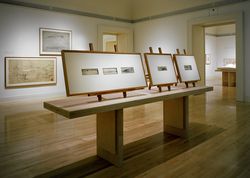
A revolutionary approach to the relationship between building and landscape, which shaped them together according to peculiarly American ideals, is the subject of Frank Lloyd Wright: Designs for an American Landscape, 1922–1932. In this exhibition, the CCA reconstructs five unbuilt, visionary projects that imagined nothing less than a new American landscape, integrating(...)
A revolutionary approach to the relationship between building and landscape, which shaped them together according to peculiarly American ideals, is the subject of Frank Lloyd Wright: Designs for an American Landscape, 1922–1932. In this exhibition, the CCA reconstructs five unbuilt, visionary projects that imagined nothing less than a new American landscape, integrating(...)
Location:
Main galleries
Main galleries
Date:
18 June 1996 to 29 September 1996
18 June 1996 to 29 September 1996
Title:
Frank Lloyd Wright: Designs for an American Landscape, 1922-1932
Actions:
Description:
A revolutionary approach to the relationship between building and landscape, which shaped them together according to peculiarly American ideals, is the subject of Frank Lloyd Wright: Designs for an American Landscape, 1922–1932. In this exhibition, the CCA reconstructs five unbuilt, visionary projects that imagined nothing less than a new American landscape, integrating(...)
Frank Lloyd Wright: Designs for an American Landscape, 1922-1932
Actions:
Description:
A revolutionary approach to the relationship between building and landscape, which shaped them together according to peculiarly American ideals, is the subject of Frank Lloyd Wright: Designs for an American Landscape, 1922–1932. In this exhibition, the CCA reconstructs five unbuilt, visionary projects that imagined nothing less than a new American landscape, integrating(...)
Form:
exhibitions
exhibitions
Date:
18 June 1996 to
29 September 1996
18 June 1996 to
29 September 1996
Location:
Main galleries
Main galleries
Form:
drawings
Quantity:
157 conceptual drawing(s)
drawings
Quantity:
157 conceptual drawing(s)
Reference number:
DR2004:1119
Description:
sketches, some with annotations, perspectives, sections, plans, elevations, design development drawings, site plans, details, measured sketches, axonometrics, photographs of model, diagrams, overlays, maps, notes, clippings, calculations, consultant's drawing, reference drawing, view of a drawing, proposal poster, proposal brochure, and postcard
DR2004:1119
Description:
sketches, some with annotations, perspectives, sections, plans, elevations, design development drawings, site plans, details, measured sketches, axonometrics, photographs of model, diagrams, overlays, maps, notes, clippings, calculations, consultant's drawing, reference drawing, view of a drawing, proposal poster, proposal brochure, and postcard
People:
Title:
Sketches, some with annotations, perspectives, sections
Actions:
DR2004:1119
Description:
sketches, some with annotations, perspectives, sections, plans, elevations, design development drawings, site plans, details, measured sketches, axonometrics, photographs of model, diagrams, overlays, maps, notes, clippings, calculations, consultant's drawing, reference drawing, view of a drawing, proposal poster, proposal brochure, and postcard
Sketches, some with annotations, perspectives, sections
Actions:
DR2004:1119
Description:
sketches, some with annotations, perspectives, sections, plans, elevations, design development drawings, site plans, details, measured sketches, axonometrics, photographs of model, diagrams, overlays, maps, notes, clippings, calculations, consultant's drawing, reference drawing, view of a drawing, proposal poster, proposal brochure, and postcard
Form:
drawings
Quantity:
157 conceptual drawing(s)
drawings
Quantity:
157 conceptual drawing(s)
People:
Form:
photographs
photographs
Actions:
Reference number:
AP140.S2.SS7.D1.P18
Description:
interior and exterior views and views of drawings for Camberwell School Assembly Hall, Brunswick Park Primary School, and of Leicester University Engineering Building, views of existing Queen Alexandra Military Hospital buildings and of Clore Gallery, and of model for Tate Gallery New Museums project
AP140.S2.SS7.D1.P18
Description:
interior and exterior views and views of drawings for Camberwell School Assembly Hall, Brunswick Park Primary School, and of Leicester University Engineering Building, views of existing Queen Alexandra Military Hospital buildings and of Clore Gallery, and of model for Tate Gallery New Museums project
People:
Title:
Interior and exterior views and views of drawings for Camberwell School Assembly Hall
Actions:
AP140.S2.SS7.D1.P18
Description:
interior and exterior views and views of drawings for Camberwell School Assembly Hall, Brunswick Park Primary School, and of Leicester University Engineering Building, views of existing Queen Alexandra Military Hospital buildings and of Clore Gallery, and of model for Tate Gallery New Museums project
Interior and exterior views and views of drawings for Camberwell School Assembly Hall
Actions:
AP140.S2.SS7.D1.P18
Description:
interior and exterior views and views of drawings for Camberwell School Assembly Hall, Brunswick Park Primary School, and of Leicester University Engineering Building, views of existing Queen Alexandra Military Hospital buildings and of Clore Gallery, and of model for Tate Gallery New Museums project
Form:
photographs
photographs
People:
Form:
events
events
Title:
Learning from... Saadiyat
Learning from... Saadiyat
Actions:
Description:
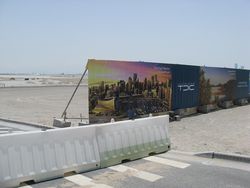
Saadiyat Island is a “dreamscape” created by Tourism Development Investment Company just half a kilometer from downtown Abu Dhabi. It is an amalgam of luxury residential areas, 5-star resorts and golf courses crowned by a Cultural District containing a hallucinatory collection of museums designed by five Pritzker Prize winners. Is this the future of private(...)
Saadiyat Island is a “dreamscape” created by Tourism Development Investment Company just half a kilometer from downtown Abu Dhabi. It is an amalgam of luxury residential areas, 5-star resorts and golf courses crowned by a Cultural District containing a hallucinatory collection of museums designed by five Pritzker Prize winners. Is this the future of private(...)
Location:
Paul-Desmarais Theatre
Paul-Desmarais Theatre
Date:
21 August 2014 , 6pm
21 August 2014 , 6pm
Title:
Learning from... Saadiyat
Actions:
Description:
Saadiyat Island is a “dreamscape” created by Tourism Development Investment Company just half a kilometer from downtown Abu Dhabi. It is an amalgam of luxury residential areas, 5-star resorts and golf courses crowned by a Cultural District containing a hallucinatory collection of museums designed by five Pritzker Prize winners. Is this the future of private(...)
Learning from... Saadiyat
Actions:
Description:
Saadiyat Island is a “dreamscape” created by Tourism Development Investment Company just half a kilometer from downtown Abu Dhabi. It is an amalgam of luxury residential areas, 5-star resorts and golf courses crowned by a Cultural District containing a hallucinatory collection of museums designed by five Pritzker Prize winners. Is this the future of private(...)
Form:
events
events
Date:
21 August 2014
6pm
21 August 2014
6pm
Location:
Paul-Desmarais Theatre
Paul-Desmarais Theatre
Form:
drawings
Quantity:
128 design development drawing(s)
drawings
Quantity:
128 design development drawing(s)
Reference number:
DR2004:1143
Description:
sketches, some with annotations, plans, conceptual drawings, perspectives, elevations, sections, views of site, measured sketches, comparison drawings, reference drawings, site plans, axonometrics, details, maps, clippings, publication drawings, layouts for publication, printing instructions, views of model, notes, labels, diagram, grid, and memorandum
DR2004:1143
Description:
sketches, some with annotations, plans, conceptual drawings, perspectives, elevations, sections, views of site, measured sketches, comparison drawings, reference drawings, site plans, axonometrics, details, maps, clippings, publication drawings, layouts for publication, printing instructions, views of model, notes, labels, diagram, grid, and memorandum
People:
Title:
Sketches, some with annotations, plans, conceptual drawings
Actions:
DR2004:1143
Description:
sketches, some with annotations, plans, conceptual drawings, perspectives, elevations, sections, views of site, measured sketches, comparison drawings, reference drawings, site plans, axonometrics, details, maps, clippings, publication drawings, layouts for publication, printing instructions, views of model, notes, labels, diagram, grid, and memorandum
Sketches, some with annotations, plans, conceptual drawings
Actions:
DR2004:1143
Description:
sketches, some with annotations, plans, conceptual drawings, perspectives, elevations, sections, views of site, measured sketches, comparison drawings, reference drawings, site plans, axonometrics, details, maps, clippings, publication drawings, layouts for publication, printing instructions, views of model, notes, labels, diagram, grid, and memorandum
Form:
drawings
Quantity:
128 design development drawing(s)
drawings
Quantity:
128 design development drawing(s)
People:


