2473 Résultats
Classification:
articles
articles

Actions:
Dossier:
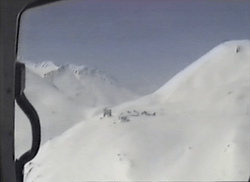
Notre client, la planète
Notre client, la planète
Mot(s)-clé(s):
Canada, environnement, changement climatique, premières nations, autochtones, constitution
Canada, environnement, changement climatique, premières nations, autochtones, constitution
Publié:
22 décembre 2016
22 décembre 2016
Dossier:
Notre client, la planète
Notre client, la planète
Classification:
documents textuels
documents textuels
Numéro de référence:
ARCH276060
Description:
16 files - Group contains office files labeled, "AE General" followed by subjects. Contains: correspondence: David Boulva Cleve; miscellaneous notes; miscellaneous correspondence; personnel applications; visitors to office; personnel correspondence; articles Re climate; biography proofs correspondence; Darlington Amenity Research Trust - Michael Dower; Keith Loffler; energy codes; furniture orders - misc.; Arcology Consultation Service; Bing Thom Association; MacMillan Building renovations, contract documents.
Personnes et institutions:
Date:
1975-1980
1975-1980
Titre:
Correspondence, notes, contract and furniture orders from Erickson's office
Actions:
ARCH276060
Description:
16 files - Group contains office files labeled, "AE General" followed by subjects. Contains: correspondence: David Boulva Cleve; miscellaneous notes; miscellaneous correspondence; personnel applications; visitors to office; personnel correspondence; articles Re climate; biography proofs correspondence; Darlington Amenity Research Trust - Michael Dower; Keith Loffler; energy codes; furniture orders - misc.; Arcology Consultation Service; Bing Thom Association; MacMillan Building renovations, contract documents.
Classification:
documents textuels
documents textuels
Date:
1975-1980
1975-1980
Personnes et institutions:
Niveau de description archivistique:
Projet
Projet
Numéro de référence:
AP027.S1.D68
Description:
Building in the North: A study of responses to the northern environment and of building experiences in northern climates. The study was published in two volumes: Building in the North, a study of building conditions and responses; and Building in the North II, a compendium of experiences in construction buildings and communities in the North. Mackenzie Pipeline: A study of the impact of a proposed pipeline from the Arctic up the Mackenzie River valley on the people and communities of the Mackenzie region. The commission included environmental, social, economic, construction and logistical considerations. An "Atlas of the Communities of the Mackenzie" was prepared and published by van Ginkel Associates and distributed to all communities and groups in the western Northwest Territories at an early stage of the study. The final published report is titled "Communities of the Mackenzie".
Personnes et institutions:
Sujet:
urbanisme
urbanisme
Date:
1976
1976
Titre:
Building in the North & Mackenzie Pipeline
Actions:
AP027.S1.D68
Description:
Building in the North: A study of responses to the northern environment and of building experiences in northern climates. The study was published in two volumes: Building in the North, a study of building conditions and responses; and Building in the North II, a compendium of experiences in construction buildings and communities in the North. Mackenzie Pipeline: A study of the impact of a proposed pipeline from the Arctic up the Mackenzie River valley on the people and communities of the Mackenzie region. The commission included environmental, social, economic, construction and logistical considerations. An "Atlas of the Communities of the Mackenzie" was prepared and published by van Ginkel Associates and distributed to all communities and groups in the western Northwest Territories at an early stage of the study. The final published report is titled "Communities of the Mackenzie".
Niveau de description archivistique:
File 68
File 68
Date:
1976
1976
Personnes et institutions:
Sujet:
urbanisme
urbanisme
Classification:
documents textuels
documents textuels
Numéro de référence:
ARCH256787
Description:
2 files - correspondence, transmittals, pages from reports (Winnipeg Parking Authority, Central Business District Parking, Parking Demand Study) showing selected sites; Planning report from 1969, draft of planning report, Transportaion Study vol. 3 Projections and Recommendations, Feasibility Study for Pedestrian Concourse by Smith, Carter and Searle, Parking Authority Annual Report, Climate Controlled Central Business Core proposal by Waisman, Ross, Blankstein, etc. architects.
Personnes et institutions:
Date:
1969-1971
1969-1971
Titre:
Correspondence, transmittals, pages from reports
Actions:
ARCH256787
Description:
2 files - correspondence, transmittals, pages from reports (Winnipeg Parking Authority, Central Business District Parking, Parking Demand Study) showing selected sites; Planning report from 1969, draft of planning report, Transportaion Study vol. 3 Projections and Recommendations, Feasibility Study for Pedestrian Concourse by Smith, Carter and Searle, Parking Authority Annual Report, Climate Controlled Central Business Core proposal by Waisman, Ross, Blankstein, etc. architects.
Classification:
documents textuels
documents textuels
Date:
1969-1971
1969-1971
Personnes et institutions:
Classification:
expositions
expositions
Titre:
Espaces oscillants
Espaces oscillants
Actions:
Localisation:
Salle octogonale
Salle octogonale
Date:
25 avril 2025 au 1 février 2026
25 avril 2025 au 1 février 2026
Classification:
expositions
expositions
Date:
25 avril 2025 au
1 février 2026
25 avril 2025 au
1 février 2026
Localisation:
Salle octogonale
Salle octogonale
Classification:
né numérique
Quantité:
29 digital file(s)
né numérique
Quantité:
29 digital file(s)
Numéro de référence:
AP174.S1.2001.D1.001
Description:
Contains minutes of meetings between the Emergent Design Group and the engineering firm Arup NY held in July 2002 on the Carbon Tower, as well as related 3D CAD structure diagrams, sketches and CAD drawings related to climate control, and some reference material on composite materials. Original directory name: "_ref_ARUP". Most common file formats: AutoCAD Drawing, Microsoft Word Document, 3D Studio, DS_store file (MAC), Tagged Image File Format
Personnes et institutions:
Date:
2002
2002
Titre:
Emergent Design Group consultation with Arup Consulting Engineers, New York
Actions:
AP174.S1.2001.D1.001
Description:
Contains minutes of meetings between the Emergent Design Group and the engineering firm Arup NY held in July 2002 on the Carbon Tower, as well as related 3D CAD structure diagrams, sketches and CAD drawings related to climate control, and some reference material on composite materials. Original directory name: "_ref_ARUP". Most common file formats: AutoCAD Drawing, Microsoft Word Document, 3D Studio, DS_store file (MAC), Tagged Image File Format
Classification:
né numérique
Quantité:
29 digital file(s)
né numérique
Quantité:
29 digital file(s)
Date:
2002
2002
Personnes et institutions:
Classification:
événements
événements
Actions:
Localisation:
en ligne Mot(s)-clé(s):
Outils d’aujourd’hui, carbonne, climat, , Nida Rehman, Hans Ibelings, Pujita Guha, Jordan Kinder
en ligne Mot(s)-clé(s):
Outils d’aujourd’hui, carbonne, climat, , Nida Rehman, Hans Ibelings, Pujita Guha, Jordan Kinder
Date:
11 juillet 2022 au 20 juillet 2022
11 juillet 2022 au 20 juillet 2022
Classification:
événements
événements
Date:
11 juillet 2022 au
20 juillet 2022
11 juillet 2022 au
20 juillet 2022
Localisation:
en ligne Mot(s)-clé(s):
Outils d’aujourd’hui, carbonne, climat, , Nida Rehman, Hans Ibelings, Pujita Guha, Jordan Kinder
en ligne Mot(s)-clé(s):
Outils d’aujourd’hui, carbonne, climat, , Nida Rehman, Hans Ibelings, Pujita Guha, Jordan Kinder
Niveau de description archivistique:
Projet
Projet
Numéro de référence:
AP164.S1.1999.D10
Description:
The project series documents the competition entry for the mixed-use tower “El Mirador” in the Bay of Algeciras. The firm was invited to submit their design proposal which won second prize. The competition was organised by the Algeciras City Council. The firm identified this project as number 123. “The project attempts to express, with an architectural gesture, the beauty of the geography of Algeciras: the bay, the port, the Rock and the Straits of Gibraltar, the proximity of Ceuta and Africa, the cork-oak forests that surround the town. For this [Abalos & Herreros] propose a building that, from a single body, opens out into two towers from one great public viewing platform. This form has strategic holes giving onto the more notable topographical features, establishing a physical relationship with them, while the section is organized as a gradient of privacy that increases with height. The competition […] proposed a mixed programme in a posture parallel to the great avenue of the harbour of Algeciras. An evanescent building apparently fragile appears to let one being stimulated by the effects of the climate and the atmospheric phenomenons with an appearance changing with the function of the hours of the day or the season. Its layered section attends ascending to the different landscapes of the city: first public space, second the cities skyline and at last the 360° horizon rising above the city.” (ARCH270975) Abalos & Herreros worked with Ángel Jaramillo, Renata Sentkiewicz, Jakob Hense. Documenting this project are conceptual, design development and presentation drawings, cartographic and graphic materials, and competition records.
Personnes et institutions:
Date:
circa 1999
circa 1999
Titre:
El mirador: torre mixta en la Bahía de Algeciras, Spain (1999)
Actions:
AP164.S1.1999.D10
Description:
The project series documents the competition entry for the mixed-use tower “El Mirador” in the Bay of Algeciras. The firm was invited to submit their design proposal which won second prize. The competition was organised by the Algeciras City Council. The firm identified this project as number 123. “The project attempts to express, with an architectural gesture, the beauty of the geography of Algeciras: the bay, the port, the Rock and the Straits of Gibraltar, the proximity of Ceuta and Africa, the cork-oak forests that surround the town. For this [Abalos & Herreros] propose a building that, from a single body, opens out into two towers from one great public viewing platform. This form has strategic holes giving onto the more notable topographical features, establishing a physical relationship with them, while the section is organized as a gradient of privacy that increases with height. The competition […] proposed a mixed programme in a posture parallel to the great avenue of the harbour of Algeciras. An evanescent building apparently fragile appears to let one being stimulated by the effects of the climate and the atmospheric phenomenons with an appearance changing with the function of the hours of the day or the season. Its layered section attends ascending to the different landscapes of the city: first public space, second the cities skyline and at last the 360° horizon rising above the city.” (ARCH270975) Abalos & Herreros worked with Ángel Jaramillo, Renata Sentkiewicz, Jakob Hense. Documenting this project are conceptual, design development and presentation drawings, cartographic and graphic materials, and competition records.
Niveau de description archivistique:
Project
Project
Date:
circa 1999
circa 1999
Personnes et institutions:
Classification:
événements
événements

Titre:
Renouveler notre perspective
Catalyser les savoirs basés sur le lieu pour un avenir holistique
Renouveler notre perspective
Catalyser les savoirs basés sur le lieu pour un avenir holistique
Actions:
Localisation:
Maison Shaughnessy, CCA Mot(s)-clé(s):
Design autochtone, pratiques basées sur le lieu, connaissances basées sur le lieu, pédagogie, environnement, crise climatique, apprentissage sur le terrain
Maison Shaughnessy, CCA Mot(s)-clé(s):
Design autochtone, pratiques basées sur le lieu, connaissances basées sur le lieu, pédagogie, environnement, crise climatique, apprentissage sur le terrain
Date:
24 février 2024, 14h à 15h30
24 février 2024, 14h à 15h30
Classification:
événements
événements
Date:
24 février 2024
14h à 15h30
24 février 2024
14h à 15h30
Localisation:
Maison Shaughnessy, CCA Mot(s)-clé(s):
Design autochtone, pratiques basées sur le lieu, connaissances basées sur le lieu, pédagogie, environnement, crise climatique, apprentissage sur le terrain
Maison Shaughnessy, CCA Mot(s)-clé(s):
Design autochtone, pratiques basées sur le lieu, connaissances basées sur le lieu, pédagogie, environnement, crise climatique, apprentissage sur le terrain
Classification:
articles
articles
Titre:
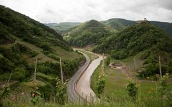
La rivière et le risque
La rivière et le risque
Actions:
Leonie Hartung s’interroge sur le sens de la protection juridique d’un paysage (fluvial) quand le concept même de paysage est ambigu et contestable
Dossier:
Pour votre sécurité
Pour votre sécurité
Mot(s)-clé(s):
Pour votre securité, photographie, paysage, paysage fluvial, inondations, Allemagne, vallée de l'Ahr, Rhénanie-Palatinat, conservation des paysages, protection des paysages, AfD, Heimat
Pour votre securité, photographie, paysage, paysage fluvial, inondations, Allemagne, vallée de l'Ahr, Rhénanie-Palatinat, conservation des paysages, protection des paysages, AfD, Heimat
Publié:
2 juillet 2024
2 juillet 2024
Titre:
La rivière et le risque
Leonie Hartung s’interroge sur le sens de la protection juridique d’un paysage (fluvial) quand le concept même de paysage est ambigu et contestable
Actions:
La rivière et le risque
Leonie Hartung s’interroge sur le sens de la protection juridique d’un paysage (fluvial) quand le concept même de paysage est ambigu et contestable
Actions:
Dossier:
Pour votre sécurité
Pour votre sécurité