94 Résultats
Classification:
livres
livres
Titre:
Cartographies of time
Cartographies of time
Actions:
Prix:
$60.00
(disponible sur commande)
Résumé:
This book is the first comprehensive history of graphic representations of time in Europe and the United States from 1450 to the present. The authors have crafted a lively history featuring fanciful characters and unexpected twists and turns. From medieval manuscripts to websites, this book features a wide variety of timelines that in their own unique ways—curving,(...)
Publication:
mars 2010
mars 2010
Titre:
Cartographies of time
Actions:
Prix:
$60.00
(disponible sur commande)
Résumé:
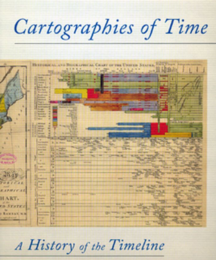
This book is the first comprehensive history of graphic representations of time in Europe and the United States from 1450 to the present. The authors have crafted a lively history featuring fanciful characters and unexpected twists and turns. From medieval manuscripts to websites, this book features a wide variety of timelines that in their own unique ways—curving, crossing, branching—defy conventional thinking about the form. A fifty-four-foot-long timeline from 1753 is mounted on a scroll and encased in a protective box. Another timeline uses the different parts of the human body to show the genealogies of Jesus Christ and the rulers of Saxony.
Cartographies of time
Actions:
Prix:
$60.00
(disponible sur commande)
Résumé:
This book is the first comprehensive history of graphic representations of time in Europe and the United States from 1450 to the present. The authors have crafted a lively history featuring fanciful characters and unexpected twists and turns. From medieval manuscripts to websites, this book features a wide variety of timelines that in their own unique ways—curving, crossing, branching—defy conventional thinking about the form. A fifty-four-foot-long timeline from 1753 is mounted on a scroll and encased in a protective box. Another timeline uses the different parts of the human body to show the genealogies of Jesus Christ and the rulers of Saxony.
Classification:
livres
livres
Publication:
mars 2010
mars 2010
Classification:
livres
livres
Prix:
$69.95
(disponible sur commande)
Résumé:
Demonstrating how cartography is a valuable instrument for urban research, this cartographic book reveals the impact of infrastructure on a region's development in an original manner. Bieke Cattoor has mapped and analysed the roads, railways and communications network of Belgium's Kortrijk region, overlaying them with historical and topical information. With this(...)
Titre:
Figures, Infrastructures: an atlas of roads and railways
Actions:
Prix:
$69.95
(disponible sur commande)
Résumé:
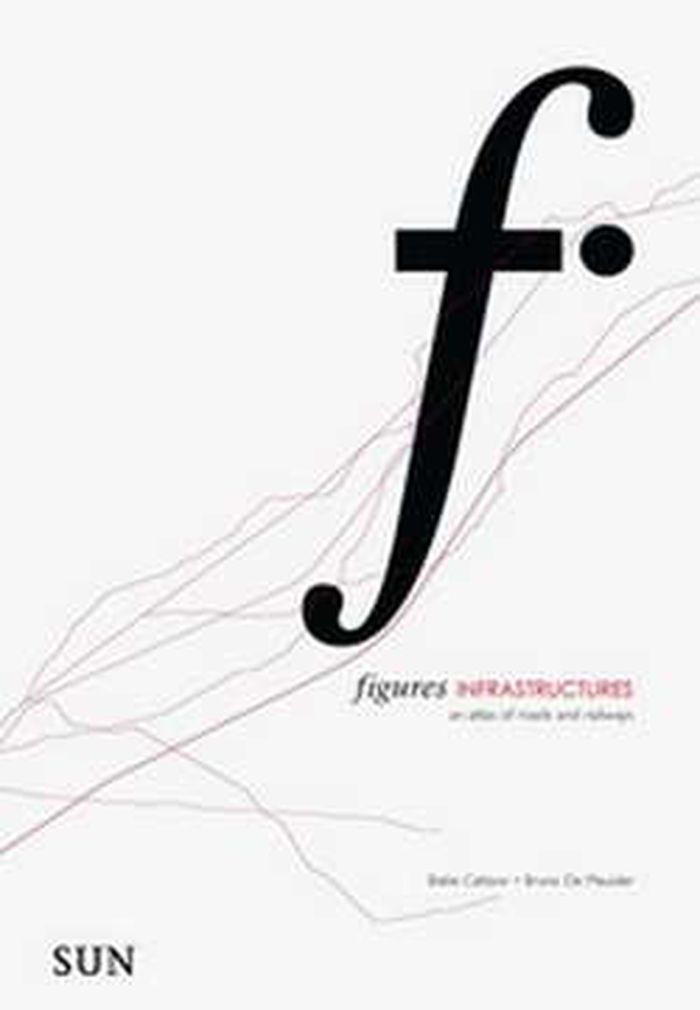
Demonstrating how cartography is a valuable instrument for urban research, this cartographic book reveals the impact of infrastructure on a region's development in an original manner. Bieke Cattoor has mapped and analysed the roads, railways and communications network of Belgium's Kortrijk region, overlaying them with historical and topical information. With this perspective, the varied elements in an infrastructural network are clarified, and Cattoor identifies how roads and railways form related patterns and lead to nodes. The book reveals the complexity of our layered urban landscape with a new and simple representational method, and suggests how this method can be deployed in urban research as a whole.
Figures, Infrastructures: an atlas of roads and railways
Actions:
Prix:
$69.95
(disponible sur commande)
Résumé:
Demonstrating how cartography is a valuable instrument for urban research, this cartographic book reveals the impact of infrastructure on a region's development in an original manner. Bieke Cattoor has mapped and analysed the roads, railways and communications network of Belgium's Kortrijk region, overlaying them with historical and topical information. With this perspective, the varied elements in an infrastructural network are clarified, and Cattoor identifies how roads and railways form related patterns and lead to nodes. The book reveals the complexity of our layered urban landscape with a new and simple representational method, and suggests how this method can be deployed in urban research as a whole.
Classification:
livres
livres
Publication:
novembre 2010
novembre 2010
Classification:
livres
livres
Titre:
Metropolis: mapping the city
Metropolis: mapping the city
Actions:
Prix:
$63.95
(disponible sur commande)
Résumé:
This volume looks at the development of the mapping and representation of the city revealing how we organize the urban space. From skyline profiles, bird's eye views and panoramas, to the schematic maps of transport networks and road layouts to help us navigate, and statistical maps that can provide information on human aspirations, cities can reveal themselves in many(...)
Titre:
Metropolis: mapping the city
Actions:
Prix:
$63.95
(disponible sur commande)
Résumé:
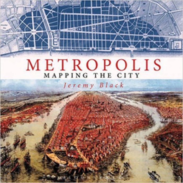
This volume looks at the development of the mapping and representation of the city revealing how we organize the urban space. From skyline profiles, bird's eye views and panoramas, to the schematic maps of transport networks and road layouts to help us navigate, and statistical maps that can provide information on human aspirations, cities can reveal themselves in many ways. Focusing on key points in the development of urban representation and including visions of the future of how we would be living today, this enlightening book illustrates some of the oldest, youngest, liveliest, and most contested cities in the world
Metropolis: mapping the city
Actions:
Prix:
$63.95
(disponible sur commande)
Résumé:
This volume looks at the development of the mapping and representation of the city revealing how we organize the urban space. From skyline profiles, bird's eye views and panoramas, to the schematic maps of transport networks and road layouts to help us navigate, and statistical maps that can provide information on human aspirations, cities can reveal themselves in many ways. Focusing on key points in the development of urban representation and including visions of the future of how we would be living today, this enlightening book illustrates some of the oldest, youngest, liveliest, and most contested cities in the world
Classification:
livres
livres
Publication:
novembre 2015
novembre 2015
Classification:
livres
livres
Prix:
$44.00
(disponible sur commande)
Résumé:
The life and legend of New York City, from the size of its skyscrapers to the ways of its inhabitants, is vividly captured in this collection of more than 250 maps, cross sections, ?owcharts, tables, board games, cartoons and infographics, and other unique diagrams spanning 150 years. Superstars such as Saul Steinberg, Maira Kalman, Christoph Niemann, Roz Chast, and(...)
Publication:
avril 2021
avril 2021
Titre:
Decoding Manhattan: island of diagrams, maps, and graphics
Actions:
Prix:
$44.00
(disponible sur commande)
Résumé:
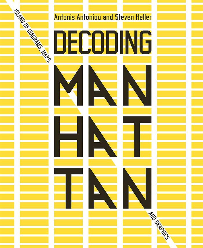
The life and legend of New York City, from the size of its skyscrapers to the ways of its inhabitants, is vividly captured in this collection of more than 250 maps, cross sections, ?owcharts, tables, board games, cartoons and infographics, and other unique diagrams spanning 150 years. Superstars such as Saul Steinberg, Maira Kalman, Christoph Niemann, Roz Chast, and Milton Glaser butt up against the unsung heroes of the popular press in a book that is made not only for lovers of New York but also for anyone who enjoys or works with information design.
Decoding Manhattan: island of diagrams, maps, and graphics
Actions:
Prix:
$44.00
(disponible sur commande)
Résumé:
The life and legend of New York City, from the size of its skyscrapers to the ways of its inhabitants, is vividly captured in this collection of more than 250 maps, cross sections, ?owcharts, tables, board games, cartoons and infographics, and other unique diagrams spanning 150 years. Superstars such as Saul Steinberg, Maira Kalman, Christoph Niemann, Roz Chast, and Milton Glaser butt up against the unsung heroes of the popular press in a book that is made not only for lovers of New York but also for anyone who enjoys or works with information design.
Classification:
livres
livres
Publication:
avril 2021
avril 2021
Classification:
livres
livres
Titre:
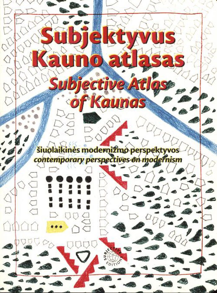
Subjective atlas of Kaunas
Subjective atlas of Kaunas
Actions:
Prix:
$48.00
(disponible en magasin)
Résumé:
Between 1919 and 1940, Kaunas served as Lithuania’s temporary capital, triggering a massive boom in construction that greatly increased its urban area. For this instalment of the Subjective Atlas series, a group of almost 40 creative residents mapped the contemporary identity of Kaunas through their personal interests, experiences, and domesticity, visualising the(...)
Titre:
Subjective atlas of Kaunas
Actions:
Prix:
$48.00
(disponible en magasin)
Résumé:
Between 1919 and 1940, Kaunas served as Lithuania’s temporary capital, triggering a massive boom in construction that greatly increased its urban area. For this instalment of the Subjective Atlas series, a group of almost 40 creative residents mapped the contemporary identity of Kaunas through their personal interests, experiences, and domesticity, visualising the heritage and history of Lithuania’s second-largest city. The book highlights a surprising collection of urban, natural, and everyday spaces and artefacts, inviting readers to reflect on how this material and immaterial modernist heritage is perceived or observed, appreciated or disliked, ignored or associated with.
Classification:
livres
livres
Publication:
mars 2022
mars 2022
Classification:
livres
livres
Titre:
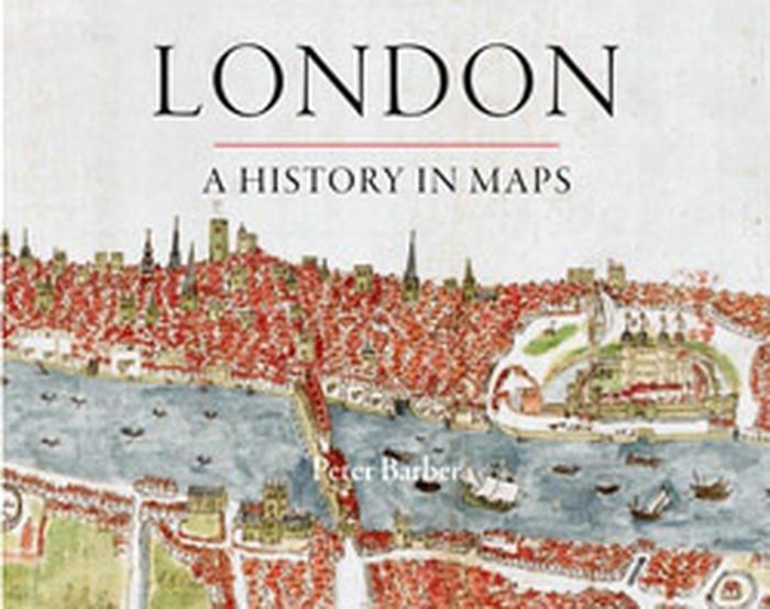
London: a history in maps
London: a history in maps
Actions:
Prix:
$49.95
(disponible sur commande)
Résumé:
Over the past two thousand years London has developed from a small town into one of the world's largest and most dynamic cities. This book charts that growth and the city's transformation through hundreds of maps culled from the collection of the British Library's Map Library. Including official documents, individual endeavors, hand-drawn renditions, and technologically(...)
Titre:
London: a history in maps
Actions:
Prix:
$49.95
(disponible sur commande)
Résumé:
Over the past two thousand years London has developed from a small town into one of the world's largest and most dynamic cities. This book charts that growth and the city's transformation through hundreds of maps culled from the collection of the British Library's Map Library. Including official documents, individual endeavors, hand-drawn renditions, and technologically advanced replicas, these maps represent a variety of perspectives. Utilitarian maps show the city as it is and serve to elucidate its inner workings, while carefully wrought plans show the city as it was envisioned. This book reveals the inside story of the creation, growth, and change of London.
Classification:
livres
livres
Publication:
septembre 2012
septembre 2012
Classification:
livres
livres
Actions:
Prix:
$95.00
(disponible sur commande)
Résumé:
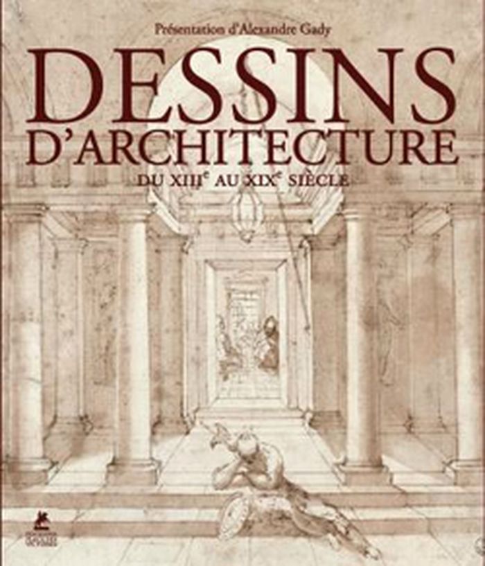
Les illustrations de cet ouvrage entraînent les lecteurs du Moyen Âge au XIXe siècle, sur les traces des bâtisseurs, architectes, décorateurs, utopistes ou simples témoins d'un passé dont ne subsistent parfois que des ruines. Ils ont pour noms Villard de Honnecourt, Jacques Androuet du Cerceau, Etienne Dupérac, Palladio, le Bernin, Borromini, Viollet-le-Duc, entre autres.
$95.00
(disponible sur commande)
Résumé:
Les illustrations de cet ouvrage entraînent les lecteurs du Moyen Âge au XIXe siècle, sur les traces des bâtisseurs, architectes, décorateurs, utopistes ou simples témoins d'un passé dont ne subsistent parfois que des ruines. Ils ont pour noms Villard de Honnecourt, Jacques Androuet du Cerceau, Etienne Dupérac, Palladio, le Bernin, Borromini, Viollet-le-Duc, entre autres.
Titre:
Dessins d'architecture, du Moyen-Âge au XIXe siècle
Actions:
Prix:
$95.00
(disponible sur commande)
Résumé:
Les illustrations de cet ouvrage entraînent les lecteurs du Moyen Âge au XIXe siècle, sur les traces des bâtisseurs, architectes, décorateurs, utopistes ou simples témoins d'un passé dont ne subsistent parfois que des ruines. Ils ont pour noms Villard de Honnecourt, Jacques Androuet du Cerceau, Etienne Dupérac, Palladio, le Bernin, Borromini, Viollet-le-Duc, entre autres.
Classification:
livres
livres
Publication:
novembre 2012
novembre 2012
Classification:
livres
livres

Prix:
$48.95
(disponible sur commande)
Résumé:
Carried out by designers Moniek Driesse and Annelys de Vet, along with Analía Solomonoff, the Subjective Atlas of Mexico is part of a series of previous subjective atlases where a varied group of artists, designers and photographers who choose personal topics as a starting point to map their cultural identity. Each were asked: what makes a Mexican? what are our likenesses(...)
Publication:
juin 2012
juin 2012
Titre:
Atlas subjectivo de México / subjective atlas of Mexico
Actions:
Prix:
$48.95
(disponible sur commande)
Résumé:
Carried out by designers Moniek Driesse and Annelys de Vet, along with Analía Solomonoff, the Subjective Atlas of Mexico is part of a series of previous subjective atlases where a varied group of artists, designers and photographers who choose personal topics as a starting point to map their cultural identity. Each were asked: what makes a Mexican? what are our likenesses and what differences do we share? Through its pages the scope of Mexico as a country limited by its borders and its latitudes suddenly vanishes and everyday practices take on new meaning. We can find Mexico reflected in the world, and the world reflected in Mexico. A DVD is included.
Classification:
livres
livres
Publication:
juin 2012
juin 2012
Classification:
livres
livres
Prix:
$42.95
(disponible sur commande)
Résumé:
The maps in this book are drawn with satellites, assembled with pixels radioed from outer space, and constructed from statistics; they record situations of intense conflict and express fundamental transformations in our ways of seeing and of experiencing space. These maps are built with GPS, remote sensing satellites,or GIS: digital spatial hardware and software designed(...)
Titre:
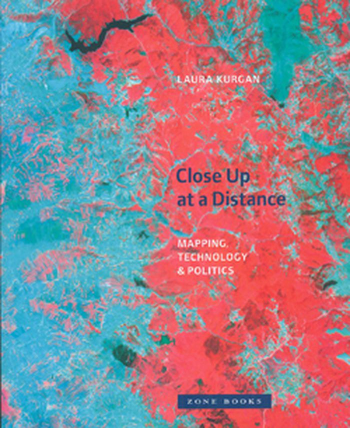
Close up at a distance: mapping, technology and politics
Actions:
Prix:
$42.95
(disponible sur commande)
Résumé:
The maps in this book are drawn with satellites, assembled with pixels radioed from outer space, and constructed from statistics; they record situations of intense conflict and express fundamental transformations in our ways of seeing and of experiencing space. These maps are built with GPS, remote sensing satellites,or GIS: digital spatial hardware and software designed for such military and governmental uses as reconnaissance, secrecy, monitoring, ballistics, the census, and national security. Rather than shying away from the politics and complexities of their intended uses, Laura Kurgan attempts to illuminate them. Poised at the intersection of art, architecture, activism, and geography, her analysis uncovers the implicit biases of the new views, the means of recording information they present, and the new spaces they have opened up.
Classification:
livres
livres
Publication:
mars 2013
mars 2013
Classification:
livres
livres
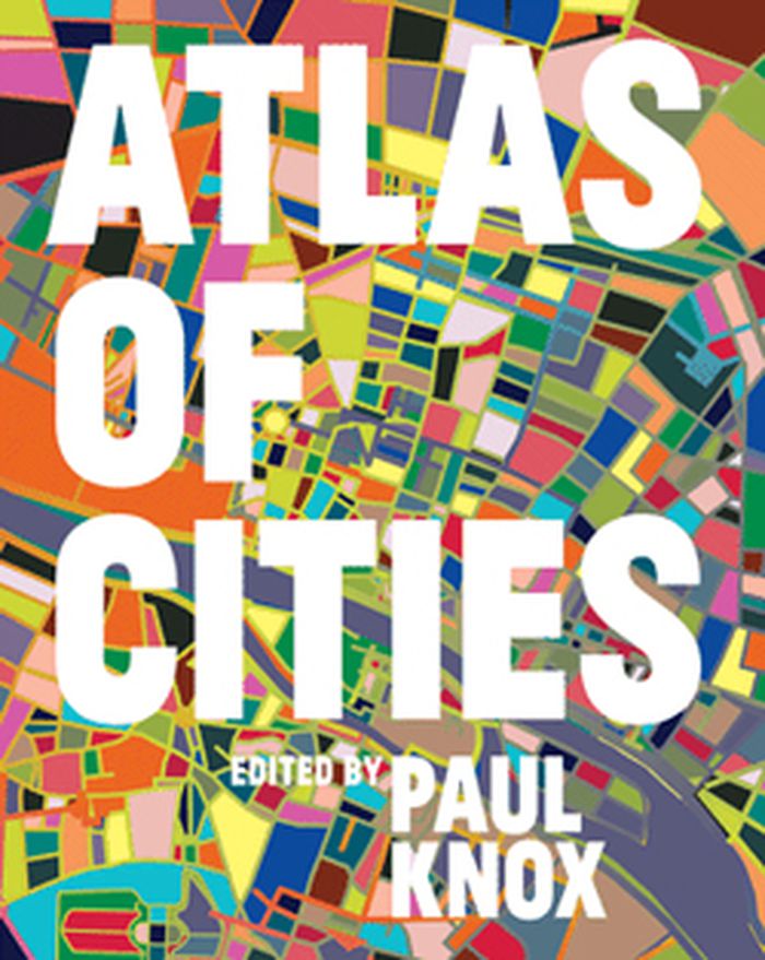
Titre:
Atlas of cities
Atlas of cities
Actions:
Prix:
$63.95
(disponible sur commande)
Résumé:
More than half the world's population lives in cities, and that proportion is expected to rise to three-quarters by 2050. Urbanization is a global phenomenon, but the way cities are developing, the experience of city life, and the prospects for the future of cities vary widely from region to region. The Atlas of Cities presents a unique taxonomy of cities that looks at(...)
Titre:
Atlas of cities
Actions:
Prix:
$63.95
(disponible sur commande)
Résumé:
More than half the world's population lives in cities, and that proportion is expected to rise to three-quarters by 2050. Urbanization is a global phenomenon, but the way cities are developing, the experience of city life, and the prospects for the future of cities vary widely from region to region. The Atlas of Cities presents a unique taxonomy of cities that looks at different aspects of their physical, economic, social, and political structures; their interactions with each other and with their hinterlands; the challenges and opportunities they present; and where cities might be going in the future.
Classification:
livres
livres
Publication:
septembre 2014
septembre 2014