


2424 Résultats
Classification:
cartes
cartes
Titre:
Insurance plan of the municipality of Saanich, B.C. : population 60,000, plan dated June 1968.
Insurance plan of the municipality of Saanich, B.C. : population 60,000, plan dated June 1968.
Actions:
Exemplaires:
Description:
1 map on 29 sheets : color ; sheets 34 x 31 cm
Description:
1 map on 29 sheets : color ; sheets 34 x 31 cm
Auteur:
Sujet:
- Fire risk assessment British Columbia Saanich Maps.,
- Real property British Columbia Saanich Maps.,
- Assurance-incendie Colombie-Britannique Saanich Plans.,
- Plans cadastraux Colombie-Britannique Saanich.,
- Assurance-incendie Colombie-Britannique Saanich Cartes.,
- Fire risk assessment.,
- Real property.,
- Saanich (B.C.) Maps.,
- Saanich (C.-B.) Plans.,
- British Columbia Saanich.,
- Fire insurance maps.,
- Maps.
Publication:
Toronto : Canadian Underwriters' Association, Plan Division, [1968]
Toronto : Canadian Underwriters' Association, Plan Division, [1968]
Titre:
Insurance plan of the municipality of Saanich, B.C. : population 60,000, plan dated June 1968.
Actions:
Exemplaires:
Description:
1 map on 29 sheets : color ; sheets 34 x 31 cm
Insurance plan of the municipality of Saanich, B.C. : population 60,000, plan dated June 1968.
Actions:
Exemplaires:
Description:
1 map on 29 sheets : color ; sheets 34 x 31 cm
Classification:
cartes
cartes
Publication:
Toronto : Canadian Underwriters' Association, Plan Division, [1968]
Toronto : Canadian Underwriters' Association, Plan Division, [1968]
Auteur:
Sujet:
- Fire risk assessment British Columbia Saanich Maps.,
- Real property British Columbia Saanich Maps.,
- Assurance-incendie Colombie-Britannique Saanich Plans.,
- Plans cadastraux Colombie-Britannique Saanich.,
- Assurance-incendie Colombie-Britannique Saanich Cartes.,
- Fire risk assessment.,
- Real property.,
- Saanich (B.C.) Maps.,
- Saanich (C.-B.) Plans.,
- British Columbia Saanich.,
- Fire insurance maps.,
- Maps.
Classification:
cartes
cartes
Titre:
Insurance plan of the municipality of Oak Bay, B.C. : population 16,000, plan dated June 1968.
Insurance plan of the municipality of Oak Bay, B.C. : population 16,000, plan dated June 1968.
Actions:
Exemplaires:
Description:
1 map on 6 sheets : color ; sheets 34 x 31 cm
Description:
1 map on 6 sheets : color ; sheets 34 x 31 cm
Auteur:
Sujet:
- Fire risk assessment British Columbia Oak Bay Maps.,
- Real property British Columbia Oak Bay Maps.,
- Assurance-incendie Colombie-Britannique Oak Bay Plans.,
- Plans cadastraux Colombie-Britannique Oak Bay.,
- Fire risk assessment.,
- Real property.,
- Oak Bay (B.C.) Maps.,
- Oak Bay (C.-B.) Plans.,
- British Columbia Oak Bay.,
- Fire insurance maps.,
- Maps.
Publication:
Toronto : Canadian Underwriters' Association, Plan Division, [1968]
Toronto : Canadian Underwriters' Association, Plan Division, [1968]
Titre:
Insurance plan of the municipality of Oak Bay, B.C. : population 16,000, plan dated June 1968.
Actions:
Exemplaires:
Description:
1 map on 6 sheets : color ; sheets 34 x 31 cm
Insurance plan of the municipality of Oak Bay, B.C. : population 16,000, plan dated June 1968.
Actions:
Exemplaires:
Description:
1 map on 6 sheets : color ; sheets 34 x 31 cm
Classification:
cartes
cartes
Publication:
Toronto : Canadian Underwriters' Association, Plan Division, [1968]
Toronto : Canadian Underwriters' Association, Plan Division, [1968]
Auteur:
Sujet:
- Fire risk assessment British Columbia Oak Bay Maps.,
- Real property British Columbia Oak Bay Maps.,
- Assurance-incendie Colombie-Britannique Oak Bay Plans.,
- Plans cadastraux Colombie-Britannique Oak Bay.,
- Fire risk assessment.,
- Real property.,
- Oak Bay (B.C.) Maps.,
- Oak Bay (C.-B.) Plans.,
- British Columbia Oak Bay.,
- Fire insurance maps.,
- Maps.
Classification:
cartes
cartes
Actions:
Exemplaires:
Description:
1 map on 6 sheets : color ; sheets 34 x 31 cm
Description:
1 map on 6 sheets : color ; sheets 34 x 31 cm
Auteur:
Sujet:
- Fire risk assessment British Columbia Castlegar Maps.,
- Real property British Columbia Castlegar Maps.,
- Assurance-incendie Colombie-Britannique Castlegar Plans.,
- Plans cadastraux Colombie-Britannique Campbell River.,
- Assurance-incendie Colombie-Britannique Castlegar Cartes.,
- Fire risk assessment.,
- Real property.,
- Castlegar (B.C.) Maps.,
- Castlegar (C.-B.) Plans.,
- British Columbia Castlegar.,
- Fire insurance maps.,
- Maps.
Publication:
[Toronto?] : Underwriters' Survey Bureau, [1959]
[Toronto?] : Underwriters' Survey Bureau, [1959]
Titre:
Insurance plan of the village of Castlegar, B.C. : population 1,900, plan dated May 1959.
Actions:
Exemplaires:
Description:
1 map on 6 sheets : color ; sheets 34 x 31 cm
Insurance plan of the village of Castlegar, B.C. : population 1,900, plan dated May 1959.
Actions:
Exemplaires:
Description:
1 map on 6 sheets : color ; sheets 34 x 31 cm
Classification:
cartes
cartes
Publication:
[Toronto?] : Underwriters' Survey Bureau, [1959]
[Toronto?] : Underwriters' Survey Bureau, [1959]
Auteur:
Sujet:
- Fire risk assessment British Columbia Castlegar Maps.,
- Real property British Columbia Castlegar Maps.,
- Assurance-incendie Colombie-Britannique Castlegar Plans.,
- Plans cadastraux Colombie-Britannique Campbell River.,
- Assurance-incendie Colombie-Britannique Castlegar Cartes.,
- Fire risk assessment.,
- Real property.,
- Castlegar (B.C.) Maps.,
- Castlegar (C.-B.) Plans.,
- British Columbia Castlegar.,
- Fire insurance maps.,
- Maps.
Classification:
cartes
cartes
Titre:
Insurance plan of the town of Iroquois Falls, Ont., population 1,500 : plan dated October, 1952.
Insurance plan of the town of Iroquois Falls, Ont., population 1,500 : plan dated October, 1952.
Actions:
Exemplaires:
Description:
1 map on 3 sheets : color ; sheets 34 x 31 cm
Description:
1 map on 3 sheets : color ; sheets 34 x 31 cm
Auteur:
Sujet:
- Fire risk assessment Ontario Iroquois Falls Maps.,
- Real property Ontario Iroquois Falls Maps.,
- Assurance-incendie Ontario Iroquois Falls Plans.,
- Plans cadastraux Ontario Iroquois Falls.,
- Assurance-incendie Ontario Iroquois Falls Cartes.,
- Fire risk assessment.,
- Real property.,
- Iroquois Falls (Ont.) Maps.,
- Iroquois Falls (Ont.) Plans.,
- Ontario Iroquois Falls.,
- Fire insurance maps.,
- Maps.
Publication:
Toronto : Underwriters' Survey Bureau, [1952]
Toronto : Underwriters' Survey Bureau, [1952]
Titre:
Insurance plan of the town of Iroquois Falls, Ont., population 1,500 : plan dated October, 1952.
Actions:
Exemplaires:
Description:
1 map on 3 sheets : color ; sheets 34 x 31 cm
Insurance plan of the town of Iroquois Falls, Ont., population 1,500 : plan dated October, 1952.
Actions:
Exemplaires:
Description:
1 map on 3 sheets : color ; sheets 34 x 31 cm
Classification:
cartes
cartes
Publication:
Toronto : Underwriters' Survey Bureau, [1952]
Toronto : Underwriters' Survey Bureau, [1952]
Auteur:
Sujet:
- Fire risk assessment Ontario Iroquois Falls Maps.,
- Real property Ontario Iroquois Falls Maps.,
- Assurance-incendie Ontario Iroquois Falls Plans.,
- Plans cadastraux Ontario Iroquois Falls.,
- Assurance-incendie Ontario Iroquois Falls Cartes.,
- Fire risk assessment.,
- Real property.,
- Iroquois Falls (Ont.) Maps.,
- Iroquois Falls (Ont.) Plans.,
- Ontario Iroquois Falls.,
- Fire insurance maps.,
- Maps.
Classification:
cartes
cartes
Titre:
Insurance plan of the town of New Liskeard, Ont., population 4,130 : plan dated October, 1952.
Insurance plan of the town of New Liskeard, Ont., population 4,130 : plan dated October, 1952.
Actions:
Exemplaires:
Description:
1 map on 6 sheets : color ; sheets 34 x 31 cm
Description:
1 map on 6 sheets : color ; sheets 34 x 31 cm
Auteur:
Sujet:
- Fire risk assessment Ontario New Liskeard Maps.,
- Real property Ontario New Liskeard Maps.,
- Assurance-incendie Ontario New Liskeard Plans.,
- Plans cadastraux Ontario New Liskeard.,
- Assurance-incendie Ontario New Liskeard Cartes.,
- Fire risk assessment.,
- Real property.,
- New Liskeard (Ont.) Maps.,
- New Liskeard (Ont.) Plans.,
- Ontario New Liskeard.,
- Fire insurance maps.,
- Maps.
Publication:
Toronto : Underwriters' Survey Bureau, [1952]
Toronto : Underwriters' Survey Bureau, [1952]
Titre:
Insurance plan of the town of New Liskeard, Ont., population 4,130 : plan dated October, 1952.
Actions:
Exemplaires:
Description:
1 map on 6 sheets : color ; sheets 34 x 31 cm
Insurance plan of the town of New Liskeard, Ont., population 4,130 : plan dated October, 1952.
Actions:
Exemplaires:
Description:
1 map on 6 sheets : color ; sheets 34 x 31 cm
Classification:
cartes
cartes
Publication:
Toronto : Underwriters' Survey Bureau, [1952]
Toronto : Underwriters' Survey Bureau, [1952]
Auteur:
Sujet:
- Fire risk assessment Ontario New Liskeard Maps.,
- Real property Ontario New Liskeard Maps.,
- Assurance-incendie Ontario New Liskeard Plans.,
- Plans cadastraux Ontario New Liskeard.,
- Assurance-incendie Ontario New Liskeard Cartes.,
- Fire risk assessment.,
- Real property.,
- New Liskeard (Ont.) Maps.,
- New Liskeard (Ont.) Plans.,
- Ontario New Liskeard.,
- Fire insurance maps.,
- Maps.
Classification:
cartes
cartes
Actions:
Exemplaires:
Description:
1 map on 9 sheets : color ; sheets 34 x 31 cm
Description:
1 map on 9 sheets : color ; sheets 34 x 31 cm
Auteur:
Sujet:
- Fire risk assessment Newfoundland and Labrador Gander Maps.,
- Real property Newfoundland and Labrador Gander Maps.,
- Assurance-incendie Terre-Neuve Gander Plans.,
- Plans cadastraux Terre-Neuve Gander.,
- Assurance-incendie Terre-Neuve-et-Labrador Gander Cartes.,
- Fire risk assessment.,
- Real property.,
- Gander (N.L.) Maps.,
- Gander (T.-N.) Plans.,
- Newfoundland and Labrador Gander.,
- Fire insurance maps.,
- Maps.
Publication:
Toronto : Canadian Underwriters' Association, [1969]
Toronto : Canadian Underwriters' Association, [1969]
Titre:
Insurance plan of the town of Gander, Nfld., (including airport), population 8,000 : plan dated September 1969.
Actions:
Exemplaires:
Description:
1 map on 9 sheets : color ; sheets 34 x 31 cm
Insurance plan of the town of Gander, Nfld., (including airport), population 8,000 : plan dated September 1969.
Actions:
Exemplaires:
Description:
1 map on 9 sheets : color ; sheets 34 x 31 cm
Classification:
cartes
cartes
Publication:
Toronto : Canadian Underwriters' Association, [1969]
Toronto : Canadian Underwriters' Association, [1969]
Auteur:
Sujet:
- Fire risk assessment Newfoundland and Labrador Gander Maps.,
- Real property Newfoundland and Labrador Gander Maps.,
- Assurance-incendie Terre-Neuve Gander Plans.,
- Plans cadastraux Terre-Neuve Gander.,
- Assurance-incendie Terre-Neuve-et-Labrador Gander Cartes.,
- Fire risk assessment.,
- Real property.,
- Gander (N.L.) Maps.,
- Gander (T.-N.) Plans.,
- Newfoundland and Labrador Gander.,
- Fire insurance maps.,
- Maps.
Classification:
cartes
cartes
Exemplaires:
Description:
1 map on 7 sheets : color ; sheets 34 x 31 cm
Description:
1 map on 7 sheets : color ; sheets 34 x 31 cm
Auteur:
Sujet:
- Fire risk assessment Newfoundland and Labrador Botwood Maps.,
- Real property Newfoundland and Labrador Botwood Maps.,
- Assurance-incendie Terre-Neuve Botwood Plans.,
- Plans cadastraux Terre-Neuve Botwood.,
- Assurance-incendie Terre-Neuve-et-Labrador Botwood Cartes.,
- Fire risk assessment.,
- Real property.,
- Botwood (N.L.) Maps.,
- Botwood (T.-N.) Plans.,
- Newfoundland and Labrador Botwood.,
- Fire insurance maps.,
- Maps.
Publication:
Toronto : Underwriters' Survey Bureau, [1956]
Toronto : Underwriters' Survey Bureau, [1956]
Titre:
Insurance plan of Botwood, Nfld. : plan dated July, 1956.
Actions:
Exemplaires:
Description:
1 map on 7 sheets : color ; sheets 34 x 31 cm
Insurance plan of Botwood, Nfld. : plan dated July, 1956.
Actions:
Exemplaires:
Description:
1 map on 7 sheets : color ; sheets 34 x 31 cm
Classification:
cartes
cartes
Publication:
Toronto : Underwriters' Survey Bureau, [1956]
Toronto : Underwriters' Survey Bureau, [1956]
Auteur:
Sujet:
- Fire risk assessment Newfoundland and Labrador Botwood Maps.,
- Real property Newfoundland and Labrador Botwood Maps.,
- Assurance-incendie Terre-Neuve Botwood Plans.,
- Plans cadastraux Terre-Neuve Botwood.,
- Assurance-incendie Terre-Neuve-et-Labrador Botwood Cartes.,
- Fire risk assessment.,
- Real property.,
- Botwood (N.L.) Maps.,
- Botwood (T.-N.) Plans.,
- Newfoundland and Labrador Botwood.,
- Fire insurance maps.,
- Maps.
Classification:
livres
livres
Titre:
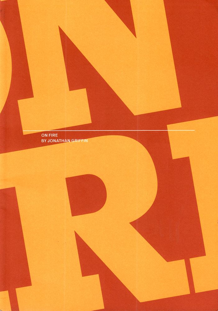
On fire
On fire
Actions:
Prix:
$20.00
(disponible en magasin)
Résumé:
Artists' studios have been burning down for centuries. In Paper Monument’s newest publication, ''On Fire'', author Jonathan Griffin asked ten contemporary artists how they recovered after their studios went up in flames. Talking to them, he gained surprising insights into their working methods, their relationship to their chosen profession, and their reasons for making art.
Titre:
On fire
Actions:
Prix:
$20.00
(disponible en magasin)
Résumé:
Artists' studios have been burning down for centuries. In Paper Monument’s newest publication, ''On Fire'', author Jonathan Griffin asked ten contemporary artists how they recovered after their studios went up in flames. Talking to them, he gained surprising insights into their working methods, their relationship to their chosen profession, and their reasons for making art.
Classification:
livres
livres
Publication:
février 2016
février 2016
Sujet:
Théorie de l’art
Théorie de l’art
Classification:
cartes
cartes
Actions:
Exemplaires:
Description:
1 map on 5 sheets : color ; sheets 34 x 31 cm
Description:
1 map on 5 sheets : color ; sheets 34 x 31 cm
Auteur:
Sujet:
- Fire risk assessment British Columbia Grand Forks Maps.,
- Real property British Columbia Grand Forks Maps.,
- Assurance-incendie Colombie-Britannique Grand Forks Plans.,
- Plans cadastraux Colombie-Britannique Grand Forks.,
- Fire risk assessment.,
- Real property.,
- Grand Forks (B.C.) Maps.,
- Grand Forks (C.-B.) Plans.,
- British Columbia Grand Forks.,
- Fire insurance maps.,
- Maps.
Publication:
Vancouver : British Columbia Underwriters' Association, [1953-1959]
Vancouver : British Columbia Underwriters' Association, [1953-1959]
Titre:
Insurance plan of Grand Forks, B.C. : May, 1953.
Actions:
Exemplaires:
Description:
1 map on 5 sheets : color ; sheets 34 x 31 cm
Insurance plan of Grand Forks, B.C. : May, 1953.
Actions:
Exemplaires:
Description:
1 map on 5 sheets : color ; sheets 34 x 31 cm
Classification:
cartes
cartes
Publication:
Vancouver : British Columbia Underwriters' Association, [1953-1959]
Vancouver : British Columbia Underwriters' Association, [1953-1959]
Auteur:
Sujet:
- Fire risk assessment British Columbia Grand Forks Maps.,
- Real property British Columbia Grand Forks Maps.,
- Assurance-incendie Colombie-Britannique Grand Forks Plans.,
- Plans cadastraux Colombie-Britannique Grand Forks.,
- Fire risk assessment.,
- Real property.,
- Grand Forks (B.C.) Maps.,
- Grand Forks (C.-B.) Plans.,
- British Columbia Grand Forks.,
- Fire insurance maps.,
- Maps.
Classification:
cartes
cartes
Titre:
Insurance plan of the city of North Bay & District, Ont. : population 25,000, plan dated June 1959.
Insurance plan of the city of North Bay & District, Ont. : population 25,000, plan dated June 1959.
Actions:
Exemplaires:
Description:
1 map on 30 sheets : color ; sheets 34 x 31 cm
Description:
1 map on 30 sheets : color ; sheets 34 x 31 cm
Auteur:
Sujet:
- Fire risk assessment Ontario North Bay Maps.,
- Real property Ontario North Bay Maps.,
- Assurance-incendie Ontario North Bay Plans.,
- Plans cadastraux Ontario North Bay.,
- Assurance-incendie Ontario North Bay Cartes.,
- Fire risk assessment.,
- Real property.,
- North Bay (Ont.) Maps.,
- North Bay (Ont.) Plans.,
- Ontario North Bay.,
- Fire insurance maps.,
- Maps.
Publication:
Toronto : Underwriters' Survey Bureau, [1959]
Toronto : Underwriters' Survey Bureau, [1959]
Titre:
Insurance plan of the city of North Bay & District, Ont. : population 25,000, plan dated June 1959.
Actions:
Exemplaires:
Description:
1 map on 30 sheets : color ; sheets 34 x 31 cm
Insurance plan of the city of North Bay & District, Ont. : population 25,000, plan dated June 1959.
Actions:
Exemplaires:
Description:
1 map on 30 sheets : color ; sheets 34 x 31 cm
Classification:
cartes
cartes
Publication:
Toronto : Underwriters' Survey Bureau, [1959]
Toronto : Underwriters' Survey Bureau, [1959]
Auteur:
Sujet:
- Fire risk assessment Ontario North Bay Maps.,
- Real property Ontario North Bay Maps.,
- Assurance-incendie Ontario North Bay Plans.,
- Plans cadastraux Ontario North Bay.,
- Assurance-incendie Ontario North Bay Cartes.,
- Fire risk assessment.,
- Real property.,
- North Bay (Ont.) Maps.,
- North Bay (Ont.) Plans.,
- Ontario North Bay.,
- Fire insurance maps.,
- Maps.


