94 Résultats
Classification:
livres
livres
Prix:
$59.99
(disponible sur commande)
Résumé:
Featuring 40 essays by U.S. and European historians, designers, cultural critics, geographers and social scientists, illustrated with over 250 color images in extensive visual "gazetteers" — including specially-commissioned portfolios by artists and designers — "Else/where mapping" investigates : how new technologies of navigation and location are emerging to chart(...)
Publication:
octobre 2005, Minneapolis
octobre 2005, Minneapolis
Titre:
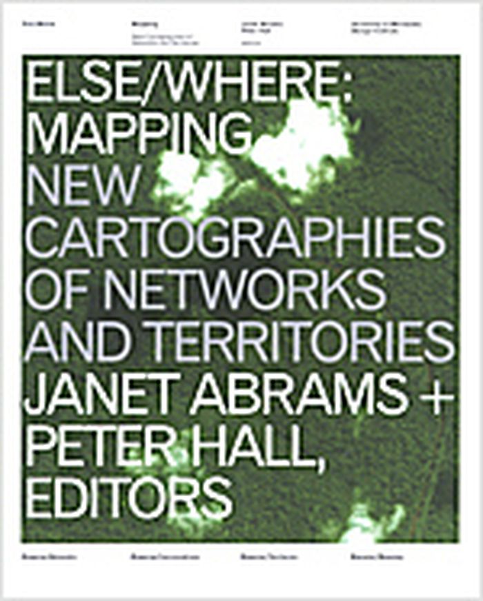
Else/where : mapping new cartographies of networks and territories
Actions:
Prix:
$59.99
(disponible sur commande)
Résumé:
Featuring 40 essays by U.S. and European historians, designers, cultural critics, geographers and social scientists, illustrated with over 250 color images in extensive visual "gazetteers" — including specially-commissioned portfolios by artists and designers — "Else/where mapping" investigates : how new technologies of navigation and location are emerging to chart "virtual" terrain such as social networks and online conversations; how these new mapping strategies borrow and reinvent metaphors adapted from the cartography of physical terrain, considered at various scales — urban, regional, continental, global ; how new modes of representation of spatial data are evolving to explore the potential for collective "bottom-up" (rather than "top-down") mapping ; how cities, communities and social networks are being re-envisioned, as artists and designers use technologies such as GPS, GIS and digital interface design to devise alternative mappings of social and spatial relationships. Authors : Janet Abrams, Ole Bouman, Andrea Codrington, Denis Cosgrove, Steve Dietz, Paul Elliman, Yuri Engelhardt, Peter Hall, Brian Holmes, J.J. King, Cathy Lang Ho, Andrea Moed, David Pescovitz, Rebecca Ross, Ben Schouten, Alex Terzich, Alice Twemlow, Dirk van Weelden, Tom Vanderbilt, Peter Walsh and Stephen Zacks. Featured artists and designers included : Antenna Design New York, Julian Bleecker, Bureau d'Etudes, Sulki Choi, Layla Curtis, Judith Donath, Entropy8Zuper!, Michael Frumin, Ben Fry, De Geuzen, govcom.org, Marti Guixe, Mark Hansen, Robert Horn, Natalie Jeremijenko, Lisa Jevbratt, Nina Katchadourian, Valdis Krebs, Laura Kurgan, Mark Lombardi, The London Particular, Lumeta.org, Barrett Lyon, Brian McGrath, Julie Mehretu, Paul Mijksenaar, Sigi Moeslinger, MUST Architects, MVRDV, Josh On, W. Bradford Paley, Scott Paterson, Esther Polak, Richard Rogers, Ben Rubin, Warren Sack, Mike Silver, Marco Susani, Terraswarm, UN Studio, Urban Tapestries, Waag Society for Old and New Media, Ronald Wall, Kimberlee Whaley, Jeremy Wood and Marina Zurkow. Book design : Deborah Littlejohn.
Classification:
livres
livres
Publication:
octobre 2005, Minneapolis
octobre 2005, Minneapolis
Classification:
livres
livres
Titre:
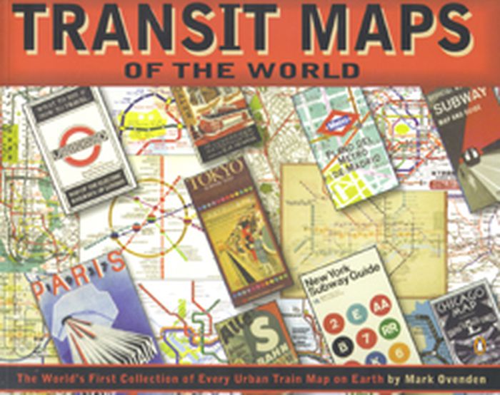
Transit maps of the world
Transit maps of the world
Actions:
Prix:
$27.50
(disponible sur commande)
Résumé:
Transit Maps of the World is the first, and only, comprehensive collection of every rapid-transit system map on earth. Using glorious graphics, Mark Ovenden traces the history of mass transit - including rare and historic maps, diagrams, and photographs, some available for the first time since their original publication. Transit Maps is a coffee-table essential for anyone(...)
Publication:
octobre 2007, New York, Toronto, London
octobre 2007, New York, Toronto, London
Titre:
Transit maps of the world
Actions:
Prix:
$27.50
(disponible sur commande)
Résumé:
Transit Maps of the World is the first, and only, comprehensive collection of every rapid-transit system map on earth. Using glorious graphics, Mark Ovenden traces the history of mass transit - including rare and historic maps, diagrams, and photographs, some available for the first time since their original publication. Transit Maps is a coffee-table essential for anyone who's ever traveled in a city, as well as a graphic designer's bible, a transport enthusiast's dream, and the ideal gift for the most challenging relative! Pick up Transit Maps of the World for a truly unusual journey.
Classification:
livres
livres
Publication:
octobre 2007, New York, Toronto, London
octobre 2007, New York, Toronto, London
Classification:
livres
livres
Titre:
Mapping England
Mapping England
Actions:
Prix:
$59.95
(disponible sur commande)
Résumé:
England has been continuously mapped from Medieval times to the present; politically, administratively and functionally as well as creatively and imaginatively. Maps have helped to define ideas of what England is and could be. They have developed and maintained its identity amongst other nations and explored its essential character and limits. The maps included show a(...)
Titre:
Mapping England
Actions:
Prix:
$59.95
(disponible sur commande)
Résumé:
England has been continuously mapped from Medieval times to the present; politically, administratively and functionally as well as creatively and imaginatively. Maps have helped to define ideas of what England is and could be. They have developed and maintained its identity amongst other nations and explored its essential character and limits. The maps included show a country at times confident but also unsure of itself. Often drawn for purely practical purposes they frequently and unconsciously reveal the true state of the nation, and the hopes and fears of its inhabitants. England has been the crucible for many of the most significant developments in cartography and Mapping England tells the story of how its position in the world has evolved and, in so doing, entails new ways of seeing and expressing such findings in graphic form.
Classification:
livres
livres
Publication:
octobre 2008
octobre 2008
Classification:
livres
livres
Actions:
Prix:
$42.99
(disponible sur commande)
Résumé:
Mazes have been a part of civilization for at least 4,000 years, and there are more being built now than ever before. What is it about these magical life-size puzzles that continues to intrigue us? The illustrations represent 60 real and imagined mazes from around the world, with a bird’s eye view of each maze. Each maze is also accompanied by a short history.
Publication:
septembre 2018
septembre 2018
Titre:
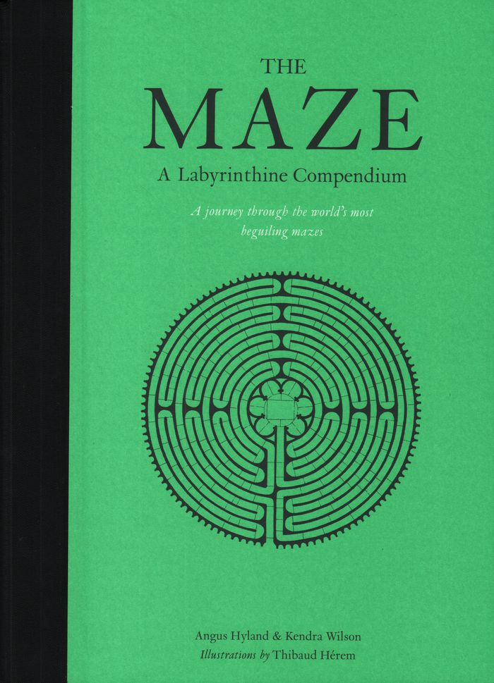
The maze: a labyrinthine compendium
Actions:
Prix:
$42.99
(disponible sur commande)
Résumé:
Mazes have been a part of civilization for at least 4,000 years, and there are more being built now than ever before. What is it about these magical life-size puzzles that continues to intrigue us? The illustrations represent 60 real and imagined mazes from around the world, with a bird’s eye view of each maze. Each maze is also accompanied by a short history.
Classification:
livres
livres
Publication:
septembre 2018
septembre 2018
Classification:
livres
livres
Titre:
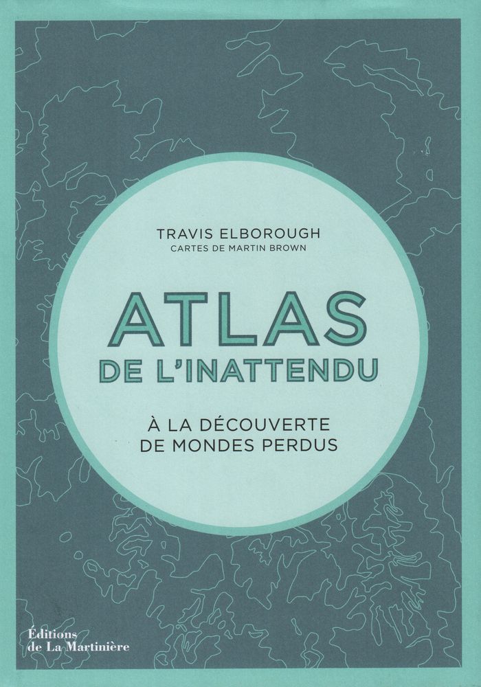
Atlas de l'inattendu
Atlas de l'inattendu
Actions:
Prix:
$57.95
(disponible sur commande)
Résumé:
Dans cette atlas, Travis Elborough poursuit son exploration mondiale des lieux inattendus, des bizarreries architecturales et autres curiosités de notre planète. À partir des cartes de Martin Brown et de documents photographiques, il cultive notre goût de l'insolite et du voyage. Des villages flottants du lac Titicaca aux arbres biscornus de Slope Point en(...)
Titre:
Atlas de l'inattendu
Actions:
Prix:
$57.95
(disponible sur commande)
Résumé:
Dans cette atlas, Travis Elborough poursuit son exploration mondiale des lieux inattendus, des bizarreries architecturales et autres curiosités de notre planète. À partir des cartes de Martin Brown et de documents photographiques, il cultive notre goût de l'insolite et du voyage. Des villages flottants du lac Titicaca aux arbres biscornus de Slope Point en Nouvelle-Zélande, des hauteurs vertigineuses d'un monastère taoïste à l'écho souterrain d'une grotte aux coquillages, Travis Elborough nous raconte un monde insoupçonné.
Classification:
livres
livres
Publication:
décembre 2018
décembre 2018
Classification:
livres
livres
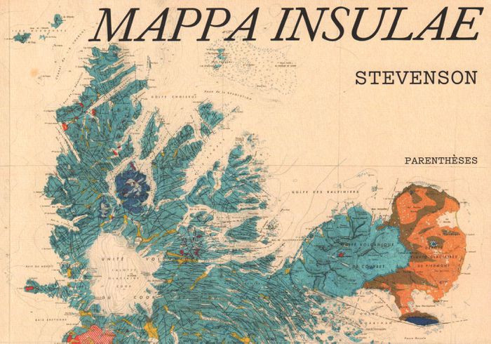
Titre:
Mappa insulae
Mappa insulae
Actions:
Prix:
$35.95
(disponible sur commande)
Résumé:
Dans l'univers sans fin des cartes, les cartes d'îles possèdent un charme tout particulier. Les deux mondes, des cartes et des îles, s'y croisent, laissant émerger des formes riches et colorées. Cinq artistes, collectionneurs, chercheurs ont formé le collectif Stevenson pour en explorer et en célébrer les beautés, les incongruités, les fantaisies autant que la précision(...)
Titre:
Mappa insulae
Actions:
Prix:
$35.95
(disponible sur commande)
Résumé:
Dans l'univers sans fin des cartes, les cartes d'îles possèdent un charme tout particulier. Les deux mondes, des cartes et des îles, s'y croisent, laissant émerger des formes riches et colorées. Cinq artistes, collectionneurs, chercheurs ont formé le collectif Stevenson pour en explorer et en célébrer les beautés, les incongruités, les fantaisies autant que la précision et la finesse. De la mise en commun de leurs trésors cartographiques chinés, dénichés, inhumés et patiemment amassés, est né Mappa insulae. Les îles s'y montrent parfois dans leur isolement absolu, cerclées d'une épaisseur bleue qui les sépare du reste du monde ; parfois en archipel, éparpillées "comme autant de pépins crachés dans l'eau" ; parfois encore simplement suggérées, récifs tapis sous des noms calligraphiés sur les flots. De carte en carte, d'île en île, de pensées en poèmes, nous voilà embarqués pour une traversée érudite et insolite.
Classification:
livres
livres
Publication:
septembre 2019
septembre 2019
Classification:
livres
livres
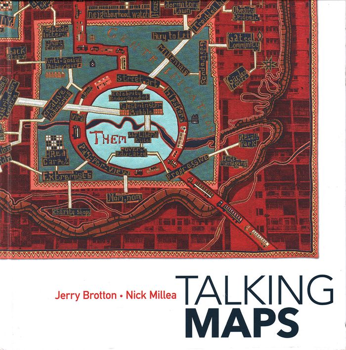
Titre:
Talking maps
Talking maps
Actions:
Prix:
$74.95
(disponible sur commande)
Résumé:
Every map tells a story. Some provide a narrative for travelers, explorers, and surveyors or offer a visual account of changes to people’s lives and surroundings, while others tell imaginary tales, transporting us to fictional worlds created by writers and artists. In turn, maps generate more stories, taking users on new journeys in search of knowledge and adventure. By(...)
Publication:
novembre 2019
novembre 2019
Titre:
Talking maps
Actions:
Prix:
$74.95
(disponible sur commande)
Résumé:
Every map tells a story. Some provide a narrative for travelers, explorers, and surveyors or offer a visual account of changes to people’s lives and surroundings, while others tell imaginary tales, transporting us to fictional worlds created by writers and artists. In turn, maps generate more stories, taking users on new journeys in search of knowledge and adventure. By telling the stories behind the artifacts and those generated by them, "Talking Maps " reveals how each map is not just a tool for navigation but also a worldly proposal that helps us to understand who we are by describing where we are.
Classification:
livres
livres
Publication:
novembre 2019
novembre 2019
Classification:
livres
livres
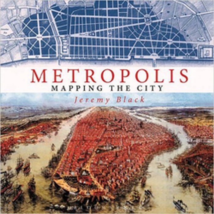
Titre:
Metropolis: mapping the city
Metropolis: mapping the city
Actions:
Prix:
$63.95
(disponible sur commande)
Résumé:
This volume looks at the development of the mapping and representation of the city revealing how we organize the urban space. From skyline profiles, bird's eye views and panoramas, to the schematic maps of transport networks and road layouts to help us navigate, and statistical maps that can provide information on human aspirations, cities can reveal themselves in many(...)
Titre:
Metropolis: mapping the city
Actions:
Prix:
$63.95
(disponible sur commande)
Résumé:
This volume looks at the development of the mapping and representation of the city revealing how we organize the urban space. From skyline profiles, bird's eye views and panoramas, to the schematic maps of transport networks and road layouts to help us navigate, and statistical maps that can provide information on human aspirations, cities can reveal themselves in many ways. Focusing on key points in the development of urban representation and including visions of the future of how we would be living today, this enlightening book illustrates some of the oldest, youngest, liveliest, and most contested cities in the world
Classification:
livres
livres
Publication:
novembre 2015
novembre 2015
Classification:
livres
livres
Prix:
$44.00
(disponible sur commande)
Résumé:
The life and legend of New York City, from the size of its skyscrapers to the ways of its inhabitants, is vividly captured in this collection of more than 250 maps, cross sections, ?owcharts, tables, board games, cartoons and infographics, and other unique diagrams spanning 150 years. Superstars such as Saul Steinberg, Maira Kalman, Christoph Niemann, Roz Chast, and(...)
Publication:
avril 2021
avril 2021
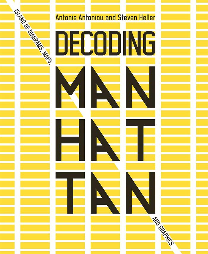
Titre:
Decoding Manhattan: island of diagrams, maps, and graphics
Actions:
Prix:
$44.00
(disponible sur commande)
Résumé:
The life and legend of New York City, from the size of its skyscrapers to the ways of its inhabitants, is vividly captured in this collection of more than 250 maps, cross sections, ?owcharts, tables, board games, cartoons and infographics, and other unique diagrams spanning 150 years. Superstars such as Saul Steinberg, Maira Kalman, Christoph Niemann, Roz Chast, and Milton Glaser butt up against the unsung heroes of the popular press in a book that is made not only for lovers of New York but also for anyone who enjoys or works with information design.
Classification:
livres
livres
Publication:
avril 2021
avril 2021
Classification:
livres
livres

Titre:
Denis Wood: Everything sings
Denis Wood: Everything sings
Actions:
Prix:
$31.00
(disponible sur commande)
Résumé:
With artful wit and rigor, cartographer Denis Wood has written numerous books (including the influential bestseller The Power of Maps) that reorient his readers not only to our neighborhoods, homes and bodies, but also to our own very human instinct to understand where we live by mapmaking. At the heart of Wood's investigations is a near-legendary endeavor: the Boylan(...)
Titre:
Denis Wood: Everything sings
Actions:
Prix:
$31.00
(disponible sur commande)
Résumé:
With artful wit and rigor, cartographer Denis Wood has written numerous books (including the influential bestseller The Power of Maps) that reorient his readers not only to our neighborhoods, homes and bodies, but also to our own very human instinct to understand where we live by mapmaking. At the heart of Wood's investigations is a near-legendary endeavor: the Boylan Heights maps, begun in 1982, and now published in Everything Sings. Surveying his century-old, half-square mile neighborhood Boylan Heights in Raleigh, North Carolina, Wood began by paring away the inessential "map crap" (scale, orientation, street grids) and, in searching for the revelatory in the unmapped and the unmappable, he ended up plotting such phenomena as radio waves permeating the air, the light cast by street lights and Halloween pumpkins on porches. Wood's maps accumulate into a multi-layered story about one neighborhood that tells the larger story of what constitutes the places we call home. With an introduction by Ira Glass.
Classification:
livres
livres
Publication:
février 2011
février 2011