


1733 Results
Level of archival description:
Project
Project
Actions:
Reference number:
AP164.S1.1993.D4
Description:
The project series documents the competition entry for a company bid to develope the infrastructure and the channelling of the Guadalhorce River, Málaga, from the local government of Andalusia, Spain. The firm identified this project as number 82. Abalos & Herreros worked with Ángel Borrego, Javier Fresneda, Rafael Hernández, Javier Herreros and the technical services of Agróman. Documenting this project are conceptual and design development drawings, graphic, cartographic and reference materials, clippings, notes, dummies, project descriptions and specifications.
AP164.S1.1993.D4
Description:
The project series documents the competition entry for a company bid to develope the infrastructure and the channelling of the Guadalhorce River, Málaga, from the local government of Andalusia, Spain. The firm identified this project as number 82. Abalos & Herreros worked with Ángel Borrego, Javier Fresneda, Rafael Hernández, Javier Herreros and the technical services of Agróman. Documenting this project are conceptual and design development drawings, graphic, cartographic and reference materials, clippings, notes, dummies, project descriptions and specifications.
People:
Date:
1993
1993
Title:
Encauzamiento del río Guadalhorce, Málaga, Spain (1993)
Actions:
AP164.S1.1993.D4
Description:
The project series documents the competition entry for a company bid to develope the infrastructure and the channelling of the Guadalhorce River, Málaga, from the local government of Andalusia, Spain. The firm identified this project as number 82. Abalos & Herreros worked with Ángel Borrego, Javier Fresneda, Rafael Hernández, Javier Herreros and the technical services of Agróman. Documenting this project are conceptual and design development drawings, graphic, cartographic and reference materials, clippings, notes, dummies, project descriptions and specifications.
Encauzamiento del río Guadalhorce, Málaga, Spain (1993)
Actions:
AP164.S1.1993.D4
Description:
The project series documents the competition entry for a company bid to develope the infrastructure and the channelling of the Guadalhorce River, Málaga, from the local government of Andalusia, Spain. The firm identified this project as number 82. Abalos & Herreros worked with Ángel Borrego, Javier Fresneda, Rafael Hernández, Javier Herreros and the technical services of Agróman. Documenting this project are conceptual and design development drawings, graphic, cartographic and reference materials, clippings, notes, dummies, project descriptions and specifications.
Level of archival description:
Project
Project
Date:
1993
1993
People:
Form:
maps
maps
Actions:
Reference number:
CD035.S1.1979.PR01.006
Description:
Documents previously stored in a box labelled "BEEKER / OUAGA / SDAV 2000 / HASKOOING" / 1983-1985". Includes maps for the aerial photographs shoots, maps of vacants and occupied lots and maps of infrastructure for wateraccess and electricity.
CD035.S1.1979.PR01.006
Description:
Documents previously stored in a box labelled "BEEKER / OUAGA / SDAV 2000 / HASKOOING" / 1983-1985". Includes maps for the aerial photographs shoots, maps of vacants and occupied lots and maps of infrastructure for wateraccess and electricity.
People:
Date:
2000
2000
Title:
Survey maps of the Ouagadougou area, Burkina Faso
Actions:
CD035.S1.1979.PR01.006
Description:
Documents previously stored in a box labelled "BEEKER / OUAGA / SDAV 2000 / HASKOOING" / 1983-1985". Includes maps for the aerial photographs shoots, maps of vacants and occupied lots and maps of infrastructure for wateraccess and electricity.
Survey maps of the Ouagadougou area, Burkina Faso
Actions:
CD035.S1.1979.PR01.006
Description:
Documents previously stored in a box labelled "BEEKER / OUAGA / SDAV 2000 / HASKOOING" / 1983-1985". Includes maps for the aerial photographs shoots, maps of vacants and occupied lots and maps of infrastructure for wateraccess and electricity.
Form:
maps
maps
Date:
2000
2000
People:
Level of archival description:
Project
Project
Actions:
Reference number:
AP164.S1.1987.D1
Description:
This project series documents the infrastructure for the reorganization of the Nueva Montaña Quijano (N.M.Q.) in Santander, Spain. The office identified this project as number 45. As described by the architect, the project is “to pursue an idea for a complete city that is independent of and complementary to the existing one, while solving the matter of Santander's connection to the rest of the region and respecting building limits set by laws in force, quantity-wise, as well as height restrictions imposed by airport authorities." (ARCH270753) Documenting the project are conceptual, design development, presentation and working drawings, project descriptions and other textual documentation, models and cartographic materials.
AP164.S1.1987.D1
Description:
This project series documents the infrastructure for the reorganization of the Nueva Montaña Quijano (N.M.Q.) in Santander, Spain. The office identified this project as number 45. As described by the architect, the project is “to pursue an idea for a complete city that is independent of and complementary to the existing one, while solving the matter of Santander's connection to the rest of the region and respecting building limits set by laws in force, quantity-wise, as well as height restrictions imposed by airport authorities." (ARCH270753) Documenting the project are conceptual, design development, presentation and working drawings, project descriptions and other textual documentation, models and cartographic materials.
People:
Date:
1987-1990
1987-1990
Title:
Ordenación de Nueva Montaña Quijano en Santander, Spain (1987)
Actions:
AP164.S1.1987.D1
Description:
This project series documents the infrastructure for the reorganization of the Nueva Montaña Quijano (N.M.Q.) in Santander, Spain. The office identified this project as number 45. As described by the architect, the project is “to pursue an idea for a complete city that is independent of and complementary to the existing one, while solving the matter of Santander's connection to the rest of the region and respecting building limits set by laws in force, quantity-wise, as well as height restrictions imposed by airport authorities." (ARCH270753) Documenting the project are conceptual, design development, presentation and working drawings, project descriptions and other textual documentation, models and cartographic materials.
Ordenación de Nueva Montaña Quijano en Santander, Spain (1987)
Actions:
AP164.S1.1987.D1
Description:
This project series documents the infrastructure for the reorganization of the Nueva Montaña Quijano (N.M.Q.) in Santander, Spain. The office identified this project as number 45. As described by the architect, the project is “to pursue an idea for a complete city that is independent of and complementary to the existing one, while solving the matter of Santander's connection to the rest of the region and respecting building limits set by laws in force, quantity-wise, as well as height restrictions imposed by airport authorities." (ARCH270753) Documenting the project are conceptual, design development, presentation and working drawings, project descriptions and other textual documentation, models and cartographic materials.
Level of archival description:
Project
Project
Date:
1987-1990
1987-1990
People:
Form:
drawings
Quantity:
20 presentation drawing(s)
drawings
Quantity:
20 presentation drawing(s)
Actions:
Reference number:
DR1995:0188:282-301
Description:
tables of theatre seating analysis, axonometric drawings, plans and sections of staircase variations, circulation plans, annotated sketches, typical plan, section showing activities and infrastructure, axonometric diagram, perspective grid, St Katherine's Dock site plan, Lea Valley site plans and maps
DR1995:0188:282-301
Description:
tables of theatre seating analysis, axonometric drawings, plans and sections of staircase variations, circulation plans, annotated sketches, typical plan, section showing activities and infrastructure, axonometric diagram, perspective grid, St Katherine's Dock site plan, Lea Valley site plans and maps
People:
Title:
Tables of theatre seating analysis, axonometric drawings
Actions:
DR1995:0188:282-301
Description:
tables of theatre seating analysis, axonometric drawings, plans and sections of staircase variations, circulation plans, annotated sketches, typical plan, section showing activities and infrastructure, axonometric diagram, perspective grid, St Katherine's Dock site plan, Lea Valley site plans and maps
Tables of theatre seating analysis, axonometric drawings
Actions:
DR1995:0188:282-301
Description:
tables of theatre seating analysis, axonometric drawings, plans and sections of staircase variations, circulation plans, annotated sketches, typical plan, section showing activities and infrastructure, axonometric diagram, perspective grid, St Katherine's Dock site plan, Lea Valley site plans and maps
Form:
drawings
Quantity:
20 presentation drawing(s)
drawings
Quantity:
20 presentation drawing(s)
People:
Form:
articles
articles
Actions:
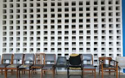
Rachel Lee, Arnold Mkony, and Monika Motylinska interrogate the neocolonial origins of Bugando Medical Centre
Title:
Foreign Bodies, Three Hills, and a Hospital
Rachel Lee, Arnold Mkony, and Monika Motylinska interrogate the neocolonial origins of Bugando Medical Centre
Actions:
Foreign Bodies, Three Hills, and a Hospital
Rachel Lee, Arnold Mkony, and Monika Motylinska interrogate the neocolonial origins of Bugando Medical Centre
Actions:
Level of archival description:
Sub-series
Sub-series
Title:
Early Drawings by Goldsmith
Early Drawings by Goldsmith
Actions:
Reference number:
AP032.S1.SS1.D3
Description:
This sub-series documents sketches and drawings completed during Goldsmith’s education and early career, from 1938 to 1953. The sub-series includes sketches completed while Goldsmith studied under Mies van der Rohe at the Armour Institute of Technology in Chicago (as of 2023 known as the Illinois Institute of Technology) in the late-1930s as well as Goldsmith’s notes and sketches from his trips to Taliesin East, Wisconsin, and Williamsburg, Virginia in the early-1940s. Further, the sub-series contains sketches and drawings for various buildings, infrastructure, and furniture from circa 1942-1943, in addition to sketches for the Stuart S. Borovay Residence and an unbuilt project dating from 1942 – 1953.
AP032.S1.SS1.D3
Description:
This sub-series documents sketches and drawings completed during Goldsmith’s education and early career, from 1938 to 1953. The sub-series includes sketches completed while Goldsmith studied under Mies van der Rohe at the Armour Institute of Technology in Chicago (as of 2023 known as the Illinois Institute of Technology) in the late-1930s as well as Goldsmith’s notes and sketches from his trips to Taliesin East, Wisconsin, and Williamsburg, Virginia in the early-1940s. Further, the sub-series contains sketches and drawings for various buildings, infrastructure, and furniture from circa 1942-1943, in addition to sketches for the Stuart S. Borovay Residence and an unbuilt project dating from 1942 – 1953.
People:
Date:
1938-1953
1938-1953
Title:
Early Drawings by Goldsmith
Actions:
AP032.S1.SS1.D3
Description:
This sub-series documents sketches and drawings completed during Goldsmith’s education and early career, from 1938 to 1953. The sub-series includes sketches completed while Goldsmith studied under Mies van der Rohe at the Armour Institute of Technology in Chicago (as of 2023 known as the Illinois Institute of Technology) in the late-1930s as well as Goldsmith’s notes and sketches from his trips to Taliesin East, Wisconsin, and Williamsburg, Virginia in the early-1940s. Further, the sub-series contains sketches and drawings for various buildings, infrastructure, and furniture from circa 1942-1943, in addition to sketches for the Stuart S. Borovay Residence and an unbuilt project dating from 1942 – 1953.
Early Drawings by Goldsmith
Actions:
AP032.S1.SS1.D3
Description:
This sub-series documents sketches and drawings completed during Goldsmith’s education and early career, from 1938 to 1953. The sub-series includes sketches completed while Goldsmith studied under Mies van der Rohe at the Armour Institute of Technology in Chicago (as of 2023 known as the Illinois Institute of Technology) in the late-1930s as well as Goldsmith’s notes and sketches from his trips to Taliesin East, Wisconsin, and Williamsburg, Virginia in the early-1940s. Further, the sub-series contains sketches and drawings for various buildings, infrastructure, and furniture from circa 1942-1943, in addition to sketches for the Stuart S. Borovay Residence and an unbuilt project dating from 1942 – 1953.
Level of archival description:
File 3
File 3
Date:
1938-1953
1938-1953
People:
Level of archival description:
Project
Project
Reference number:
AP206.S1.1987.PR04
Description:
This project series documents a competition entry for new structures and upgrades to the Mysore Dasara Exhibition complex in Mysuru, India in 1987. It should be noted that the previous name of Mysuru was Mysore. The project consisted of upgrades to the existing exhibition grounds to create permanent infrastructure for the annual festivities. The client, Karnataka Exhibition Authority, asked architects to design a general layout for the site including pavilions, administrative offices, restaurants, kiosks, parking, amusements and theatres, among many others. A new entrance gate was also emphasized in the competition guidelines. The project is recorded through drawings of the site, gate and museum dating from around 1987 and correspondence dating from 1987.
AP206.S1.1987.PR04
Description:
This project series documents a competition entry for new structures and upgrades to the Mysore Dasara Exhibition complex in Mysuru, India in 1987. It should be noted that the previous name of Mysuru was Mysore. The project consisted of upgrades to the existing exhibition grounds to create permanent infrastructure for the annual festivities. The client, Karnataka Exhibition Authority, asked architects to design a general layout for the site including pavilions, administrative offices, restaurants, kiosks, parking, amusements and theatres, among many others. A new entrance gate was also emphasized in the competition guidelines. The project is recorded through drawings of the site, gate and museum dating from around 1987 and correspondence dating from 1987.
People:
Date:
1987
1987
Title:
Mysore Exhibition complex, Mysuru, India (1987)
Actions:
AP206.S1.1987.PR04
Description:
This project series documents a competition entry for new structures and upgrades to the Mysore Dasara Exhibition complex in Mysuru, India in 1987. It should be noted that the previous name of Mysuru was Mysore. The project consisted of upgrades to the existing exhibition grounds to create permanent infrastructure for the annual festivities. The client, Karnataka Exhibition Authority, asked architects to design a general layout for the site including pavilions, administrative offices, restaurants, kiosks, parking, amusements and theatres, among many others. A new entrance gate was also emphasized in the competition guidelines. The project is recorded through drawings of the site, gate and museum dating from around 1987 and correspondence dating from 1987.
Mysore Exhibition complex, Mysuru, India (1987)
Actions:
AP206.S1.1987.PR04
Description:
This project series documents a competition entry for new structures and upgrades to the Mysore Dasara Exhibition complex in Mysuru, India in 1987. It should be noted that the previous name of Mysuru was Mysore. The project consisted of upgrades to the existing exhibition grounds to create permanent infrastructure for the annual festivities. The client, Karnataka Exhibition Authority, asked architects to design a general layout for the site including pavilions, administrative offices, restaurants, kiosks, parking, amusements and theatres, among many others. A new entrance gate was also emphasized in the competition guidelines. The project is recorded through drawings of the site, gate and museum dating from around 1987 and correspondence dating from 1987.
Level of archival description:
Project
Project
Date:
1987
1987
People:
Form:
articles
articles
Title:
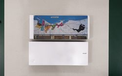
Postcards on the Move
Postcards on the Move
Actions:
Armin Linke on global infrastructure, the Anthropocene, and playing games with the public
Published:
30 October 2023
30 October 2023
Title:
Postcards on the Move
Armin Linke on global infrastructure, the Anthropocene, and playing games with the public
Actions:
Postcards on the Move
Armin Linke on global infrastructure, the Anthropocene, and playing games with the public
Actions:
Level of archival description:
Project
Project
Title:
Pahang Tenggara
Pahang Tenggara
Reference number:
AP027.S1.D51
Description:
The preparation of a comprehensive plan for the socio-economic development of Pahang Tenggara, a region of approximately 4,000 square miles. A master plan for the optimum utilization and development of its human and natural resources over a 20 year period was prepared. A complete inventory of the physical condition and natural resources of the area was required, as well as an assessment of the human and economic capabilities, both in its adjoining regions and the nation as a whole. The plan provides guidelines and a basic framework for future development by public, government-assisted and private investments until 1990. The plan also details the economic feasibility of primary resources and secondary industrial projects, and all related social and physical infrastructure requirements.
AP027.S1.D51
Description:
The preparation of a comprehensive plan for the socio-economic development of Pahang Tenggara, a region of approximately 4,000 square miles. A master plan for the optimum utilization and development of its human and natural resources over a 20 year period was prepared. A complete inventory of the physical condition and natural resources of the area was required, as well as an assessment of the human and economic capabilities, both in its adjoining regions and the nation as a whole. The plan provides guidelines and a basic framework for future development by public, government-assisted and private investments until 1990. The plan also details the economic feasibility of primary resources and secondary industrial projects, and all related social and physical infrastructure requirements.
People:
Subject:
urban planning
urban planning
Date:
1969-1972
1969-1972
Title:
Pahang Tenggara
Actions:
AP027.S1.D51
Description:
The preparation of a comprehensive plan for the socio-economic development of Pahang Tenggara, a region of approximately 4,000 square miles. A master plan for the optimum utilization and development of its human and natural resources over a 20 year period was prepared. A complete inventory of the physical condition and natural resources of the area was required, as well as an assessment of the human and economic capabilities, both in its adjoining regions and the nation as a whole. The plan provides guidelines and a basic framework for future development by public, government-assisted and private investments until 1990. The plan also details the economic feasibility of primary resources and secondary industrial projects, and all related social and physical infrastructure requirements.
Pahang Tenggara
Actions:
AP027.S1.D51
Description:
The preparation of a comprehensive plan for the socio-economic development of Pahang Tenggara, a region of approximately 4,000 square miles. A master plan for the optimum utilization and development of its human and natural resources over a 20 year period was prepared. A complete inventory of the physical condition and natural resources of the area was required, as well as an assessment of the human and economic capabilities, both in its adjoining regions and the nation as a whole. The plan provides guidelines and a basic framework for future development by public, government-assisted and private investments until 1990. The plan also details the economic feasibility of primary resources and secondary industrial projects, and all related social and physical infrastructure requirements.
Level of archival description:
File 51
File 51
Date:
1969-1972
1969-1972
People:
Subject:
urban planning
urban planning
Level of archival description:
Series
Series
Title:
Documents professionnels
Documents professionnels
Actions:
Reference number:
AP081.S3
Description:
La série contient des cahiers d'arpentages pour la ville de Maisonneuve datant de 1910 à 1913, et d'autres documents datant 1892 à 1921 qui portent sur les infrastructures de la ville de Maisonneuve. Elle contient aussi des documents portant sur divers sujets, y compris des lois relatives aux arpenteurs-géomètres au Québec, et une décision de la Cour du Banc du Roi.
AP081.S3
Description:
La série contient des cahiers d'arpentages pour la ville de Maisonneuve datant de 1910 à 1913, et d'autres documents datant 1892 à 1921 qui portent sur les infrastructures de la ville de Maisonneuve. Elle contient aussi des documents portant sur divers sujets, y compris des lois relatives aux arpenteurs-géomètres au Québec, et une décision de la Cour du Banc du Roi.
People:
Date:
1892-1921
1892-1921
Title:
Documents professionnels
Actions:
AP081.S3
Description:
La série contient des cahiers d'arpentages pour la ville de Maisonneuve datant de 1910 à 1913, et d'autres documents datant 1892 à 1921 qui portent sur les infrastructures de la ville de Maisonneuve. Elle contient aussi des documents portant sur divers sujets, y compris des lois relatives aux arpenteurs-géomètres au Québec, et une décision de la Cour du Banc du Roi.
Documents professionnels
Actions:
AP081.S3
Description:
La série contient des cahiers d'arpentages pour la ville de Maisonneuve datant de 1910 à 1913, et d'autres documents datant 1892 à 1921 qui portent sur les infrastructures de la ville de Maisonneuve. Elle contient aussi des documents portant sur divers sujets, y compris des lois relatives aux arpenteurs-géomètres au Québec, et une décision de la Cour du Banc du Roi.
Level of archival description:
Série
Série
Date:
1892-1921
1892-1921
People:


