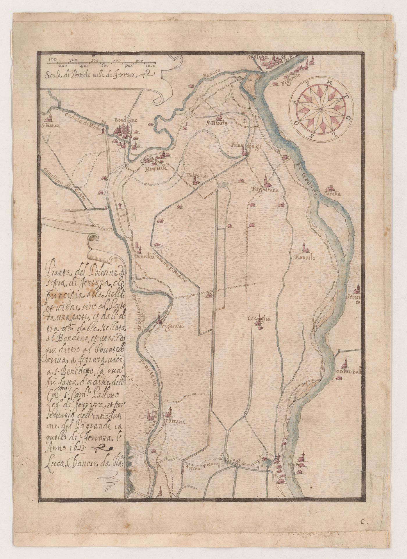
Map of the Po River delta near Ferrara
ca. 1630-1640
Pen and dark brown ink with watercolour over black chalk underdrawing
secondary support: 27.6 x 19.6 cm sheet: 26.5 x 19.6 cm
DR1981:0017:070
- This drawing is laid down on a secondary support which was formerly bound into an album as indicated by the letter and number indicating pagination. The drawing has been squared for transfer.
inscribed, signed and dated - by the draughtsman, in pen and dark brown ink, cl. to l.l.: with an inscription describing the map, "Pianta del Polesine ... Anno 1633 / Luca Danese da Ra.a"; and throughout: with inscriptions identifying towns, canals and rivers inscribed - by a contemporary hand, in pen and dark brown ink, l.r.: "c."
Inscrivez-vous pour recevoir de nos nouvelles
Merci. Vous êtes maintenant abonné. Vous recevrez bientôt nos courriels.
Pour le moment, notre système n’est pas capable de mettre à jour vos préférences. Veuillez réessayer plus tard.
Vous êtes déjà inscrit avec cette adresse électronique. Si vous souhaitez vous inscrire avec une autre adresse, merci de réessayer.
Cete adresse courriel a été définitivement supprimée de notre base de données. Si vous souhaitez vous réabonner avec cette adresse courriel, veuillez contactez-nous
Veuillez, s'il vous plaît, remplir le formulaire ci-dessous pour acheter:
[Title of the book, authors]
ISBN: [ISBN of the book]
Prix [Price of book]
Merci d'avoir passé une commande. Nous vous contacterons sous peu.
Nous ne sommes pas en mesure de traiter votre demande pour le moment. Veuillez réessayer plus tard.
Votre classeur est vide.