


5847 Résultats
Classification:
photographies
photographies
Numéro de référence:
ARCH268473
Description:
Contains images of drawings and views of buildings and projects, like airship hangars and bridges, by Eugène Freyssinet, Pier Luigi Nervi, Eduardo Torroja, Felix Candela, and Robert Maillart.
ARCH268473
Description:
Contains images of drawings and views of buildings and projects, like airship hangars and bridges, by Eugène Freyssinet, Pier Luigi Nervi, Eduardo Torroja, Felix Candela, and Robert Maillart.
Personnes et institutions:
Titre:
Images of drawings and views of buildings and projects
Actions:
ARCH268473
Description:
Contains images of drawings and views of buildings and projects, like airship hangars and bridges, by Eugène Freyssinet, Pier Luigi Nervi, Eduardo Torroja, Felix Candela, and Robert Maillart.
Images of drawings and views of buildings and projects
Actions:
ARCH268473
Description:
Contains images of drawings and views of buildings and projects, like airship hangars and bridges, by Eugène Freyssinet, Pier Luigi Nervi, Eduardo Torroja, Felix Candela, and Robert Maillart.
Classification:
photographies
photographies
Personnes et institutions:
Classification:
né numérique
Quantité:
2304 digital file(s)
né numérique
Quantité:
2304 digital file(s)
Titre:
Maya and ZBrush renderings
Maya and ZBrush renderings
Numéro de référence:
AP174.S1.2006.D2.006
Description:
Contains the results of rendering tests in Maya, 2006 and 2009; renderings of Strand Tower used in the Skin and Bones exhibit at the Museum of Contemporary Art, Los Angeles, 2006; renderings of Strand Tower and exhibition photos from the Wild Child exhibit at Bridge Gallery, New York, 2009; ZBrush renders from 2009; and final renderings created in ZBrush in 2013. Includes a README file from 2014 indicating that final ZBrush renderings can also be found in the directory containing InDesign material (AP174.S1.2006.D2.004). Original directory name: "RENDERS". Most common file formats: Tagged Image File Format, JPEG File Interchange Format, Portable Network Graphics, Maya Binary File Format, Unidentified
AP174.S1.2006.D2.006
Description:
Contains the results of rendering tests in Maya, 2006 and 2009; renderings of Strand Tower used in the Skin and Bones exhibit at the Museum of Contemporary Art, Los Angeles, 2006; renderings of Strand Tower and exhibition photos from the Wild Child exhibit at Bridge Gallery, New York, 2009; ZBrush renders from 2009; and final renderings created in ZBrush in 2013. Includes a README file from 2014 indicating that final ZBrush renderings can also be found in the directory containing InDesign material (AP174.S1.2006.D2.004). Original directory name: "RENDERS". Most common file formats: Tagged Image File Format, JPEG File Interchange Format, Portable Network Graphics, Maya Binary File Format, Unidentified
Personnes et institutions:
Date:
2006-2014
2006-2014
Titre:
Maya and ZBrush renderings
Actions:
AP174.S1.2006.D2.006
Description:
Contains the results of rendering tests in Maya, 2006 and 2009; renderings of Strand Tower used in the Skin and Bones exhibit at the Museum of Contemporary Art, Los Angeles, 2006; renderings of Strand Tower and exhibition photos from the Wild Child exhibit at Bridge Gallery, New York, 2009; ZBrush renders from 2009; and final renderings created in ZBrush in 2013. Includes a README file from 2014 indicating that final ZBrush renderings can also be found in the directory containing InDesign material (AP174.S1.2006.D2.004). Original directory name: "RENDERS". Most common file formats: Tagged Image File Format, JPEG File Interchange Format, Portable Network Graphics, Maya Binary File Format, Unidentified
Maya and ZBrush renderings
Actions:
AP174.S1.2006.D2.006
Description:
Contains the results of rendering tests in Maya, 2006 and 2009; renderings of Strand Tower used in the Skin and Bones exhibit at the Museum of Contemporary Art, Los Angeles, 2006; renderings of Strand Tower and exhibition photos from the Wild Child exhibit at Bridge Gallery, New York, 2009; ZBrush renders from 2009; and final renderings created in ZBrush in 2013. Includes a README file from 2014 indicating that final ZBrush renderings can also be found in the directory containing InDesign material (AP174.S1.2006.D2.004). Original directory name: "RENDERS". Most common file formats: Tagged Image File Format, JPEG File Interchange Format, Portable Network Graphics, Maya Binary File Format, Unidentified
Classification:
né numérique
Quantité:
2304 digital file(s)
né numérique
Quantité:
2304 digital file(s)
Date:
2006-2014
2006-2014
Personnes et institutions:
Classification:
expositions
expositions
Actions:
Description:
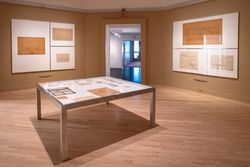
Pour le troisième et dernier exposition de cette série, Mauricio Pezo et Sofia von Ellrichshausen de Pezo von Ellrichshausen explorent la monumentalité domestique dans lœuvre de Williams. Lexposition présente des dessins techniques déléments monumentaux incorporés dans deux projets clés - Casa Sobre el Arroyo [Maison sur le fleuve] et Casa Demarás [Maison Desmarás] -(...)
Pour le troisième et dernier exposition de cette série, Mauricio Pezo et Sofia von Ellrichshausen de Pezo von Ellrichshausen explorent la monumentalité domestique dans lœuvre de Williams. Lexposition présente des dessins techniques déléments monumentaux incorporés dans deux projets clés - Casa Sobre el Arroyo [Maison sur le fleuve] et Casa Demarás [Maison Desmarás] -(...)
Localisation:
Salle octogonale Mot(s)-clé(s):
Amancio Williams, Pezo von Ellrichshausen, Buenos Aires, sortis du cadre, Argentine, Casa sobre el arroyo, Casa Desmarás, maison pont
Salle octogonale Mot(s)-clé(s):
Amancio Williams, Pezo von Ellrichshausen, Buenos Aires, sortis du cadre, Argentine, Casa sobre el arroyo, Casa Desmarás, maison pont
Date:
22 février 2024 au 19 mai 2024
22 février 2024 au 19 mai 2024
Titre:
Monument domestique : Amancio Williams revu par Pezo von Ellrichshausen
Actions:
Description:
Pour le troisième et dernier exposition de cette série, Mauricio Pezo et Sofia von Ellrichshausen de Pezo von Ellrichshausen explorent la monumentalité domestique dans lœuvre de Williams. Lexposition présente des dessins techniques déléments monumentaux incorporés dans deux projets clés - Casa Sobre el Arroyo [Maison sur le fleuve] et Casa Demarás [Maison Desmarás] -(...)
Monument domestique : Amancio Williams revu par Pezo von Ellrichshausen
Actions:
Description:
Pour le troisième et dernier exposition de cette série, Mauricio Pezo et Sofia von Ellrichshausen de Pezo von Ellrichshausen explorent la monumentalité domestique dans lœuvre de Williams. Lexposition présente des dessins techniques déléments monumentaux incorporés dans deux projets clés - Casa Sobre el Arroyo [Maison sur le fleuve] et Casa Demarás [Maison Desmarás] -(...)
Classification:
expositions
expositions
Date:
22 février 2024 au
19 mai 2024
22 février 2024 au
19 mai 2024
Localisation:
Salle octogonale Mot(s)-clé(s):
Amancio Williams, Pezo von Ellrichshausen, Buenos Aires, sortis du cadre, Argentine, Casa sobre el arroyo, Casa Desmarás, maison pont
Salle octogonale Mot(s)-clé(s):
Amancio Williams, Pezo von Ellrichshausen, Buenos Aires, sortis du cadre, Argentine, Casa sobre el arroyo, Casa Desmarás, maison pont
Classification:
photographies
photographies
Titre:
Our Old Home
Our Old Home
Actions:
Numéro de référence:
PH1979:0602.02
Description:
Nathaniel Hawthorne was born in 1804 in Salem, Massachusetts. He started writing seriously in 1846 and spent the years 1853 to 1857 in England as the American Consul in Liverpool. The collection of essays that constitute 'Our Old Home' comes from the journals he kept during his stay in England. After spending two years in Italy he returned to the United States and completed his final novel, 'The Marble Faun' and 'Our Old Home'. This 594-page book comprises 14 photogravures, one engraving, a Title page and a Contents and list of illustrations and Index : Title page: Our Old Home by Nathaniel Hawthorne annotated with passages from the author's note-book, and illustrated with photogravures Volume II. Cambridge. Printed at the Riverside Press. MDCCCXCI. Verso of title page: Copyright, 1863 by Nathaniel Hawthorne Copyright, 1870 By Sophia Hawthorne Copyright, 1883, 1890 By Houghton, Mifflin & Co. All rights reserved Two Hundred and Fifty Copies Printed No. 69 Contents and list of Illustrations: [Photogravures executed by A.W. Elson & Co. Boston] Lord Nelson Frontispiece NEAR OXFORD Blenheim The Thames at Oxford from Folly Bridge Magdalen College, Oxford, from the Cherwell SOME OF THE HAUNTS OF BURNS Robert Burns Burn's Birthplace, Alloway Parish, near Ayr The Auld Brig o' Doon, Ayr Alloway Kirk A LONDON SUBURB A Country House The Houses of Parliament UP THE THAMES London Bridge Tower of London, showing Traitor's Gate St. Paul's Cathedral Poets' Corner, Westminster Abbey OUTSIDE GLIMPSES OF ENGLISH POVERTY An English Almshouse CIVIC BANQUETS Index
PH1979:0602.02
Description:
Nathaniel Hawthorne was born in 1804 in Salem, Massachusetts. He started writing seriously in 1846 and spent the years 1853 to 1857 in England as the American Consul in Liverpool. The collection of essays that constitute 'Our Old Home' comes from the journals he kept during his stay in England. After spending two years in Italy he returned to the United States and completed his final novel, 'The Marble Faun' and 'Our Old Home'. This 594-page book comprises 14 photogravures, one engraving, a Title page and a Contents and list of illustrations and Index : Title page: Our Old Home by Nathaniel Hawthorne annotated with passages from the author's note-book, and illustrated with photogravures Volume II. Cambridge. Printed at the Riverside Press. MDCCCXCI. Verso of title page: Copyright, 1863 by Nathaniel Hawthorne Copyright, 1870 By Sophia Hawthorne Copyright, 1883, 1890 By Houghton, Mifflin & Co. All rights reserved Two Hundred and Fifty Copies Printed No. 69 Contents and list of Illustrations: [Photogravures executed by A.W. Elson & Co. Boston] Lord Nelson Frontispiece NEAR OXFORD Blenheim The Thames at Oxford from Folly Bridge Magdalen College, Oxford, from the Cherwell SOME OF THE HAUNTS OF BURNS Robert Burns Burn's Birthplace, Alloway Parish, near Ayr The Auld Brig o' Doon, Ayr Alloway Kirk A LONDON SUBURB A Country House The Houses of Parliament UP THE THAMES London Bridge Tower of London, showing Traitor's Gate St. Paul's Cathedral Poets' Corner, Westminster Abbey OUTSIDE GLIMPSES OF ENGLISH POVERTY An English Almshouse CIVIC BANQUETS Index
Personnes et institutions:
Sujet:
architecture
architecture
Date:
1891
1891
Titre:
Our Old Home
Actions:
PH1979:0602.02
Description:
Nathaniel Hawthorne was born in 1804 in Salem, Massachusetts. He started writing seriously in 1846 and spent the years 1853 to 1857 in England as the American Consul in Liverpool. The collection of essays that constitute 'Our Old Home' comes from the journals he kept during his stay in England. After spending two years in Italy he returned to the United States and completed his final novel, 'The Marble Faun' and 'Our Old Home'. This 594-page book comprises 14 photogravures, one engraving, a Title page and a Contents and list of illustrations and Index : Title page: Our Old Home by Nathaniel Hawthorne annotated with passages from the author's note-book, and illustrated with photogravures Volume II. Cambridge. Printed at the Riverside Press. MDCCCXCI. Verso of title page: Copyright, 1863 by Nathaniel Hawthorne Copyright, 1870 By Sophia Hawthorne Copyright, 1883, 1890 By Houghton, Mifflin & Co. All rights reserved Two Hundred and Fifty Copies Printed No. 69 Contents and list of Illustrations: [Photogravures executed by A.W. Elson & Co. Boston] Lord Nelson Frontispiece NEAR OXFORD Blenheim The Thames at Oxford from Folly Bridge Magdalen College, Oxford, from the Cherwell SOME OF THE HAUNTS OF BURNS Robert Burns Burn's Birthplace, Alloway Parish, near Ayr The Auld Brig o' Doon, Ayr Alloway Kirk A LONDON SUBURB A Country House The Houses of Parliament UP THE THAMES London Bridge Tower of London, showing Traitor's Gate St. Paul's Cathedral Poets' Corner, Westminster Abbey OUTSIDE GLIMPSES OF ENGLISH POVERTY An English Almshouse CIVIC BANQUETS Index
Our Old Home
Actions:
PH1979:0602.02
Description:
Nathaniel Hawthorne was born in 1804 in Salem, Massachusetts. He started writing seriously in 1846 and spent the years 1853 to 1857 in England as the American Consul in Liverpool. The collection of essays that constitute 'Our Old Home' comes from the journals he kept during his stay in England. After spending two years in Italy he returned to the United States and completed his final novel, 'The Marble Faun' and 'Our Old Home'. This 594-page book comprises 14 photogravures, one engraving, a Title page and a Contents and list of illustrations and Index : Title page: Our Old Home by Nathaniel Hawthorne annotated with passages from the author's note-book, and illustrated with photogravures Volume II. Cambridge. Printed at the Riverside Press. MDCCCXCI. Verso of title page: Copyright, 1863 by Nathaniel Hawthorne Copyright, 1870 By Sophia Hawthorne Copyright, 1883, 1890 By Houghton, Mifflin & Co. All rights reserved Two Hundred and Fifty Copies Printed No. 69 Contents and list of Illustrations: [Photogravures executed by A.W. Elson & Co. Boston] Lord Nelson Frontispiece NEAR OXFORD Blenheim The Thames at Oxford from Folly Bridge Magdalen College, Oxford, from the Cherwell SOME OF THE HAUNTS OF BURNS Robert Burns Burn's Birthplace, Alloway Parish, near Ayr The Auld Brig o' Doon, Ayr Alloway Kirk A LONDON SUBURB A Country House The Houses of Parliament UP THE THAMES London Bridge Tower of London, showing Traitor's Gate St. Paul's Cathedral Poets' Corner, Westminster Abbey OUTSIDE GLIMPSES OF ENGLISH POVERTY An English Almshouse CIVIC BANQUETS Index
Classification:
photographies
photographies
Date:
1891
1891
Personnes et institutions:
Sujet:
architecture
architecture
Niveau de description archivistique:
Projet
Projet
Numéro de référence:
AP075.S1.1965.PR01
Description:
This project series documents Cornelia Hahn Oberlander's landscape project for the outdoor playground of the Children's Creative Centre. The Centre was part of the Canadian Federal Pavilion built for the Universal and International Exposition of 1967 (Expo 67), located at the south end of Notre-Dame Island in Montréal. Oberlander worked on this project from 1965-1966. She based her design on children's spontaneous exploration, to encourage self-motivation and creative play. The playground included a rolling terrain, looping paths, a wobble walk made of short logs embeded in the ground, a canal, and "giant wooden building pieces and a rocking boat in water replaced static sculptures". [1] The playground included a sand beach-like area with drifwood and plants to be used as play props. At the centre of the playground was a grass mound with an interior cave and a high wooden platform only reachable by a commando rope. A forty-foot long circulating water channel was situated in the east section of the playground and included two small islands linked by bridges, but was narrow enough to allow children to jump over it. The project series contains sketches, preliminary landscape concept plans, site plans, general landscape plans at different stages of design development, several sections and detail drawings for the playground's equipment and installations, and presentation drawings, including perspective views. The project series also contains architectural, electrical, and structural drawings of the Pavilion, which were provided to Oberlander for reference. Also included are photographs of the playground, research material on playgrounds, and articles and publications on the project, including Oberlander's writings, and publications on Expo '67. Source: [1] Herrington, Susan. Cornelia Hahn Oberlander: Making the Modern Landscape, University of Virginia Press, 2014, 304 pages. p. 106.
AP075.S1.1965.PR01
Description:
This project series documents Cornelia Hahn Oberlander's landscape project for the outdoor playground of the Children's Creative Centre. The Centre was part of the Canadian Federal Pavilion built for the Universal and International Exposition of 1967 (Expo 67), located at the south end of Notre-Dame Island in Montréal. Oberlander worked on this project from 1965-1966. She based her design on children's spontaneous exploration, to encourage self-motivation and creative play. The playground included a rolling terrain, looping paths, a wobble walk made of short logs embeded in the ground, a canal, and "giant wooden building pieces and a rocking boat in water replaced static sculptures". [1] The playground included a sand beach-like area with drifwood and plants to be used as play props. At the centre of the playground was a grass mound with an interior cave and a high wooden platform only reachable by a commando rope. A forty-foot long circulating water channel was situated in the east section of the playground and included two small islands linked by bridges, but was narrow enough to allow children to jump over it. The project series contains sketches, preliminary landscape concept plans, site plans, general landscape plans at different stages of design development, several sections and detail drawings for the playground's equipment and installations, and presentation drawings, including perspective views. The project series also contains architectural, electrical, and structural drawings of the Pavilion, which were provided to Oberlander for reference. Also included are photographs of the playground, research material on playgrounds, and articles and publications on the project, including Oberlander's writings, and publications on Expo '67. Source: [1] Herrington, Susan. Cornelia Hahn Oberlander: Making the Modern Landscape, University of Virginia Press, 2014, 304 pages. p. 106.
Personnes et institutions:
Date:
1965-1971
1965-1971
Titre:
Children's Creative Centre Playground, Canadian Federal Pavilion, Expo '67, Montréal, Québec (1965-1967)
Actions:
AP075.S1.1965.PR01
Description:
This project series documents Cornelia Hahn Oberlander's landscape project for the outdoor playground of the Children's Creative Centre. The Centre was part of the Canadian Federal Pavilion built for the Universal and International Exposition of 1967 (Expo 67), located at the south end of Notre-Dame Island in Montréal. Oberlander worked on this project from 1965-1966. She based her design on children's spontaneous exploration, to encourage self-motivation and creative play. The playground included a rolling terrain, looping paths, a wobble walk made of short logs embeded in the ground, a canal, and "giant wooden building pieces and a rocking boat in water replaced static sculptures". [1] The playground included a sand beach-like area with drifwood and plants to be used as play props. At the centre of the playground was a grass mound with an interior cave and a high wooden platform only reachable by a commando rope. A forty-foot long circulating water channel was situated in the east section of the playground and included two small islands linked by bridges, but was narrow enough to allow children to jump over it. The project series contains sketches, preliminary landscape concept plans, site plans, general landscape plans at different stages of design development, several sections and detail drawings for the playground's equipment and installations, and presentation drawings, including perspective views. The project series also contains architectural, electrical, and structural drawings of the Pavilion, which were provided to Oberlander for reference. Also included are photographs of the playground, research material on playgrounds, and articles and publications on the project, including Oberlander's writings, and publications on Expo '67. Source: [1] Herrington, Susan. Cornelia Hahn Oberlander: Making the Modern Landscape, University of Virginia Press, 2014, 304 pages. p. 106.
Children's Creative Centre Playground, Canadian Federal Pavilion, Expo '67, Montréal, Québec (1965-1967)
Actions:
AP075.S1.1965.PR01
Description:
This project series documents Cornelia Hahn Oberlander's landscape project for the outdoor playground of the Children's Creative Centre. The Centre was part of the Canadian Federal Pavilion built for the Universal and International Exposition of 1967 (Expo 67), located at the south end of Notre-Dame Island in Montréal. Oberlander worked on this project from 1965-1966. She based her design on children's spontaneous exploration, to encourage self-motivation and creative play. The playground included a rolling terrain, looping paths, a wobble walk made of short logs embeded in the ground, a canal, and "giant wooden building pieces and a rocking boat in water replaced static sculptures". [1] The playground included a sand beach-like area with drifwood and plants to be used as play props. At the centre of the playground was a grass mound with an interior cave and a high wooden platform only reachable by a commando rope. A forty-foot long circulating water channel was situated in the east section of the playground and included two small islands linked by bridges, but was narrow enough to allow children to jump over it. The project series contains sketches, preliminary landscape concept plans, site plans, general landscape plans at different stages of design development, several sections and detail drawings for the playground's equipment and installations, and presentation drawings, including perspective views. The project series also contains architectural, electrical, and structural drawings of the Pavilion, which were provided to Oberlander for reference. Also included are photographs of the playground, research material on playgrounds, and articles and publications on the project, including Oberlander's writings, and publications on Expo '67. Source: [1] Herrington, Susan. Cornelia Hahn Oberlander: Making the Modern Landscape, University of Virginia Press, 2014, 304 pages. p. 106.
Niveau de description archivistique:
Project
Project
Date:
1965-1971
1965-1971
Personnes et institutions:
Classification:
dessins
Quantité:
62 conceptual drawing(s)
dessins
Quantité:
62 conceptual drawing(s)
Numéro de référence:
DR2004:0897
Description:
elevations, some with annotations, sections, sketches, perspectives, engineer's drawings, views of railway bridges, views of site, photomontages, design development drawings, postcards, montages, presentation drawings, details, maps, overlays, notes, clippings, land survey, plan, site plan, and diagram
DR2004:0897
Description:
elevations, some with annotations, sections, sketches, perspectives, engineer's drawings, views of railway bridges, views of site, photomontages, design development drawings, postcards, montages, presentation drawings, details, maps, overlays, notes, clippings, land survey, plan, site plan, and diagram
Personnes et institutions:
Titre:
Elevations, some with annotations, sections, sketches
Actions:
DR2004:0897
Description:
elevations, some with annotations, sections, sketches, perspectives, engineer's drawings, views of railway bridges, views of site, photomontages, design development drawings, postcards, montages, presentation drawings, details, maps, overlays, notes, clippings, land survey, plan, site plan, and diagram
Elevations, some with annotations, sections, sketches
Actions:
DR2004:0897
Description:
elevations, some with annotations, sections, sketches, perspectives, engineer's drawings, views of railway bridges, views of site, photomontages, design development drawings, postcards, montages, presentation drawings, details, maps, overlays, notes, clippings, land survey, plan, site plan, and diagram
Classification:
dessins
Quantité:
62 conceptual drawing(s)
dessins
Quantité:
62 conceptual drawing(s)
Personnes et institutions:
Classification:
dessins
dessins
Numéro de référence:
DR2004:0865
Description:
sketches, some with annotations, sections, elevations, axonometrics, site plans, plans, design development drawings, drawings from the Control project, views of bridges, views of trains, engineer's drawings, presentation drawings, perspectives, clippings, proposal documents, maps, notes, fax, overlay, and agenda
DR2004:0865
Description:
sketches, some with annotations, sections, elevations, axonometrics, site plans, plans, design development drawings, drawings from the Control project, views of bridges, views of trains, engineer's drawings, presentation drawings, perspectives, clippings, proposal documents, maps, notes, fax, overlay, and agenda
Personnes et institutions:
Titre:
Sketches, some with annotations, sections, elevations
Actions:
DR2004:0865
Description:
sketches, some with annotations, sections, elevations, axonometrics, site plans, plans, design development drawings, drawings from the Control project, views of bridges, views of trains, engineer's drawings, presentation drawings, perspectives, clippings, proposal documents, maps, notes, fax, overlay, and agenda
Sketches, some with annotations, sections, elevations
Actions:
DR2004:0865
Description:
sketches, some with annotations, sections, elevations, axonometrics, site plans, plans, design development drawings, drawings from the Control project, views of bridges, views of trains, engineer's drawings, presentation drawings, perspectives, clippings, proposal documents, maps, notes, fax, overlay, and agenda
Classification:
dessins
dessins
Personnes et institutions:
Niveau de description archivistique:
Projet
Projet
Titre:
BTDB Computer
BTDB Computer
Numéro de référence:
AP144.S2.D70
Description:
File documents the executed project for an office building to house the computer facilities of the British Transport Docks Board (BTDB) at Bulls Bridge and Hayes Road, in Southall, Ealing, England. The building has few doors and no corridors, rooms for computers, data control and preparation, and offices for engineers, programmers, and analysts. The client anticipated a 20% expansion of facilities during the life-cycle of the building and Cedric Price developed designs for "expanding" the building without interrupting computer services which were to run 24 hours a day. Design included interior walls that can be dismounted and reinstalled, a raised flexible floor system, and an exterior cladding system that allowed for an interchange between opaque and transparent panels. Existing conditions material includes an ordinance survey (1963) and floor plans for an unidentified building. Design development and working drawings include site plans, floor plans, sections, elevations, and construction details. The plans show: circulation patterns and relationships between areas; a series of alternate floor plans for computer room expansion; connections between original and expanded services; the computer room and equipment; furniture layout; framing and structure; and plans for acoustic and visual barriers. Also included are axonometric drawings of the phased development/expansion of the structure; design validation charts which measure projected "required" design elements against observation and investigation; environmental control charts exploring alternate proposals for illumination, ventilation, air, temperature, and acoustic control of certain areas, and diagrammatic sections showing environmental controls for air intake, returns and circulation; project requirements charts; project task sequencing diagrams; perspective drawings; elevations and sections for an illuminated sign; and details and wall sections for the exterior cladding. Twenty-nine individual and 60 sets of reprographic copies are stamped "issued contractor". Material for publication includes: details, site plans, floor plans and exterior elevations, b/w post-construction photographs, and a photo collage. Some material from this file was published in: Price, Cedric, "ECHOES: Environment Controlled Human Operational Enclosed Spaces", 'Architectural Design' (October 1969), 547-552; "Cedric Price Supplement No. 2", 'Architectural Design', vol. 41, (January 1971), 25; Price, Cedric, 'Cedric Price-Works II' (London: Architectural Press, 1984), 72, 82-83, 112, 113. Material in this file was produced between 1966 and 1984, but predominantly between 1968 and 1973. Sandy Brown appears as the acoustics consultant and Zisman, Bowyer & Partners appear as the services consultants in this file. File contains design development drawings, working drawings, reference drawings, photographic materials, and textual records.
AP144.S2.D70
Description:
File documents the executed project for an office building to house the computer facilities of the British Transport Docks Board (BTDB) at Bulls Bridge and Hayes Road, in Southall, Ealing, England. The building has few doors and no corridors, rooms for computers, data control and preparation, and offices for engineers, programmers, and analysts. The client anticipated a 20% expansion of facilities during the life-cycle of the building and Cedric Price developed designs for "expanding" the building without interrupting computer services which were to run 24 hours a day. Design included interior walls that can be dismounted and reinstalled, a raised flexible floor system, and an exterior cladding system that allowed for an interchange between opaque and transparent panels. Existing conditions material includes an ordinance survey (1963) and floor plans for an unidentified building. Design development and working drawings include site plans, floor plans, sections, elevations, and construction details. The plans show: circulation patterns and relationships between areas; a series of alternate floor plans for computer room expansion; connections between original and expanded services; the computer room and equipment; furniture layout; framing and structure; and plans for acoustic and visual barriers. Also included are axonometric drawings of the phased development/expansion of the structure; design validation charts which measure projected "required" design elements against observation and investigation; environmental control charts exploring alternate proposals for illumination, ventilation, air, temperature, and acoustic control of certain areas, and diagrammatic sections showing environmental controls for air intake, returns and circulation; project requirements charts; project task sequencing diagrams; perspective drawings; elevations and sections for an illuminated sign; and details and wall sections for the exterior cladding. Twenty-nine individual and 60 sets of reprographic copies are stamped "issued contractor". Material for publication includes: details, site plans, floor plans and exterior elevations, b/w post-construction photographs, and a photo collage. Some material from this file was published in: Price, Cedric, "ECHOES: Environment Controlled Human Operational Enclosed Spaces", 'Architectural Design' (October 1969), 547-552; "Cedric Price Supplement No. 2", 'Architectural Design', vol. 41, (January 1971), 25; Price, Cedric, 'Cedric Price-Works II' (London: Architectural Press, 1984), 72, 82-83, 112, 113. Material in this file was produced between 1966 and 1984, but predominantly between 1968 and 1973. Sandy Brown appears as the acoustics consultant and Zisman, Bowyer & Partners appear as the services consultants in this file. File contains design development drawings, working drawings, reference drawings, photographic materials, and textual records.
Personnes et institutions:
Date:
1966-1984, predominant 1968-1973
1966-1984, predominant 1968-1973
Titre:
BTDB Computer
Actions:
AP144.S2.D70
Description:
File documents the executed project for an office building to house the computer facilities of the British Transport Docks Board (BTDB) at Bulls Bridge and Hayes Road, in Southall, Ealing, England. The building has few doors and no corridors, rooms for computers, data control and preparation, and offices for engineers, programmers, and analysts. The client anticipated a 20% expansion of facilities during the life-cycle of the building and Cedric Price developed designs for "expanding" the building without interrupting computer services which were to run 24 hours a day. Design included interior walls that can be dismounted and reinstalled, a raised flexible floor system, and an exterior cladding system that allowed for an interchange between opaque and transparent panels. Existing conditions material includes an ordinance survey (1963) and floor plans for an unidentified building. Design development and working drawings include site plans, floor plans, sections, elevations, and construction details. The plans show: circulation patterns and relationships between areas; a series of alternate floor plans for computer room expansion; connections between original and expanded services; the computer room and equipment; furniture layout; framing and structure; and plans for acoustic and visual barriers. Also included are axonometric drawings of the phased development/expansion of the structure; design validation charts which measure projected "required" design elements against observation and investigation; environmental control charts exploring alternate proposals for illumination, ventilation, air, temperature, and acoustic control of certain areas, and diagrammatic sections showing environmental controls for air intake, returns and circulation; project requirements charts; project task sequencing diagrams; perspective drawings; elevations and sections for an illuminated sign; and details and wall sections for the exterior cladding. Twenty-nine individual and 60 sets of reprographic copies are stamped "issued contractor". Material for publication includes: details, site plans, floor plans and exterior elevations, b/w post-construction photographs, and a photo collage. Some material from this file was published in: Price, Cedric, "ECHOES: Environment Controlled Human Operational Enclosed Spaces", 'Architectural Design' (October 1969), 547-552; "Cedric Price Supplement No. 2", 'Architectural Design', vol. 41, (January 1971), 25; Price, Cedric, 'Cedric Price-Works II' (London: Architectural Press, 1984), 72, 82-83, 112, 113. Material in this file was produced between 1966 and 1984, but predominantly between 1968 and 1973. Sandy Brown appears as the acoustics consultant and Zisman, Bowyer & Partners appear as the services consultants in this file. File contains design development drawings, working drawings, reference drawings, photographic materials, and textual records.
BTDB Computer
Actions:
AP144.S2.D70
Description:
File documents the executed project for an office building to house the computer facilities of the British Transport Docks Board (BTDB) at Bulls Bridge and Hayes Road, in Southall, Ealing, England. The building has few doors and no corridors, rooms for computers, data control and preparation, and offices for engineers, programmers, and analysts. The client anticipated a 20% expansion of facilities during the life-cycle of the building and Cedric Price developed designs for "expanding" the building without interrupting computer services which were to run 24 hours a day. Design included interior walls that can be dismounted and reinstalled, a raised flexible floor system, and an exterior cladding system that allowed for an interchange between opaque and transparent panels. Existing conditions material includes an ordinance survey (1963) and floor plans for an unidentified building. Design development and working drawings include site plans, floor plans, sections, elevations, and construction details. The plans show: circulation patterns and relationships between areas; a series of alternate floor plans for computer room expansion; connections between original and expanded services; the computer room and equipment; furniture layout; framing and structure; and plans for acoustic and visual barriers. Also included are axonometric drawings of the phased development/expansion of the structure; design validation charts which measure projected "required" design elements against observation and investigation; environmental control charts exploring alternate proposals for illumination, ventilation, air, temperature, and acoustic control of certain areas, and diagrammatic sections showing environmental controls for air intake, returns and circulation; project requirements charts; project task sequencing diagrams; perspective drawings; elevations and sections for an illuminated sign; and details and wall sections for the exterior cladding. Twenty-nine individual and 60 sets of reprographic copies are stamped "issued contractor". Material for publication includes: details, site plans, floor plans and exterior elevations, b/w post-construction photographs, and a photo collage. Some material from this file was published in: Price, Cedric, "ECHOES: Environment Controlled Human Operational Enclosed Spaces", 'Architectural Design' (October 1969), 547-552; "Cedric Price Supplement No. 2", 'Architectural Design', vol. 41, (January 1971), 25; Price, Cedric, 'Cedric Price-Works II' (London: Architectural Press, 1984), 72, 82-83, 112, 113. Material in this file was produced between 1966 and 1984, but predominantly between 1968 and 1973. Sandy Brown appears as the acoustics consultant and Zisman, Bowyer & Partners appear as the services consultants in this file. File contains design development drawings, working drawings, reference drawings, photographic materials, and textual records.
Niveau de description archivistique:
File 70
File 70
Date:
1966-1984, predominant 1968-1973
1966-1984, predominant 1968-1973
Personnes et institutions:
Classification:
articles
articles
Actions:
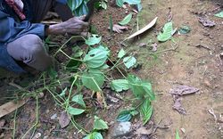
Pujita Guha s’intéresse aux manières dont les Khasi tissent leurs mondes dans la forêt
Mot(s)-clé(s):
Khasi, Khasis, forest, Zomia, pont, Tyrna, Pujita Guha, Meghalaya, ficus elastica, bamboo, Zomia Garden, Yutong Lin, Programme de résidence pour commissaires émergents
Khasi, Khasis, forest, Zomia, pont, Tyrna, Pujita Guha, Meghalaya, ficus elastica, bamboo, Zomia Garden, Yutong Lin, Programme de résidence pour commissaires émergents
Publié:
23 juin 2025
23 juin 2025
Titre:
Siej, Jri Bramon et autres plantes
Pujita Guha s’intéresse aux manières dont les Khasi tissent leurs mondes dans la forêt
Actions:
Siej, Jri Bramon et autres plantes
Pujita Guha s’intéresse aux manières dont les Khasi tissent leurs mondes dans la forêt
Actions:
Niveau de description archivistique:
Projet
Projet
Titre:
University Art Museum
University Art Museum
Numéro de référence:
AP143.S4.D65
Description:
File documents the unexecuted project for the University Art Museum, Long Beach, California. Material in this file was produced between 1986 and 1988. California State University, Long Beach (CSULB), commissioned Eisenman/Robertson Architects to design an art museum adjacent to the main campus entrance. The 67,500-square-foot building was to comprise four galleries, a black-box theater, an auditorium, a cafe, conference rooms, a library, offices, preparation spaces, and storage vaults. The project, sited on a 23-acre arboretum, included landscaping; terraced sculpture courtyards, botanical gardens, and a two-acre pond. Eisenman linked the northern and southern parts of the arboretum by an elevated public walkway through the museum. Sets of drawings were presented on 8 and 30 April, 2 June, and 5 Aug. In the first design phase Eisenman explores the cartographic figures which form the basis of his artificial excavation when superposed: a series of sketches establishes the analogical relationships which fix the relative scales of the plans and produce the superpositions; another series contextualizes the superposed figures by placing them within the museum site (DR1987:0859:087-090). The second phase concerns the building; the working model shows the building carved out of a square pit, from which spring an oil derrick and a reconstruction of a recreational pier (Rainbow Pier, 1920s) used here as circulatory bridge (DR1987:0859:160). In the third phase the architect systematizes his archeological procedure by using five significant cartographic dates - 1849, 1889, 1949, 1989, 2049 - each corresponding to a specific superposition (see DR1987:0859:274-277). In the fourth phase, Eisenman simplifies the superposition of 2049 to a few iconic colour-coded forms: ranch (green), ranch house (blue), campus site (red), and water forms (river and pond) (gold). Material for the fourth phase includes three relief models, four presentation drawings, and a model (property of the CSULB) (relief models: DR1987:0859:001-003; drawings: DR1987:0859:004-008). Eisenman "inhabits" his artifical archeology by detailed planning of interior spaces, and gives substance to the cartographic traces in a series of sketch sections, perspectives, and working models. Working models reveal how the central "canal" area gradually became the museum's access point (DR1987:0859:484-490); the museum, galleries, offices, and preparation areas are on one side of this deep cut, while the cafeteria and black-box theater are on the other. The upper level was to house offices, meeting rooms, and the library. File contains audiovisual material, conceptual drawings, design development drawings, presentation drawings, reference drawings, working drawings, photographic materials, and textual records.
AP143.S4.D65
Description:
File documents the unexecuted project for the University Art Museum, Long Beach, California. Material in this file was produced between 1986 and 1988. California State University, Long Beach (CSULB), commissioned Eisenman/Robertson Architects to design an art museum adjacent to the main campus entrance. The 67,500-square-foot building was to comprise four galleries, a black-box theater, an auditorium, a cafe, conference rooms, a library, offices, preparation spaces, and storage vaults. The project, sited on a 23-acre arboretum, included landscaping; terraced sculpture courtyards, botanical gardens, and a two-acre pond. Eisenman linked the northern and southern parts of the arboretum by an elevated public walkway through the museum. Sets of drawings were presented on 8 and 30 April, 2 June, and 5 Aug. In the first design phase Eisenman explores the cartographic figures which form the basis of his artificial excavation when superposed: a series of sketches establishes the analogical relationships which fix the relative scales of the plans and produce the superpositions; another series contextualizes the superposed figures by placing them within the museum site (DR1987:0859:087-090). The second phase concerns the building; the working model shows the building carved out of a square pit, from which spring an oil derrick and a reconstruction of a recreational pier (Rainbow Pier, 1920s) used here as circulatory bridge (DR1987:0859:160). In the third phase the architect systematizes his archeological procedure by using five significant cartographic dates - 1849, 1889, 1949, 1989, 2049 - each corresponding to a specific superposition (see DR1987:0859:274-277). In the fourth phase, Eisenman simplifies the superposition of 2049 to a few iconic colour-coded forms: ranch (green), ranch house (blue), campus site (red), and water forms (river and pond) (gold). Material for the fourth phase includes three relief models, four presentation drawings, and a model (property of the CSULB) (relief models: DR1987:0859:001-003; drawings: DR1987:0859:004-008). Eisenman "inhabits" his artifical archeology by detailed planning of interior spaces, and gives substance to the cartographic traces in a series of sketch sections, perspectives, and working models. Working models reveal how the central "canal" area gradually became the museum's access point (DR1987:0859:484-490); the museum, galleries, offices, and preparation areas are on one side of this deep cut, while the cafeteria and black-box theater are on the other. The upper level was to house offices, meeting rooms, and the library. File contains audiovisual material, conceptual drawings, design development drawings, presentation drawings, reference drawings, working drawings, photographic materials, and textual records.
Personnes et institutions:
Date:
1986-1988
1986-1988
Titre:
University Art Museum
Actions:
AP143.S4.D65
Description:
File documents the unexecuted project for the University Art Museum, Long Beach, California. Material in this file was produced between 1986 and 1988. California State University, Long Beach (CSULB), commissioned Eisenman/Robertson Architects to design an art museum adjacent to the main campus entrance. The 67,500-square-foot building was to comprise four galleries, a black-box theater, an auditorium, a cafe, conference rooms, a library, offices, preparation spaces, and storage vaults. The project, sited on a 23-acre arboretum, included landscaping; terraced sculpture courtyards, botanical gardens, and a two-acre pond. Eisenman linked the northern and southern parts of the arboretum by an elevated public walkway through the museum. Sets of drawings were presented on 8 and 30 April, 2 June, and 5 Aug. In the first design phase Eisenman explores the cartographic figures which form the basis of his artificial excavation when superposed: a series of sketches establishes the analogical relationships which fix the relative scales of the plans and produce the superpositions; another series contextualizes the superposed figures by placing them within the museum site (DR1987:0859:087-090). The second phase concerns the building; the working model shows the building carved out of a square pit, from which spring an oil derrick and a reconstruction of a recreational pier (Rainbow Pier, 1920s) used here as circulatory bridge (DR1987:0859:160). In the third phase the architect systematizes his archeological procedure by using five significant cartographic dates - 1849, 1889, 1949, 1989, 2049 - each corresponding to a specific superposition (see DR1987:0859:274-277). In the fourth phase, Eisenman simplifies the superposition of 2049 to a few iconic colour-coded forms: ranch (green), ranch house (blue), campus site (red), and water forms (river and pond) (gold). Material for the fourth phase includes three relief models, four presentation drawings, and a model (property of the CSULB) (relief models: DR1987:0859:001-003; drawings: DR1987:0859:004-008). Eisenman "inhabits" his artifical archeology by detailed planning of interior spaces, and gives substance to the cartographic traces in a series of sketch sections, perspectives, and working models. Working models reveal how the central "canal" area gradually became the museum's access point (DR1987:0859:484-490); the museum, galleries, offices, and preparation areas are on one side of this deep cut, while the cafeteria and black-box theater are on the other. The upper level was to house offices, meeting rooms, and the library. File contains audiovisual material, conceptual drawings, design development drawings, presentation drawings, reference drawings, working drawings, photographic materials, and textual records.
University Art Museum
Actions:
AP143.S4.D65
Description:
File documents the unexecuted project for the University Art Museum, Long Beach, California. Material in this file was produced between 1986 and 1988. California State University, Long Beach (CSULB), commissioned Eisenman/Robertson Architects to design an art museum adjacent to the main campus entrance. The 67,500-square-foot building was to comprise four galleries, a black-box theater, an auditorium, a cafe, conference rooms, a library, offices, preparation spaces, and storage vaults. The project, sited on a 23-acre arboretum, included landscaping; terraced sculpture courtyards, botanical gardens, and a two-acre pond. Eisenman linked the northern and southern parts of the arboretum by an elevated public walkway through the museum. Sets of drawings were presented on 8 and 30 April, 2 June, and 5 Aug. In the first design phase Eisenman explores the cartographic figures which form the basis of his artificial excavation when superposed: a series of sketches establishes the analogical relationships which fix the relative scales of the plans and produce the superpositions; another series contextualizes the superposed figures by placing them within the museum site (DR1987:0859:087-090). The second phase concerns the building; the working model shows the building carved out of a square pit, from which spring an oil derrick and a reconstruction of a recreational pier (Rainbow Pier, 1920s) used here as circulatory bridge (DR1987:0859:160). In the third phase the architect systematizes his archeological procedure by using five significant cartographic dates - 1849, 1889, 1949, 1989, 2049 - each corresponding to a specific superposition (see DR1987:0859:274-277). In the fourth phase, Eisenman simplifies the superposition of 2049 to a few iconic colour-coded forms: ranch (green), ranch house (blue), campus site (red), and water forms (river and pond) (gold). Material for the fourth phase includes three relief models, four presentation drawings, and a model (property of the CSULB) (relief models: DR1987:0859:001-003; drawings: DR1987:0859:004-008). Eisenman "inhabits" his artifical archeology by detailed planning of interior spaces, and gives substance to the cartographic traces in a series of sketch sections, perspectives, and working models. Working models reveal how the central "canal" area gradually became the museum's access point (DR1987:0859:484-490); the museum, galleries, offices, and preparation areas are on one side of this deep cut, while the cafeteria and black-box theater are on the other. The upper level was to house offices, meeting rooms, and the library. File contains audiovisual material, conceptual drawings, design development drawings, presentation drawings, reference drawings, working drawings, photographic materials, and textual records.
Niveau de description archivistique:
File 65
File 65
Date:
1986-1988
1986-1988
Personnes et institutions:


