34950 Résultats
Classification:
dessins
dessins
Numéro de référence:
AP046.S1.1983.PR02.019
Description:
This file includes aerial maps by Public Works Canada.
AP046.S1.1983.PR02.019
Description:
This file includes aerial maps by Public Works Canada.
Personnes et institutions:
Date:
ca 1980
ca 1980
Titre:
Aerial photo map, Old Port of Montreal Master Plan, Montréal, Québec
Actions:
AP046.S1.1983.PR02.019
Description:
This file includes aerial maps by Public Works Canada.
Aerial photo map, Old Port of Montreal Master Plan, Montréal, Québec
Actions:
AP046.S1.1983.PR02.019
Description:
This file includes aerial maps by Public Works Canada.
Classification:
dessins
dessins
Date:
ca 1980
ca 1980
Personnes et institutions:
Classification:
dessins
dessins
Numéro de référence:
DR2012:0012:046:024
Description:
Includes an elevation and a planimetric map produced by the Ministère des Affaires Municipales et de la Métropole, Sherbrooke, Québec. The elevation is titled "Coupe-Place Publique, Programme de Renouveau Urbain, Restauration du Secteur Frontenac - Plan Concept d'Aménagement".
Personnes et institutions:
Date:
2002
2002
Titre:
Elevation and a planimetric map, Place des Moulins, Esplanade Frontenac, Sherbrooke, Québec
Actions:
DR2012:0012:046:024
Description:
Includes an elevation and a planimetric map produced by the Ministère des Affaires Municipales et de la Métropole, Sherbrooke, Québec. The elevation is titled "Coupe-Place Publique, Programme de Renouveau Urbain, Restauration du Secteur Frontenac - Plan Concept d'Aménagement".
Classification:
dessins
dessins
Date:
2002
2002
Personnes et institutions:
Classification:
dessins
dessins
Numéro de référence:
ARCH259914
Description:
City of Vanier (Ontario) - land use plan, zone map, roads plan, residental development plan, urban renwal plan (Official Plans of the Vanier Planning Area)
ARCH259914
Description:
City of Vanier (Ontario) - land use plan, zone map, roads plan, residental development plan, urban renwal plan (Official Plans of the Vanier Planning Area)
Personnes et institutions:
Date:
1973
1973
Titre:
Reference land use plan, and zone map for the City of Vanier, in Ontario
Actions:
ARCH259914
Description:
City of Vanier (Ontario) - land use plan, zone map, roads plan, residental development plan, urban renwal plan (Official Plans of the Vanier Planning Area)
Reference land use plan, and zone map for the City of Vanier, in Ontario
Actions:
ARCH259914
Description:
City of Vanier (Ontario) - land use plan, zone map, roads plan, residental development plan, urban renwal plan (Official Plans of the Vanier Planning Area)
Classification:
dessins
dessins
Date:
1973
1973
Personnes et institutions:
Classification:
dessins
dessins
Numéro de référence:
ARCH261763
Description:
4 reprographic copies and an original map " Taseko Lakes, British Columbia
ARCH261763
Description:
4 reprographic copies and an original map " Taseko Lakes, British Columbia
Personnes et institutions:
Date:
circa 1950-2002
circa 1950-2002
Titre:
Perspective sketches and a map of Taseko Lakes in British Columbia for an unidentified project
Actions:
ARCH261763
Description:
4 reprographic copies and an original map " Taseko Lakes, British Columbia
Perspective sketches and a map of Taseko Lakes in British Columbia for an unidentified project
Actions:
ARCH261763
Description:
4 reprographic copies and an original map " Taseko Lakes, British Columbia
Classification:
dessins
dessins
Date:
circa 1950-2002
circa 1950-2002
Personnes et institutions:
Classification:
photographies
photographies
Numéro de référence:
DR2004:0324
DR2004:0324
Personnes et institutions:
Classification:
photographies
photographies
Personnes et institutions:
Classification:
dessins
dessins
Numéro de référence:
ARCH268335
ARCH268335
Personnes et institutions:
Date:
ca. 1989
ca. 1989
Classification:
dessins
dessins
Date:
ca. 1989
ca. 1989
Personnes et institutions:
Classification:
livres
livres
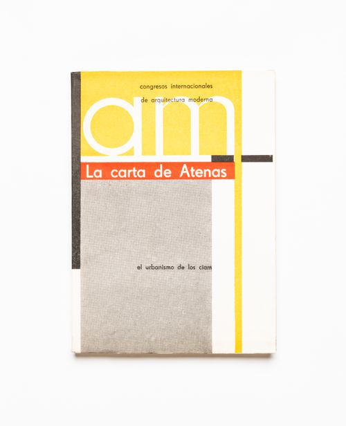
Numéro de référence:
ARCH288371
ARCH288371
Personnes et institutions:
Date:
1957
1957
Classification:
livres
livres
Date:
1957
1957
Personnes et institutions:
Classification:
dessins
dessins

Numéro de référence:
DR1995:0255:090
DR1995:0255:090
Personnes et institutions:
Date:
between 1971 and 1974?
between 1971 and 1974?
Classification:
dessins
dessins
Date:
between 1971 and 1974?
between 1971 and 1974?
Personnes et institutions:
Classification:
dessins
dessins

Numéro de référence:
DR1995:0255:093
DR1995:0255:093
Personnes et institutions:
Date:
October 1972 or later
October 1972 or later
Titre:
Two Tree Island project (England): schematic map showing activity availability
Actions:
DR1995:0255:093
Two Tree Island project (England): schematic map showing activity availability
Actions:
DR1995:0255:093
Classification:
dessins
dessins
Date:
October 1972 or later
October 1972 or later
Personnes et institutions:
Classification:
documents textuels
documents textuels
Numéro de référence:
DR1999:0516
DR1999:0516
Personnes et institutions:
Classification:
documents textuels
documents textuels
Personnes et institutions: