


1446 Résultats
Niveau de description archivistique:
Projet
Projet
Numéro de référence:
AP022.S1.1992.PR10
Description:
File documents a master plan for an educational complex consisting of academic, social, administrative and residential buildings, New Territories, Hong Kong. File contains design development drawings.
AP022.S1.1992.PR10
Description:
File documents a master plan for an educational complex consisting of academic, social, administrative and residential buildings, New Territories, Hong Kong. File contains design development drawings.
Personnes et institutions:
Date:
1992
1992
Titre:
Hong Kong Institute of Education
Actions:
AP022.S1.1992.PR10
Description:
File documents a master plan for an educational complex consisting of academic, social, administrative and residential buildings, New Territories, Hong Kong. File contains design development drawings.
Hong Kong Institute of Education
Actions:
AP022.S1.1992.PR10
Description:
File documents a master plan for an educational complex consisting of academic, social, administrative and residential buildings, New Territories, Hong Kong. File contains design development drawings.
Niveau de description archivistique:
Project
Project
Date:
1992
1992
Personnes et institutions:
Classification:
articles
articles
Sony Devabhaktuni analyse l’image stillmoving
Dossier:
Figurer un territoire
Figurer un territoire
Publié:
16 janvier 2023
16 janvier 2023
Titre:
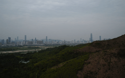
Hong Kong / l’ouverture de l’espace et le film à plan fixe
Sony Devabhaktuni analyse l’image stillmoving
Actions:
Hong Kong / l’ouverture de l’espace et le film à plan fixe
Sony Devabhaktuni analyse l’image stillmoving
Actions:
Classification:
articles
articles
Publié:
16 janvier 2023
16 janvier 2023
Dossier:
Figurer un territoire
Figurer un territoire
Classification:
articles
articles

Sebastián López Cardozo sur les fixations territoriales du capital. Illustrations by de Cécile Ngọc Sương Perdu
Dossier:
Figurer un territoire
Figurer un territoire
Mot(s)-clé(s):
Figurer le territoire, capital, capitalisme, argent, dématérialisation, formes d'argent
Figurer le territoire, capital, capitalisme, argent, dématérialisation, formes d'argent
Publié:
31 octobre 2022
31 octobre 2022
Titre:
Le capital en mouvement et la reproduction de l'empire
Sebastián López Cardozo sur les fixations territoriales du capital. Illustrations by de Cécile Ngọc Sương Perdu
Actions:
Le capital en mouvement et la reproduction de l'empire
Sebastián López Cardozo sur les fixations territoriales du capital. Illustrations by de Cécile Ngọc Sương Perdu
Actions:
Classification:
articles
articles
Publié:
31 octobre 2022
31 octobre 2022
Dossier:
Figurer un territoire
Figurer un territoire
Classification:
photographies
Quantité:
6 photographic material(s)
photographies
Quantité:
6 photographic material(s)
Numéro de référence:
ARCH267248
Description:
This group consists of photographs of the model and site plans for the riverfront planning project in Longueuil, Québec. There is also a photograph of an etching that represents a scene on the St. Lawrence River and a map of the occupied territory in the area of Longueuil and Montréal.
ARCH267248
Description:
This group consists of photographs of the model and site plans for the riverfront planning project in Longueuil, Québec. There is also a photograph of an etching that represents a scene on the St. Lawrence River and a map of the occupied territory in the area of Longueuil and Montréal.
Personnes et institutions:
Titre:
Photographs of the model and site plans for the riverfront planning project in Longueuil
Actions:
ARCH267248
Description:
This group consists of photographs of the model and site plans for the riverfront planning project in Longueuil, Québec. There is also a photograph of an etching that represents a scene on the St. Lawrence River and a map of the occupied territory in the area of Longueuil and Montréal.
Photographs of the model and site plans for the riverfront planning project in Longueuil
Actions:
ARCH267248
Description:
This group consists of photographs of the model and site plans for the riverfront planning project in Longueuil, Québec. There is also a photograph of an etching that represents a scene on the St. Lawrence River and a map of the occupied territory in the area of Longueuil and Montréal.
Classification:
photographies
Quantité:
6 photographic material(s)
photographies
Quantité:
6 photographic material(s)
Personnes et institutions:
Classification:
articles
articles
Titre:
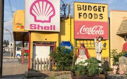
Promesses ou inquiétudes
Promesses ou inquiétudes
Actions:
Cinq notes de terrain le long des routes canadiennes
Dossier:
Figurer un territoire
Figurer un territoire
Publié:
20 mars 2023
20 mars 2023
Dossier:
Figurer un territoire
Figurer un territoire
Niveau de description archivistique:
Projet
Projet
Numéro de référence:
AP207.S1.1989.PR02
Description:
The project series documents "Mappe Recinti Itinerari Territori", a rug made of eleven small tapestries hand-woven together. Pettena designed this rug for a special production for "Megalopoli" in 1989. Each of the tapestries represent four subjects: itineraries, territories, maps and enclosures. These subjects "are the means required for the definition of space inside or outside those “magic circles” that are the walls of a city, the beginning of a construction, as the rituals that are performed inside any enclosure take on a unique quality and role, different from whatever lies beyond this boundary." [1] The project series contains a reference photograph and photo montages of the eleven small tapestries forming the rug. Source: [1] Gianni Pettena website, https://www.giannipettena.it/italiano/opere-1/design-itineraries-territories-1989/ (last accessed 11 December 2019).
AP207.S1.1989.PR02
Description:
The project series documents "Mappe Recinti Itinerari Territori", a rug made of eleven small tapestries hand-woven together. Pettena designed this rug for a special production for "Megalopoli" in 1989. Each of the tapestries represent four subjects: itineraries, territories, maps and enclosures. These subjects "are the means required for the definition of space inside or outside those “magic circles” that are the walls of a city, the beginning of a construction, as the rituals that are performed inside any enclosure take on a unique quality and role, different from whatever lies beyond this boundary." [1] The project series contains a reference photograph and photo montages of the eleven small tapestries forming the rug. Source: [1] Gianni Pettena website, https://www.giannipettena.it/italiano/opere-1/design-itineraries-territories-1989/ (last accessed 11 December 2019).
Personnes et institutions:
Date:
circa 1989-2015
circa 1989-2015
Titre:
Mappe Recinti Itinerari Territori [Itineraires Territoires Maps Enclosures] (1989)
Actions:
AP207.S1.1989.PR02
Description:
The project series documents "Mappe Recinti Itinerari Territori", a rug made of eleven small tapestries hand-woven together. Pettena designed this rug for a special production for "Megalopoli" in 1989. Each of the tapestries represent four subjects: itineraries, territories, maps and enclosures. These subjects "are the means required for the definition of space inside or outside those “magic circles” that are the walls of a city, the beginning of a construction, as the rituals that are performed inside any enclosure take on a unique quality and role, different from whatever lies beyond this boundary." [1] The project series contains a reference photograph and photo montages of the eleven small tapestries forming the rug. Source: [1] Gianni Pettena website, https://www.giannipettena.it/italiano/opere-1/design-itineraries-territories-1989/ (last accessed 11 December 2019).
Mappe Recinti Itinerari Territori [Itineraires Territoires Maps Enclosures] (1989)
Actions:
AP207.S1.1989.PR02
Description:
The project series documents "Mappe Recinti Itinerari Territori", a rug made of eleven small tapestries hand-woven together. Pettena designed this rug for a special production for "Megalopoli" in 1989. Each of the tapestries represent four subjects: itineraries, territories, maps and enclosures. These subjects "are the means required for the definition of space inside or outside those “magic circles” that are the walls of a city, the beginning of a construction, as the rituals that are performed inside any enclosure take on a unique quality and role, different from whatever lies beyond this boundary." [1] The project series contains a reference photograph and photo montages of the eleven small tapestries forming the rug. Source: [1] Gianni Pettena website, https://www.giannipettena.it/italiano/opere-1/design-itineraries-territories-1989/ (last accessed 11 December 2019).
Niveau de description archivistique:
Project
Project
Date:
circa 1989-2015
circa 1989-2015
Personnes et institutions:
Niveau de description archivistique:
Projet
Projet
Numéro de référence:
AP178.S1.1983.PR08
Description:
This project series documents the Plano de Expansão da Cidade de Macau (Areia P. e Porto E.) in Macau, China. While the records were held in the office’s archives this project was assigned the number 16/80. The office assigned the date 1982 to this project. Macau is a Chinese-Portuguese peninsula near the Pear River Delta on the south coast of China. After 1950, the speedy industrial growth caused massive waves of immigration and created housing problems. Macau's governement wanted to reorganize the urban landscape in order to readapt the territory to the economic and political realities. Siza was hired by the P&T Group as part of a team of specialist-consultants to rethink the districts of Areia Preta and Porto Exterior. A first proposal was submitted in 1984. The proposed plans were accepted by the authorities years later, but never realized due to the construction of hotels and casinos instead of housing. Documenting this project are studies, plans and project site plans. Textual materials include project documentation and correspondence. Photographic materials document the models and project site. These materials date from 1981-2012.
AP178.S1.1983.PR08
Description:
This project series documents the Plano de Expansão da Cidade de Macau (Areia P. e Porto E.) in Macau, China. While the records were held in the office’s archives this project was assigned the number 16/80. The office assigned the date 1982 to this project. Macau is a Chinese-Portuguese peninsula near the Pear River Delta on the south coast of China. After 1950, the speedy industrial growth caused massive waves of immigration and created housing problems. Macau's governement wanted to reorganize the urban landscape in order to readapt the territory to the economic and political realities. Siza was hired by the P&T Group as part of a team of specialist-consultants to rethink the districts of Areia Preta and Porto Exterior. A first proposal was submitted in 1984. The proposed plans were accepted by the authorities years later, but never realized due to the construction of hotels and casinos instead of housing. Documenting this project are studies, plans and project site plans. Textual materials include project documentation and correspondence. Photographic materials document the models and project site. These materials date from 1981-2012.
Personnes et institutions:
Date:
1981-2012
1981-2012
Titre:
Plano de Expansão da Cidade de Macau (Areia P. e Porto E.) [Macau City expansion plan], Macau, China (1982)
Actions:
AP178.S1.1983.PR08
Description:
This project series documents the Plano de Expansão da Cidade de Macau (Areia P. e Porto E.) in Macau, China. While the records were held in the office’s archives this project was assigned the number 16/80. The office assigned the date 1982 to this project. Macau is a Chinese-Portuguese peninsula near the Pear River Delta on the south coast of China. After 1950, the speedy industrial growth caused massive waves of immigration and created housing problems. Macau's governement wanted to reorganize the urban landscape in order to readapt the territory to the economic and political realities. Siza was hired by the P&T Group as part of a team of specialist-consultants to rethink the districts of Areia Preta and Porto Exterior. A first proposal was submitted in 1984. The proposed plans were accepted by the authorities years later, but never realized due to the construction of hotels and casinos instead of housing. Documenting this project are studies, plans and project site plans. Textual materials include project documentation and correspondence. Photographic materials document the models and project site. These materials date from 1981-2012.
Plano de Expansão da Cidade de Macau (Areia P. e Porto E.) [Macau City expansion plan], Macau, China (1982)
Actions:
AP178.S1.1983.PR08
Description:
This project series documents the Plano de Expansão da Cidade de Macau (Areia P. e Porto E.) in Macau, China. While the records were held in the office’s archives this project was assigned the number 16/80. The office assigned the date 1982 to this project. Macau is a Chinese-Portuguese peninsula near the Pear River Delta on the south coast of China. After 1950, the speedy industrial growth caused massive waves of immigration and created housing problems. Macau's governement wanted to reorganize the urban landscape in order to readapt the territory to the economic and political realities. Siza was hired by the P&T Group as part of a team of specialist-consultants to rethink the districts of Areia Preta and Porto Exterior. A first proposal was submitted in 1984. The proposed plans were accepted by the authorities years later, but never realized due to the construction of hotels and casinos instead of housing. Documenting this project are studies, plans and project site plans. Textual materials include project documentation and correspondence. Photographic materials document the models and project site. These materials date from 1981-2012.
Niveau de description archivistique:
Project
Project
Date:
1981-2012
1981-2012
Personnes et institutions:
Classification:
expositions
expositions
Titre:
Avec la forêt
Avec la forêt
Actions:
Description:
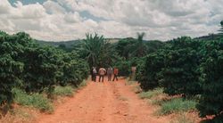
Avec la forêt suit l’architecte Carla Juaçaba dans son projet de développement d’un musée en solidarité avec Flor de Café, un collectif de petits agriculteurs du Minas Gerais. Inspirée par la temporalité des structures collectives autochtones et la forme des panneaux autoroutiers qui ponctuent le vaste paysage rural de la région, Juaçaba propose un point de repère sur une(...)
Avec la forêt suit l’architecte Carla Juaçaba dans son projet de développement d’un musée en solidarité avec Flor de Café, un collectif de petits agriculteurs du Minas Gerais. Inspirée par la temporalité des structures collectives autochtones et la forme des panneaux autoroutiers qui ponctuent le vaste paysage rural de la région, Juaçaba propose un point de repère sur une(...)
Localisation:
Salles principales Mot(s)-clé(s):
Brésil, Carla Juacaba, Sur le terrain, café, Nepomuceno, Minas Gerais, Irene Chin, Francesco Garutti, Joshua Frank
Salles principales Mot(s)-clé(s):
Brésil, Carla Juacaba, Sur le terrain, café, Nepomuceno, Minas Gerais, Irene Chin, Francesco Garutti, Joshua Frank
Date:
19 juin 2025 au 12 octobre 2025
19 juin 2025 au 12 octobre 2025
Titre:
Avec la forêt
Actions:
Description:
Avec la forêt suit l’architecte Carla Juaçaba dans son projet de développement d’un musée en solidarité avec Flor de Café, un collectif de petits agriculteurs du Minas Gerais. Inspirée par la temporalité des structures collectives autochtones et la forme des panneaux autoroutiers qui ponctuent le vaste paysage rural de la région, Juaçaba propose un point de repère sur une(...)
Avec la forêt
Actions:
Description:
Avec la forêt suit l’architecte Carla Juaçaba dans son projet de développement d’un musée en solidarité avec Flor de Café, un collectif de petits agriculteurs du Minas Gerais. Inspirée par la temporalité des structures collectives autochtones et la forme des panneaux autoroutiers qui ponctuent le vaste paysage rural de la région, Juaçaba propose un point de repère sur une(...)
Classification:
expositions
expositions
Date:
19 juin 2025 au
12 octobre 2025
19 juin 2025 au
12 octobre 2025
Localisation:
Salles principales Mot(s)-clé(s):
Brésil, Carla Juacaba, Sur le terrain, café, Nepomuceno, Minas Gerais, Irene Chin, Francesco Garutti, Joshua Frank
Salles principales Mot(s)-clé(s):
Brésil, Carla Juacaba, Sur le terrain, café, Nepomuceno, Minas Gerais, Irene Chin, Francesco Garutti, Joshua Frank
Classification:
événements
événements
Actions:
Description:
Un atelier pratique animé par Bellingcat propose une introduction aux méthodes d’enquête en sources ouvertes. Ces méthodes mobilisent des images satellites, des cartes, des photographies, des vidéos et des métadonnées pour examiner la manière dont les territoires sont transformés, représentés et contestés à partir de documents accessibles au public.
Un atelier pratique animé par Bellingcat propose une introduction aux méthodes d’enquête en sources ouvertes. Ces méthodes mobilisent des images satellites, des cartes, des photographies, des vidéos et des métadonnées pour examiner la manière dont les territoires sont transformés, représentés et contestés à partir de documents accessibles au public.
Localisation:
Maison Shaughnessy
Maison Shaughnessy
Date:
28 novembre 2026, 13h à 16h
28 novembre 2026, 13h à 16h
Titre:
La distance entre nous et le sol : prendre la mesure
Actions:
Description:
Un atelier pratique animé par Bellingcat propose une introduction aux méthodes d’enquête en sources ouvertes. Ces méthodes mobilisent des images satellites, des cartes, des photographies, des vidéos et des métadonnées pour examiner la manière dont les territoires sont transformés, représentés et contestés à partir de documents accessibles au public.
La distance entre nous et le sol : prendre la mesure
Actions:
Description:
Un atelier pratique animé par Bellingcat propose une introduction aux méthodes d’enquête en sources ouvertes. Ces méthodes mobilisent des images satellites, des cartes, des photographies, des vidéos et des métadonnées pour examiner la manière dont les territoires sont transformés, représentés et contestés à partir de documents accessibles au public.
Classification:
événements
événements
Date:
28 novembre 2026
13h à 16h
28 novembre 2026
13h à 16h
Localisation:
Maison Shaughnessy
Maison Shaughnessy
Classification:
événements
événements
Actions:
Description:
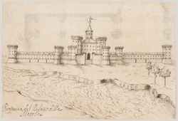
Architecte et ingénieur en hydraulique, Luca Danese est actif dans le nord-est de l’Italie durant la première moitié du XVIIe siècle. Sa carrière, bien qu’ancrée dans la géographie particulière du delta du Pô, sera influencée et façonnée par l’hydropolitique plus large du gouvernement papal, occupé à transformer l’infrastructure hydraulique de Rome. C’est aussi l’époque(...)
Architecte et ingénieur en hydraulique, Luca Danese est actif dans le nord-est de l’Italie durant la première moitié du XVIIe siècle. Sa carrière, bien qu’ancrée dans la géographie particulière du delta du Pô, sera influencée et façonnée par l’hydropolitique plus large du gouvernement papal, occupé à transformer l’infrastructure hydraulique de Rome. C’est aussi l’époque(...)
Localisation:
Salle d'étude Mot(s)-clé(s):
chercheur en résidence 2023, séminaire, recherche, Andrea Bagnato, Luca Danese, Italie, XVIIe siècle, hydropolitique, eau
Salle d'étude Mot(s)-clé(s):
chercheur en résidence 2023, séminaire, recherche, Andrea Bagnato, Luca Danese, Italie, XVIIe siècle, hydropolitique, eau
Date:
6 juillet, 18 h
6 juillet, 18 h
Titre:
Séminaire de chercheur en résidence : Andrea Bagnato
Actions:
Description:
Architecte et ingénieur en hydraulique, Luca Danese est actif dans le nord-est de l’Italie durant la première moitié du XVIIe siècle. Sa carrière, bien qu’ancrée dans la géographie particulière du delta du Pô, sera influencée et façonnée par l’hydropolitique plus large du gouvernement papal, occupé à transformer l’infrastructure hydraulique de Rome. C’est aussi l’époque(...)
Séminaire de chercheur en résidence : Andrea Bagnato
Actions:
Description:
Architecte et ingénieur en hydraulique, Luca Danese est actif dans le nord-est de l’Italie durant la première moitié du XVIIe siècle. Sa carrière, bien qu’ancrée dans la géographie particulière du delta du Pô, sera influencée et façonnée par l’hydropolitique plus large du gouvernement papal, occupé à transformer l’infrastructure hydraulique de Rome. C’est aussi l’époque(...)
Classification:
événements
événements
Date:
6 juillet
18 h
6 juillet
18 h
Localisation:
Salle d'étude Mot(s)-clé(s):
chercheur en résidence 2023, séminaire, recherche, Andrea Bagnato, Luca Danese, Italie, XVIIe siècle, hydropolitique, eau
Salle d'étude Mot(s)-clé(s):
chercheur en résidence 2023, séminaire, recherche, Andrea Bagnato, Luca Danese, Italie, XVIIe siècle, hydropolitique, eau


