


On Phantom Islands and Unknown Lands
A cartographic history by Victoria Addona
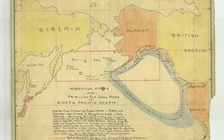
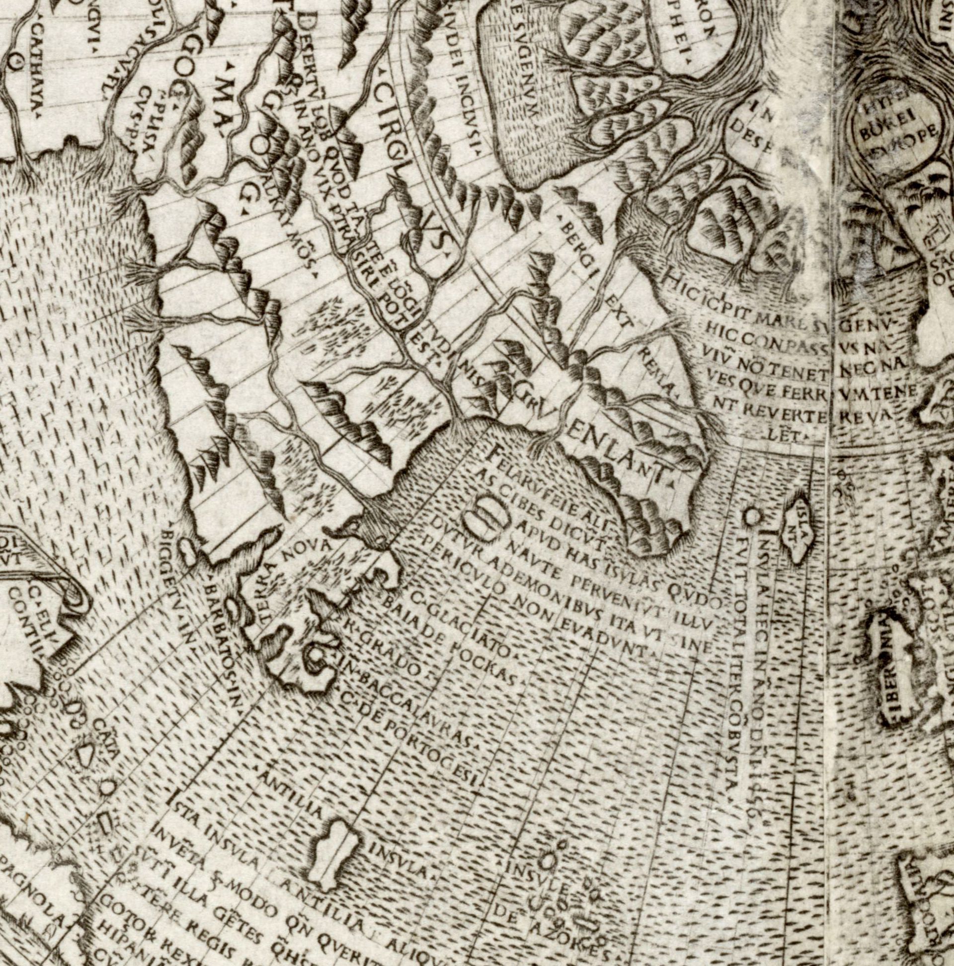
Giacomo Gastaldi, Nuova Francia [New France], in Terzo volvme delle navigationi et viaggi raccolto gia da M. Gio. Battista Ramvsio [Third volume of the navigations and voyages assembled by M. Gio. Battista Ramusio] (Venice: Giunti, 1556). Hand-coloured woodcut, 26.9 x 36.4 cm. G 3435 1556 R3 c.2 MAP, Centre for Newfoundland Studies, Memorial University of Newfoundland.
Around the beginning of the sixteenth century, an island with a foreboding name first appeared on European world maps near the coasts of Newfoundland and Labrador: the Isle of Demons, named for the evil spirits said to occupy its shores. The cartographic appearance of a new territory was not in itself a remarkable phenomenon. Early modern European cartographers continuously revised the locations of known and recently discovered lands based on explorers’ reports and more precise methods of navigation.1 But the Isle of Demons joined a group of less measurable territories known as “phantom islands,” which were mapped as real landmasses despite the absence of material evidence they existed. Instead, it was myths and superstitions, mariners’ tales, local legends, mirages, exaggerations, lies, and mistaken coordinates that gave shape to the contours of these indeterminate spaces. They were given names such as Antillia, a group of islands west of Portugal and Spain apparently settled by Christian bishops who had fled the Umayyad conquest of Hispania in 747; the Isola des Santanazes, directly north of Antillia, also thought to be occupied by demons; and Hy-Brasil, an island near Ireland, shrouded by mist and visible only once every seven years.2 Phantom islands appeared and disappeared from maps as explorers dismissed their existence, or legends faded from a collective imaginary. Yet as cartographic features that transformed anecdote into fact, they challenge a widespread tendency to understand cartography as an abstract, objective, and fixed picture of the world. In so doing, they emphasize the power and politics of storytelling in the cultural conception of global territory.3
-
See, for example, early controversies regarding the correct location of the Americas: Toby Lester, “The Waldseemüller Map: Charting the New World,” Smithsonian Magazine, December 2009. https://www.smithsonianmag.com/history/the-waldseemuller-map-charting-the-new-world-148815355/. ↩
-
Donald S. Johnson, Phantom Islands of the Atlantic: The Legends of Seven Lands That Never Were (London: Souvenir Press, 1997), 131–163. ↩
-
On more general connections between islands and the imagination, see Ricardo Padrón, “Mapping Imaginary Worlds,” in Maps: Finding Our Place in the World, eds. James Akerman and Robert Karrow (Chicago: Chicago University Press, 2007), 255–287. ↩
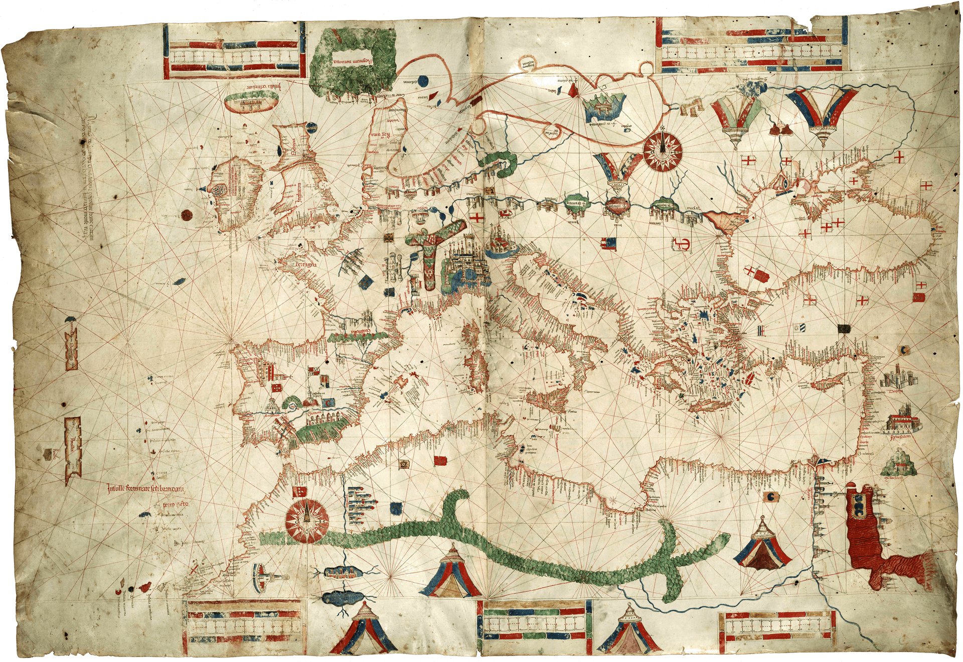
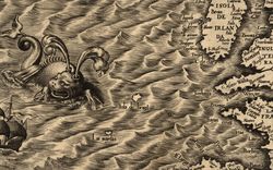
Albino de Canepa, Portolan Chart, 1489. Hand-coloured parchment, 80 x 120 cm. Bell 1489 mCa, James Ford Bell Library, University of Minnesota.

Detail of Antillia (below) and Isola de Satanazes (above).
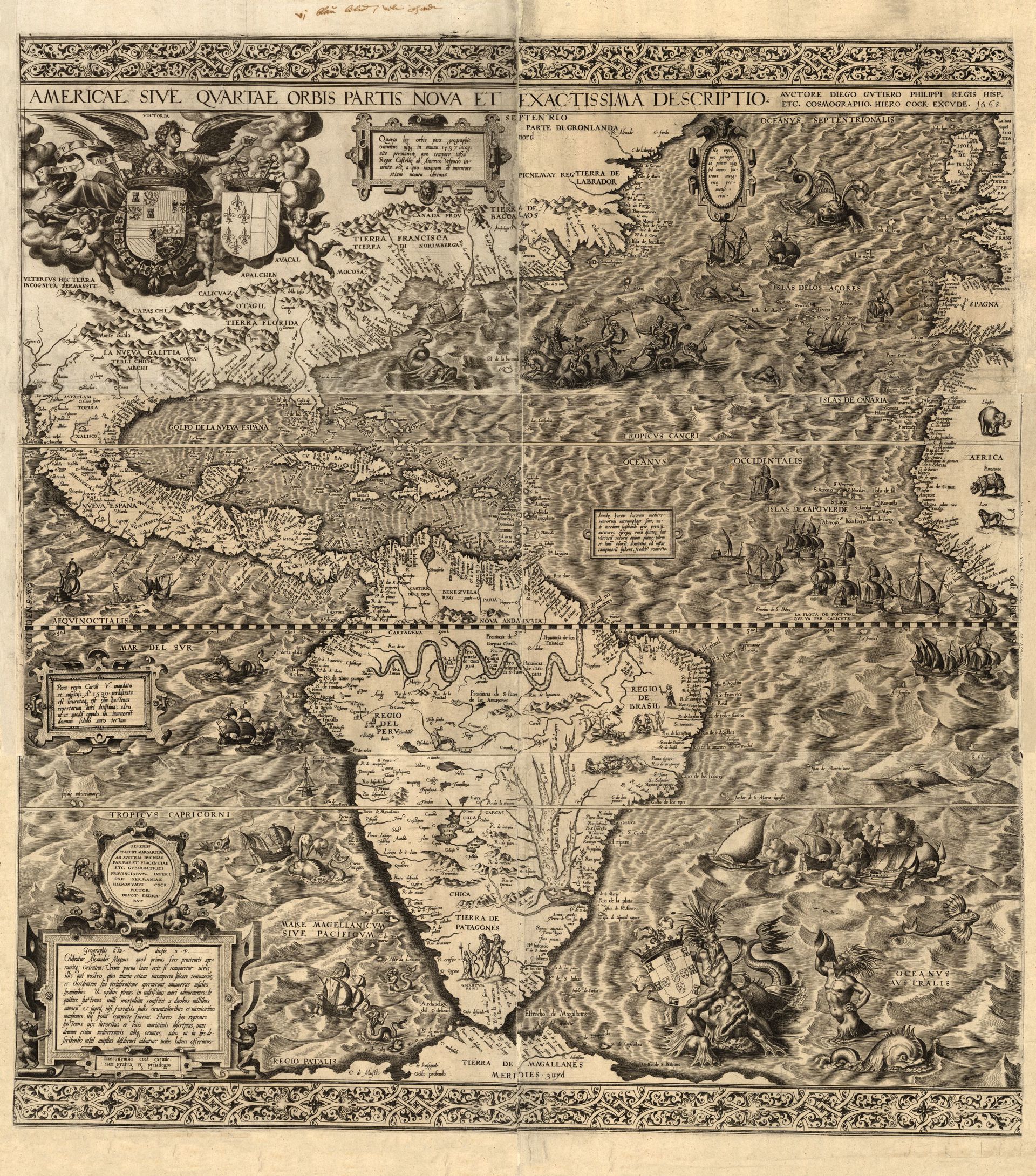
Hieronymous Cock (printmaker) and Diego Gutiérrez (cartographer), America sive qvartae orbis partis nova et exactissima descriptio (Antwerp, 1592). Engraving, 83 x 86 cm. G3290 1562.G7, Rosenwald Collection, Library of Congress, Geography and Map Division.
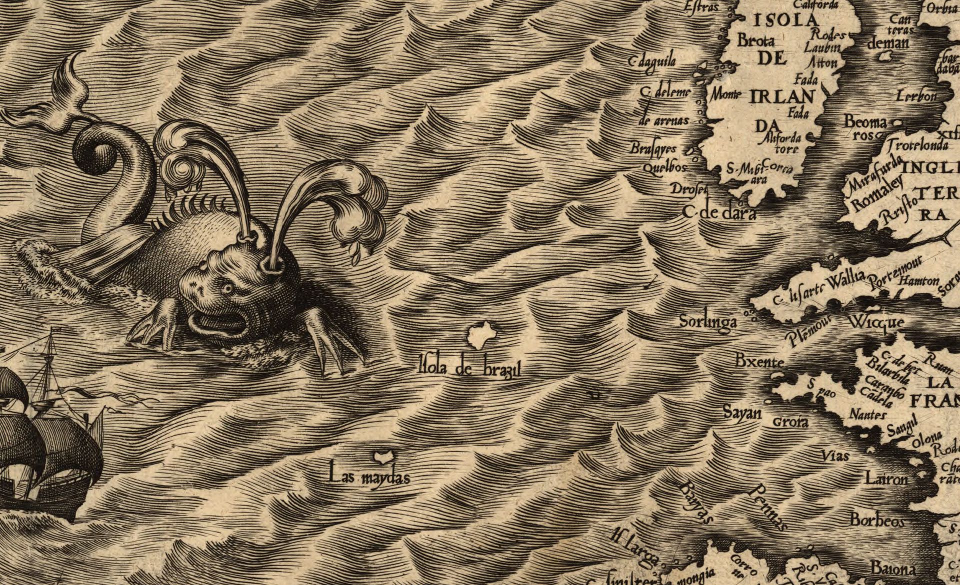
Detail of Isola de Brasil.
Isle of Demons
The Isle of Demons surfaced in whispers before it materialized as a distinct cartographic body. As French explorers and colonists began to cross the Atlantic Ocean and enter the Gulf of St. Lawrence with greater frequency from the early sixteenth century, they shared reports of eerie wails that haunted a passage near the Hamilton Inlet. According to the Franciscan friar André Thevet, who claimed to have located and visited the island in 1553, “they heard in the air, as if on the crow’s nest or masts of their vessels, these human voices making a great noise, without their being able to discern intelligible words, only such a murmur as you hear on market-day in the middle of a public market, whereupon they well knew that the Isle of Demons was not far off.”1 Misinterpreting the mating calls of local gannets and pelagic birds, European explorers would have accepted such garbled sounds, long associated with the demonic and the occult, as confirming the assumptions many held about the New World: that they had arrived, in fact, at the edges of civilization.
-
André Thevet, La cosmographie universelle (Paris, 1575), translated in Mary Baine Campbell, Wonder and Science: Imagining Worlds in early Modern Europe (Ithaca: Cornell University Press, 1999), 35. ↩
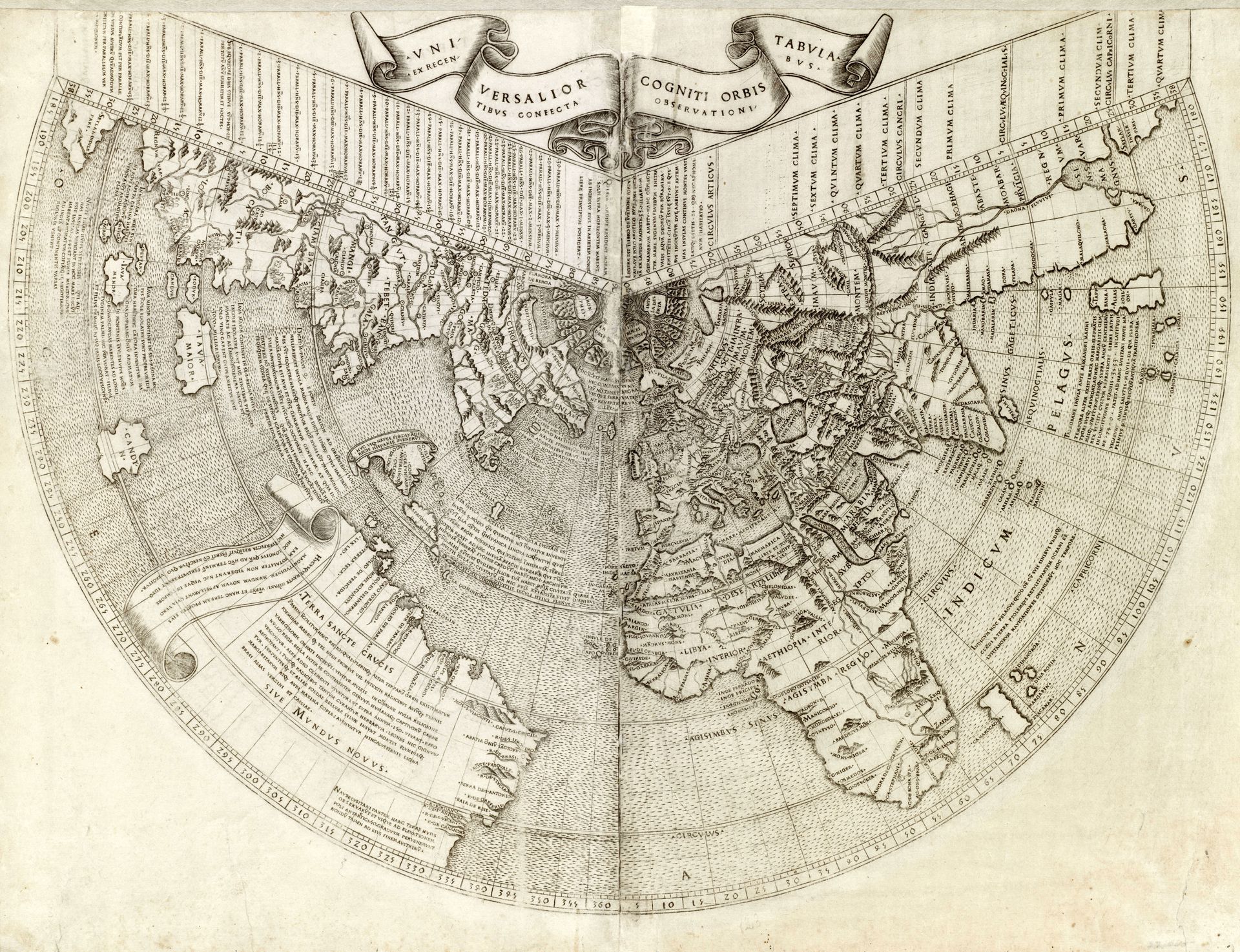
Johann Ruysch, Univrsalior cogniti orbis tabula ex recentibus confecta observationibus (Romeo: Bernardinus Venetus de Vitalibus, 1508). Woodcut, 41 x 54 cm. 05_01_00021, Mapping Boston Collection, Norman B. Leventhal Map & Education Center, Boston Public Library.
Detail of island off the coast of Newfoundland.
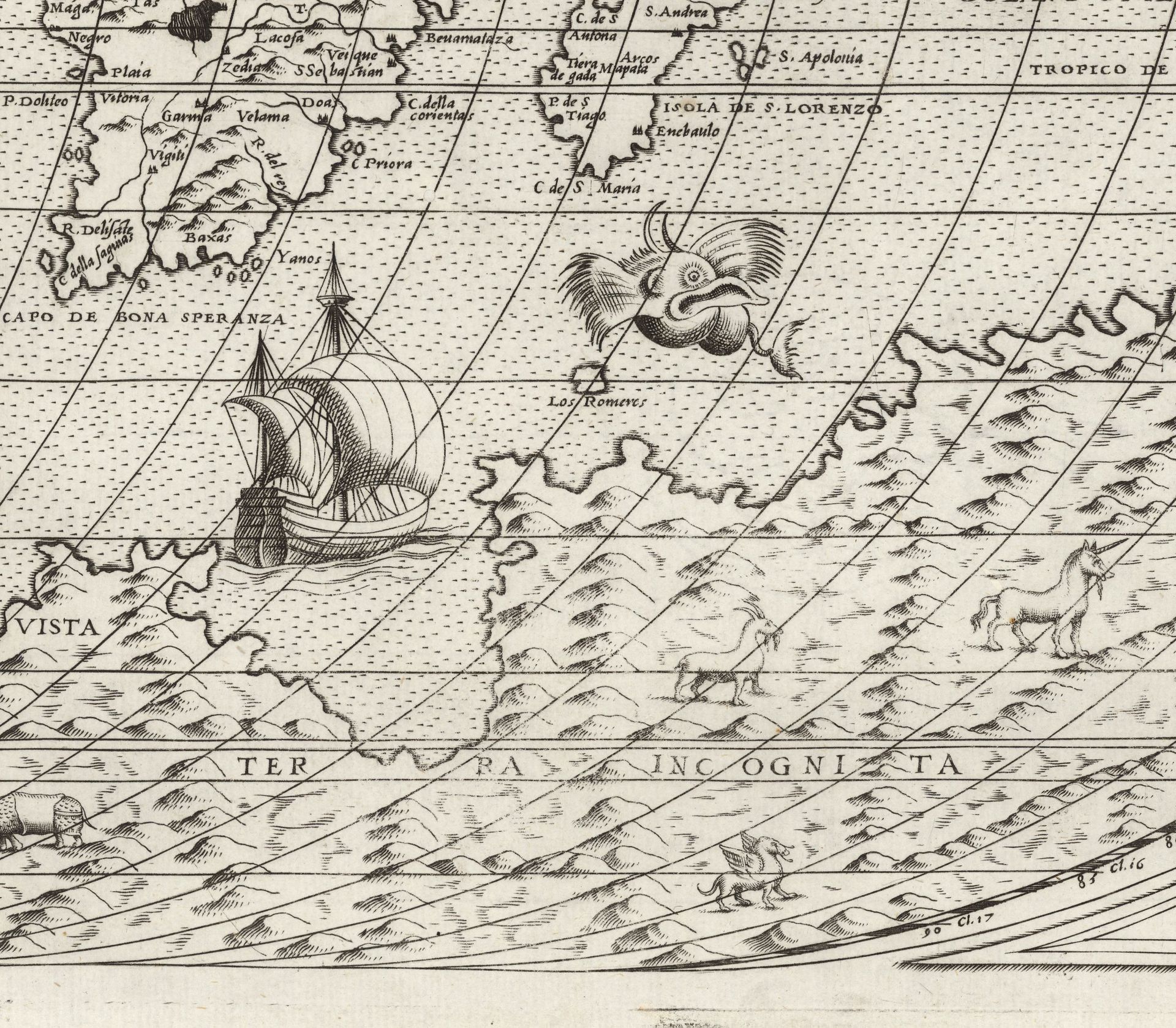
The reputation of the island as an infernal place to be avoided at all costs quickly shaped its imaging. On Johann Ruysch’s 1508 world map, the first to represent Canada, a warning accompanies the depiction of a small, unnamed island adjacent to Newfoundland: “Demons assaulted ships near these islands, which were avoided, but not without peril.”1 Giacomo Gastaldi’s 1556 map of Nuova Francia (New France) is the most imaginative cartographic interpretation of the Isle of Demons. The map features a closely cropped representation of New France and Newfoundland. By compressing the actual distance between the mainland shore and maritime islets, Gastaldi enhances an impression of a productive settlement, countering the European perception of Canada as a frigid and inhospitable place. Instead, a fiction unfolds within his interpretation of European colonization, as Indigenous contacts teach settlers to hunt and kayak within a lush landscape of boreal forests and fertile rivers. A short distance away, the Isle of Demons figures as a threat to these adjacent scenes of colonial harmony. Its titular demons dance at the edge of an island located between Newfoundland and Labrador. At its other end, a figure hunts an enormous bird, perhaps a reference to the island’s most famous resident, a French woman named Marguerite de la Rocque. She had accompanied her uncle on a colonizing mission to New France sponsored by then King of France Francis I, only for him to banish her to the Isle of Demons after discovering her passionate indiscretion with an officer. Marguerite survived for two years and five months, killing monsters and staving off demons with her rifle and Bible, before she was rescued by fisherman and returned to France.2
It is difficult to measure the blurred edges of fact and fiction on Gastaldi’s map. Tales of female vice and fortitude overlap with claims of colonial peace and the bounties of the Americas. Stories, rather than coordinates, define the territory of Gastaldi’s New France.
Mapping Unknowns
Today, early modern cartography exemplifies the origin point of an ongoing effort to consolidate and rationalize geographical knowledge. In order to improve methods of navigation, fifteenth-century geographers returned to a Ptolemaic cartographic tradition, which used latitude and longitude to map spatial locations. The linear matrices produced by geometric projections abstracted the world into measurable units. By the time Gerardus Mercator developed his famous world map in 1569, which distorted latitude at the poles to allow for curved rhumb lines to be plotted as straight lines, consumers of maps had begun to consider them as objective images of the world. Despite distortions to the size and shape of continents, Mercator’s projection appeared so visually accurate that it remains pervasive—and controversial—as the singular image of the globe.1
-
On the Mercator projection as “an icon of Western imperialism,” see Mark Monmonier, Rhumb Lines and Map Wars: A Social History of the Mercator Projection (Chicago: University of Chicago Press, 2010). ↩
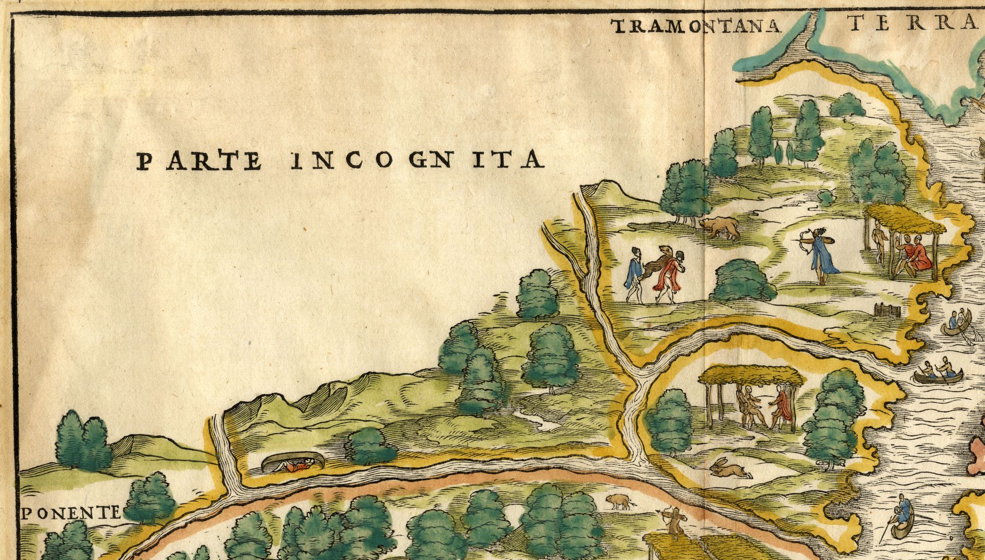
Detail of the Parte Incognita, in Gastaldi, Nuova Francia, 1556.
Cartographers often turned to more imaginative strategies to make sense of the unknown parts of the world. Terra incognita, or unknown lands, emblematized both the limitations of geographical knowledge and the promise of future expansion. They highlighted many of the epistemological uncertainties that troubled early modern European explorers: namely, how to bridge traditional cosmographic conceptions of the world with new discoveries; how to align impressions of thriving Indigenous civilizations with Western notions of cultural dominance; and how to contend with the representation of an incomplete world picture.1 Some cartographers reduced the size of “undiscovered” areas on maps to downplay how much of the world remained beyond European knowledge. Others, including Gastaldi, adopted more paternalistic attitudes toward global territory by following Ptolemy’s counsel to map unknown lands as precisely as possible.2 In Gastaldi’s map of New France, a third of the printed page is left blank to indicate the boundaries of lands settled by Europeans. The unknown, in such a case, escapes figuration. It does not, however, escape naming. According to the Canadian poet and literary critic W. H. New, the cartographic decision to name unknown lands Parte Incognita “was a way of claiming it for European intellectual possession,” thereby bookmarking the intention to discover, chart, and possess lands that certainly existed and were mostly inhabited.3 The material blankness of the page presented a temporary condition: this part of the world is merely unknown for now. Its close juxtaposition to the thriving landscape of New France, with rivers sharply cut off but not bounded, suggests the eventual figuration—and settlement—of the “empty” territory.
-
Jose Rabasa, Inventing America: Spanish Historiography and the Formation of Eurocentrism (Norman: The University of Oklahoma Press, 1994). ↩
-
Alfred Hiatt, Terra Incognita: Mapping the Antipodes Before 1600 (Ann Arbor: The University of Michigan Press, 2008), 153. ↩
-
W. H. New, “Mythmakers: Early Literature,” in A History of Canadian Literature (Montreal: McGill-Queen’s University Press, 2003), 20. ↩
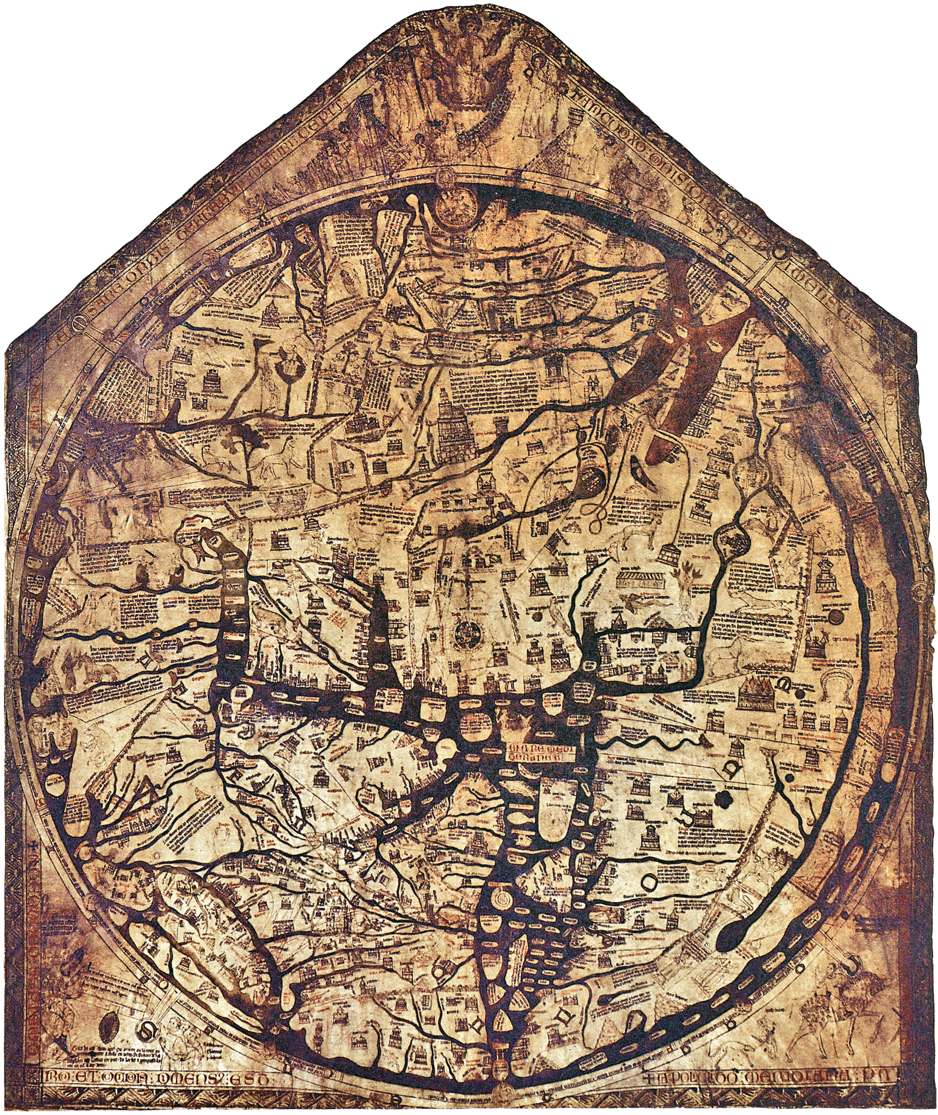
Richard of Haldingham or Lafford, Hereford Mappa Mundi, ca. 1300. Hand-coloured vellum, 1.59 x 1.34 m. Hereford Cathedral, Hereford.
More often, the edges of the known world opened spaces for fantastical improvisations on early modern maps, a tradition drawing from medieval mappa mundi that documented cosmography rather than geography. In maps such as the Hereford Mappa Mundi, biblical architecture and spaces, such as the Tower of Babel, Noah’s Ark, and the Garden of Eden, shared the same surface as inhabited cities. Monsters—bodies with heads on their chest, double-headed dogs, and giants, among others—populated their edges, marvels indicating God’s limitless creativity.1 These monsters did not disappear from early modern maps. Rather, mermaids, unicorns, griffins, and other fantastical creatures proliferated in their liminal spaces, occupying bodies of water and uncharted continents. If, following the ideas of architectural historian Fernando Luiz Lara, the abstraction and rationalization of space on European maps made knowledge of the world visible and apprehensible, then the inclusion of monsters signalled the dissolution of that space into the realm of the figural and imaginative. Rather than dismiss such features as neutral ornamental elements, the historian Surekha Davies invokes the literary critic Stephen Greenblatt’s concept of “representational machines”—the processes and apparatuses that circulate representations of cultural difference—to call attention to the ways that cartographic monsters enforce notions of alterity. Davies emphasizes, in particular, how imagery and concepts of the monstrous were mapped, almost too easily, onto European stereotypes of foreign cultures as savage and inferior.2 As figures occupying the edges of the known world, monsters, like spatial abstraction, transformed cartography into an “ideological tool of domination and inequality.”3
-
Lorraine Daston and Katharine Park, Wonders and the Order of Nature, 1150–1750 (New York: Zone Books, 1998), 25–59. ↩
-
Surekha Davies, Renaissance Ethnography and the Invention of the Human: New Worlds, Maps, and Monsters (Cambridge, UK: Cambridge University Press, 2016); Stephen Greenblatt, Marvelous Possessions: The Wonder of the New World (Oxford: Oxford University Press, 1991). See also Mario Pozzi, “Politica e grandi scoperte geografiche. Alcuni aspetti e problemi,” in Laboratoire italien. Politique et societé 8 (2008): 15–62. ↩
-
Ricardo Padron, The Spacious Word: Cartography, Literature, and Empire in Early Modern Spain (Chicago: University of Chicago Press, 2004); Fernando Luiz Lara, “Abstraction Is a Privilege,” Platformspace (June 2021), https://www.platformspace.net/home/abstraction-is-a-privilege. ↩
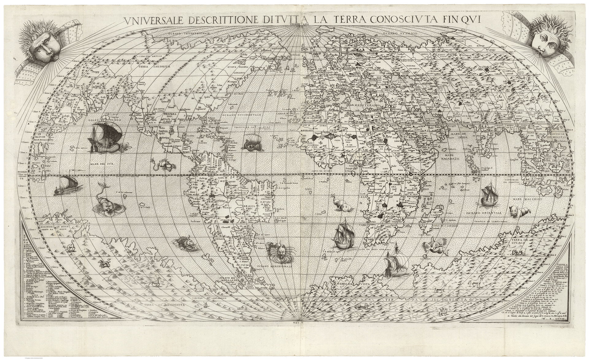
Paolo Forlani (copy after Giacomo Gastaldi), Universale Descrittione Di Tutta la Terra Conosciuta Fin Qui [Universal Description of All Lands Known until Now] (Venice, 1568). 53 x 81 cm. 10009.000, David Rumsey Historical Map Collection, Stanford University.
Detail of Terra Incognita.
Limits of Perception
Phantom islands occupied a space between grids and monsters, fact and fiction, on early modern maps. While mapped according to the same mathematical approach as physical territories, they introduced a measure of uncertainty, rather than the unknown, to cartographic space. Like cartographic monsters, their figuration followed an alternate mode of geographical projection, one rooted in a psychological and subjective understanding of space. Phantom islands captivated, in part, because they inscribed narrative within an increasingly rational system for picturing the world. Through their momentary appearances on maps, they alluded to the power of stories to shape a history of place. For New, “mapping was […] an adjunct of ownership.”1 That is, by claiming control over spatial representation of the world, early modern European geographers, explorers, and colonizers projected their ownership over its lands, resources, and people. Mapping phantom islands further projected their control of its psychic reception. Born of the fears and exaggerations of French explorers, the cartographic representation of the Isle of Demons affirmed their anxieties as rooted in fact, rather than prejudice.
But what happens to a phantom island when it disappears from a map? Does it also disappear from the collective imaginary? Or does it focus attention on cartography as a fiction, to the artificial boundaries we draw to transform geographical spaces into governed territories? Fascinated by the interplay of fact and fiction as they shape cultural attitudes to global territory, contemporary artists have recently explored such questions by revisiting the early modern phenomenon of phantom islands. In Phantom Islands—A Sonic Atlas, the sound artist Andrew Pekler constructs a digital atlas of historic phantom islands overlain by individual soundtracks.2 As users navigate from island to island, they are not only provided with facts about each territory—its coordinates, context, as well as first and last cartographic appearance—, but further undertake a multisensorial tour of each space. Countering the primacy of vision to make sense of the world, Pekler simulates the acoustic environments of geographical exploration not recorded by longitude and latitude, where bird calls could be mistaken for the unintelligible language of demons. The Polish conceptual artist Agnieszka Kurant instead imagines a world composed only of phantom islands in Map of Phantom Islands [Fig. 8]. Historic phantom islands resurface against an expansive blue ground to emphasize the enduring, and perhaps overbearing, force of fictions and lies as they alter the beliefs that people harbour about their world.
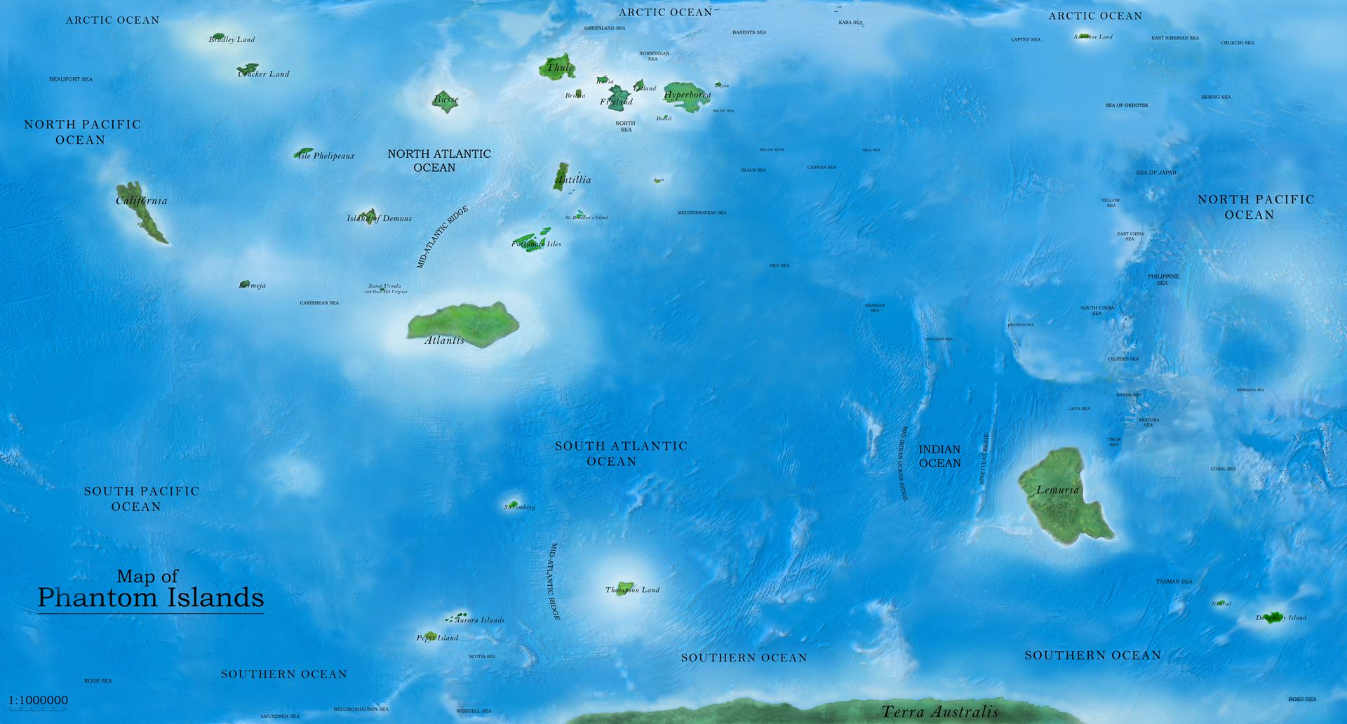
Agnieszka Kurant, Map of Phantom Islands II, 2011. Pigment print on archival paper, 69.9 x 115.6 cm (framed). TBG 15295. Courtesy of the artist and Tanya Bonakdar Gallery, New York/Los Angeles.
Lest we assume that phantom islands are cartographic artefacts made obsolete by satellite imaging and bathymetry, geographers continue to emphasize the frailty of human perception and confirmation bias when it comes to our knowledge of the world. In 2012, an obituary to Sandy Island was published in the magazine Eos.1 Ships passing by the so-called Sandy Island noticed something strange: evidence of a landmass did not appear on their navigational charts. Rather, when they looked out to the space corresponding to the recorded coordinates of the island, they made an “undiscovery.” The island that had appeared on maps and Google Earth was demoted to a floating pumice raft. Contradicting the data sets of contemporary geographers, the undiscovery of Sandy Island exposed limitations to abstracting and quantifying of spatial knowledge. Whether pumice rafts or demonic wails, phantom islands point to a human tendency to see shapes in clouds and build castles in the sky, to mold absences of evidence and lapses in perception into apprehensible forms.
-
Maria Seton, Simon Williams, Sabin Zahirovic, and Stephen Micklethwaite, “Obituary: Sandy Island (1876–2012),” Eos: Transactions American Geophysical Union 94 (15): 141–142. ↩